Mapping Canada’s Forest Wildfires Having a clear picture of how much forested area is consumed by wildfires in any given year is becoming increasingly important. That’s why researchers looking for the most advanced wildfire maps turn to an expert team from Natural Resources Canada. Keywords: Forestry and insects Maps Read more
Making a very real difference while working in artificial intelligence Shiva Tirdad is a new geophysical researcher and artificial intelligence specialist at Natural Resources Canada. Keywords: Climate change Geosciences Maps Read more
From Nova Scotia to the far North: A scientist’s somewhat unexpected career As a young girl growing up in Nova Scotia, Ellen Whitman was at the top of her class for biology, chemistry and all of her science electives — but she never thought she “fit” the role of scientist. Keywords: Climate change Forestry and insects Maps Read more
Experts in groundwater, vegetation, forestry, wetlands and landscapes work together for a common goal It grew from a study of oil and gas impacts on aquifers to become a multidisciplinary project involving 20 experts from various backgrounds. Keywords: Climate change Geosciences Maps Read more
Sable Island: Canada’s original North Atlantic shapeshifter 
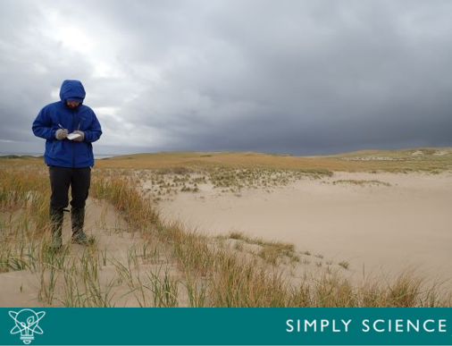
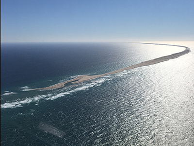
Sable Island is a truly unique microenvironment that’s been shaped and reshaped by changing sea levels, ice sheets, strong winds and waves for at least 10,000 years. It’s well known for its thriving wild horse population and one-of-a-kind wildlife. And now, scientists from Natural Resources Canada (NRCan) and Parks Canada are working together to understand how the wild forces of nature influence this shapeshifter. Keywords: Climate change Geosciences Maps Read more
The Future of Sable Island Southeast of mainland Nova Scotia sits "Sable Island", a small crescent shaped island home to magnificent wild horses and one-of-a-kind wildlife. But with the potential impacts of climate change on sensitive coastal areas, can a small island made entirely of sand survive the forces of nature in the middle of the Atlantic Ocean? On this episode, we talk to scientists with new research examining the future of Sable Island. Keywords: Climate change Geosciences Maps Read more
Exploring the past to help plan for the future Researchers in the Northwest Territories turn to experts from Natural Resources Canada to help interpret archival satellite images and see how climate change has affected the landscape over time. Keywords: Climate change Maps Read more
Machine Mapping Canada: training technology to complete the picture As the second-largest country in the world, Canada has a lot of territory and different types of land cover to map, including urban areas, water, desert, rock, ice and snow formations. Keywords: Geosciences Maps Read more
The gift of reading for science buffs The written word has long helped us understand science and the natural world around us. In fact, Natural Resources Canada is home to the first ever science library in Canada, dating back to 1854. Keywords: Climate change Geosciences Maps Mining Read more
Incorporating Artificial Intelligence (Ask NRcan) Like many organizations, the Government of Canada is exploring ways to incorporate artificial intelligence into our work to make us more efficient and effective. On this episode, we’ll learn what artificial intelligence is, and we’ll see how it can be used to solve problems that the natural resource sectors are facing. Keywords: Energy Forestry and insects Geosciences Maps Mining Natural hazards Read more