In today’s hyper-connected era, Canadians are seeking immediate and easy to access mapping where and when it’s needed most. At Natural Resources Canada (NRCan), a team is using artificial intelligence to meet this demand.
July 2024
Emergencies are inevitable, whether they’re natural disasters like floods, earthquakes and storms or human-caused events, like some wildfires and landslides. While these events can’t completely be avoided, specialists are now using artificial intelligence (AI) as a powerful tool to process satellite imagery and generate maps on-demand before flooding occurs or as a wildfire is spreading. This method allows community decision makers and emergency services managers to understand the risks, identify hazards and take steps to reduce damage.

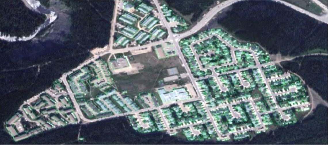
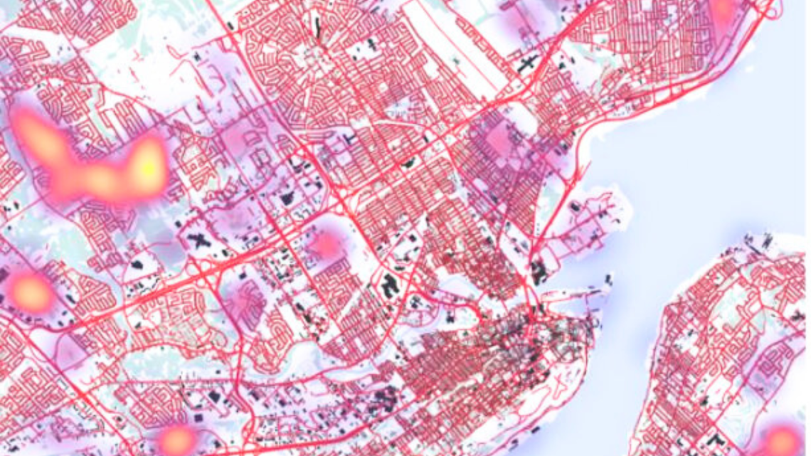
A team at NRCan’s Canada Centre for Mapping and Earth Observation (CCMEO) is transforming emergency preparedness by creating Canada’s first open, on-demand mapping series powered by AI. Called GeoAI, it provides up-to-date information on various geographical features across the country, including surface water, roads, buildings and forested areas.
What sets the GeoAI series apart is its ability to generate updates faster than ever while maintaining incredible precision. “Mapping that once would have taken months or years can now be completed in weeks, days, or even hours,” says Marc-André Faucher, project manager for on-demand mapping. This includes pinpointing the locations of buildings, infrastructure and natural elements, thus enabling a better understanding of potential risks and hazards. GeoAI users will have access to more accurate and more frequently updated data, delivered with a higher level of detail.
One thousand times faster
To put this development in perspective, it took over a century to produce the first comprehensive set of topographical maps of Canada at a 1:50,000 scale. The process was not only long but also inefficient: by the time the maps were finished, some of them were already outdated. A qualified technician could spend an hour working by hand to cover just two square kilometres, depending on complexity. Now, the GeoAI process can cover the same area in less than a minute, regardless of the complexity.
“This means achieving more with less,” explains Marc-André. With GeoAI, data creation is fully automatic, making the process 1,000 times faster compared with manual digitization. This level of speed was unimaginable just a few years ago and brings many advantages. “It allows us to maximize our limited human resources, creating products for more areas and more frequently,” says Mathieu Turgeon-Pelchat, senior project officer.
Recent events such as the unprecedented 2023 wildfire season show how important it is to have the latest data. GeoAI-generated maps can quickly and automatically quantify changes in forest cover over time, identify areas affected by wildfires or harvesting activities, and even detect regenerated forest when it has grown tall enough. Similarly, for flood risk assessment, up-to-date data can show how the landscape is reshaped as buildings are under construction, roadways are rerouted and other major infrastructure projects are built.

It takes more than tech

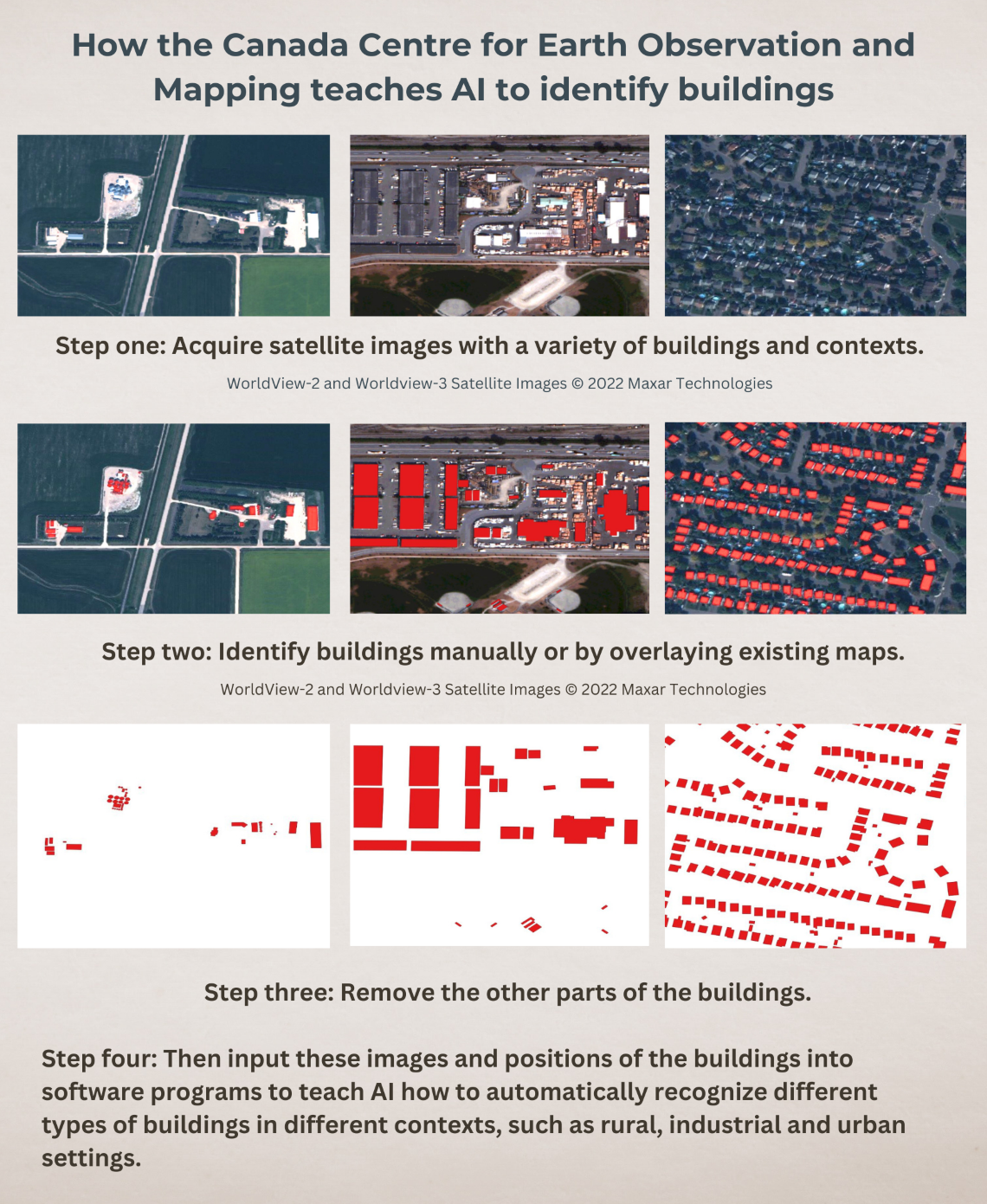
But it’s not just about the technology. When the GeoAI project kicked off, the team realized they were about to do something that had never been done before. “Even with the very best technology available, there was no ready-made solution,” says Mathieu. In 2018, AI and computer vision were already making waves in fields like medicine, where they were used to interpret magnetic resonance imaging (MRI) results automatically. The team saw an opportunity to adapt these technologies to the world of mapping in the area of analyzing satellite and aerial imagery.
They already had extensive experience creating maps as well as the largest collection of geospatial data in the country. And as they started to work on this project, the team devised a new operating philosophy: Instead of spending resources to create country-wide maps, they focused on providing geospatial AI in specific areas where and when it’s needed.
It took only a few months to produce the first GeoAI prototype. The team concentrated on extracting more detail. They narrowed their focus to only four essential features — buildings, roads, surface water and forested areas — instead of trying to incorporate the 100 different features included previously. They identified regions that are prone to natural hazards, densely populated areas, remote communities and areas undergoing permanent changes like urban expansion or changes to forest cover. By adopting this approach, they could revisit critical areas more often, ensuring the availability of up-to-date information.
Embracing the future: The evolution of GeoAI
As technology advances, AI is becoming increasingly useful and accessible to everyone. This progress is fuelled by advances in hardware, with processing capacity doubling every few years and AI models becoming more capable of learning complex features across various fields.

"Another fascinating thing is seeing how the use of AI for geospatial applications, and certainly AI in general is becoming more and more accessible,” says Mathieu. “When our team built our first prototype, we had to create many tools ourselves, relying on experts in AI and mathematics. Now, readily available tools can handle low-level operations, allowing experts to finesse models instead of spending time deploying them.”
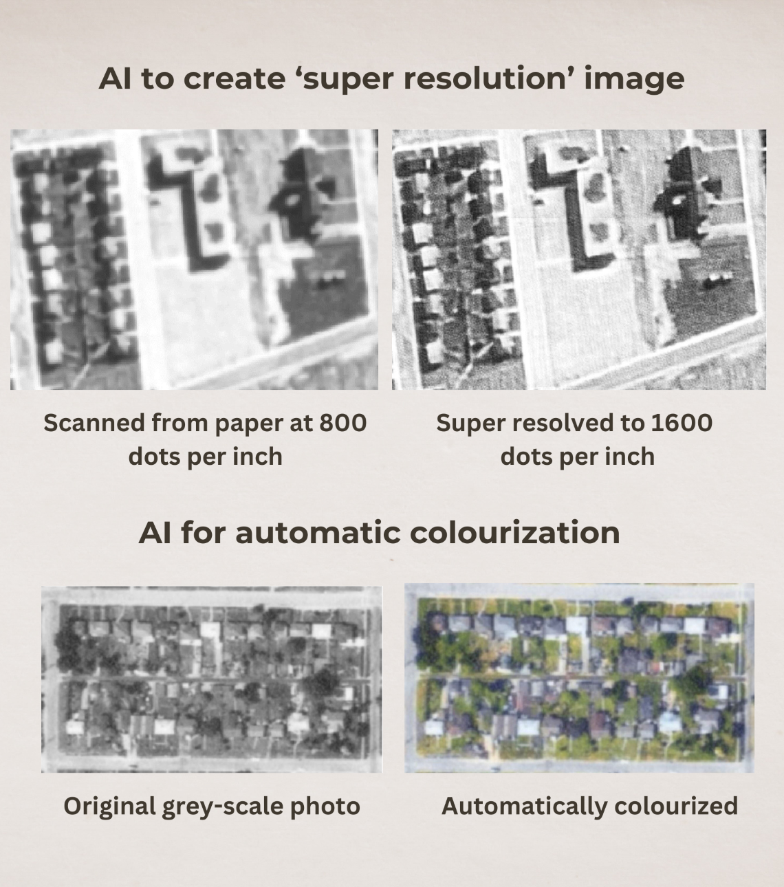
The possibilities with GeoAI are exciting. It can quickly enhance image resolution for more detail and even automatically colourize images. It can highlight changes over time by comparing historical photos with current images, helping researchers to understand landscape changes such as urban growth, deforestation and coastal erosion.
A transformative technology
It’s an exciting development, and it’s only just the beginning. In the future, GeoAI will incorporate various data types — including optical and radar imagery, point cloud data and historical images — for a wider range of applications. “Ultimately, the goal is to unlock the value of large geospatial data assets, like the ones at NRCan,” says Mathieu. “We want to ensure that AI-based tools are user-friendly for non-experts, incorporating seamless interaction with GeoAI in everyday work tasks.”
By using AI for mapping, CCMEO not only meets the demands of the digital age but also revolutionizes emergency preparedness and mitigation efforts. The GeoAI series exemplifies the power of innovation in providing the practical benefits of timely and accurate information when and where it’s needed most.
Explore:
GeoAI Series
Canada Centre for Mapping and Earth Observation