Extending our outer limits: Canada’s 2019 Arctic Ocean continental shelf submission to the United Nations
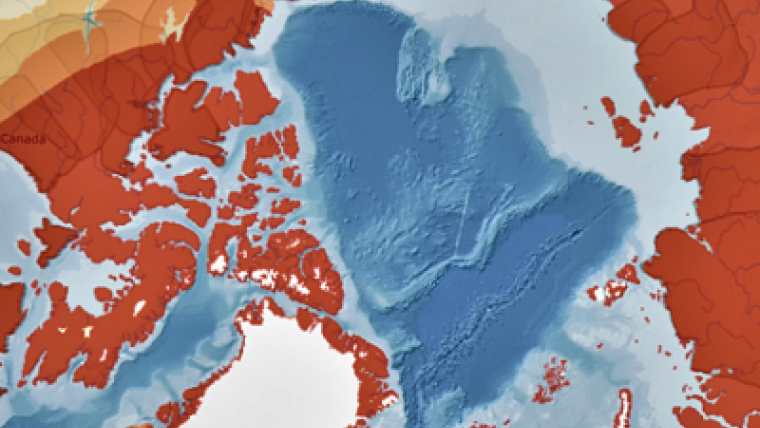
The Arctic Ocean is a vast, cold, isolated and utterly fascinating part of the northern hemisphere. Beneath its surface, thousands of metres below, is an extension of our country known as the continental shelf. And now, based on massive amounts of geoscientific data measuring the seafloor, an additional 1.2 million square kilometres could be added to Canada’s land area of 9.98 million km2.

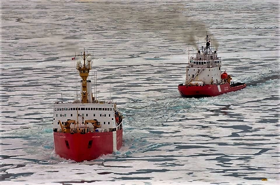
Canadian Coast Guard Ship (CCGS) Louis S. St-Laurent and CCGS Terry Fox in the Arctic Ocean.
As a signatory in 2003 to the United Nations Convention on the Law of the Sea (UNCLOS), Canada was obliged to formally define the extent of its continental shelf beyond 200 nautical miles. That’s because, under the Convention, countries have rights over the seabed and natural resources deep below the ocean’s surface if they can present authoritative scientific evidence that their continental shelf both extends past 200 nautical miles from their coast and is a natural extension of the continental landmass.
Accordingly, using this new seafloor data, a Canadian delegation from Natural Resources Canada (NRCan), Global Affairs Canada and the Department of Fisheries and Oceans Canada (DFO) in May 2019 filed Canada’s Arctic Ocean submission, a 2,100-page scientific report, to the United Nations Commission on the Limits of the Continental Shelf in New York.

Canada’s proposed new outer limits
Find out more on how NRCan scientists collected rocks from the ocean floor in this
Simply Science byte-size science video:
Transcript
My name is Gordon Oakey. I’m a research scientist with the Geological Survey of Canada. And in 2016, I was involved in a two-icebreaker operation to the Arctic Ocean. I was responsible on the Swedish icebreaker Oden to oversee a large portion of the science program and, specifically, to collect rock samples from the sea floor.
We’re analyzing the rocks right now to figure out the depositional environments of the sedimentary rocks that we found, as well as the mineralogy of the volcanic rocks. We’re trying to figure out the ages that these rocks were deposited and their significance to defining Canada’s extension of its continental margin.
I’ve spent a lot of time in ships, working in the Atlantic Ocean. This is the first time that I’ve been able to go on an Icebreaker crossing the Arctic Ocean and the first time that I’ve been to the North Pole. It’s been really exciting to work on the analysis of these samples and figure out not only scientifically what they mean but apply that scientific knowledge to extend Canada’s sovereign limit.
To collect and analyze the data was a long and intensive project — taking NRCan and DFO research teams 15 missions and more than 10 years — and much is at stake. “If our outer limits are accepted, we could add more than a million square kilometres to Canada, which is the size of two of our prairie provinces,” says Mary Lynn Dickson, NRCan’s UNCLOS Program Director. “The Arctic Ocean is the world’s smallest ocean, and it’s certainly the least studied and, as a result, the least understood.”
New tools, new discoveries
NRCan geologists and geophysicists played key roles in surveying the seafloor to measure sediment thickness and recover rocks from great depths.
Working under some of the most challenging ice conditions on the planet meant that the scientists had to find new ways of gathering data. For instance, to record high-resolution seafloor images in areas inaccessible to icebreakers, they programmed an autonomous underwater vehicle to perform mapping surveys that lasted for three days over a distance of 400 km — a technique never used before. In the absence of commercially available tools, NRCan technicians developed new survey equipment that could be towed under the ice.
As a result of these efforts, scientific knowledge of the Arctic Ocean has increased exponentially.
Page details
- Date modified:


