An account of Joe Harrietha’s 2017 expedition on the Yukon–Alaska border. Joe is a surveyor with the International Boundary Commission, a joint commission between Canada and the U.S. tasked with locating and maintaining our vast border. The Canadian section of the commission is part of Natural Resources Canada. You can see more pictures of Joe working the line in this Simply Science photo gallery.
By Joe Harrietha
January 2020
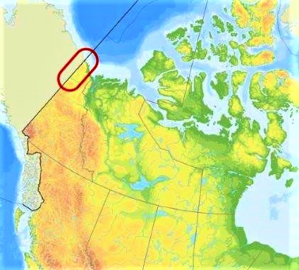
The Yukon–Alaska border: a vast expanse of beauty and, by far, a unique untouched wilderness of caribou, moose, muskox, grizzly bears, birds — a real northern wilderness. The project: resurvey a 400-km piece of the 8,891-km puzzle called the Canada–U.S. border.
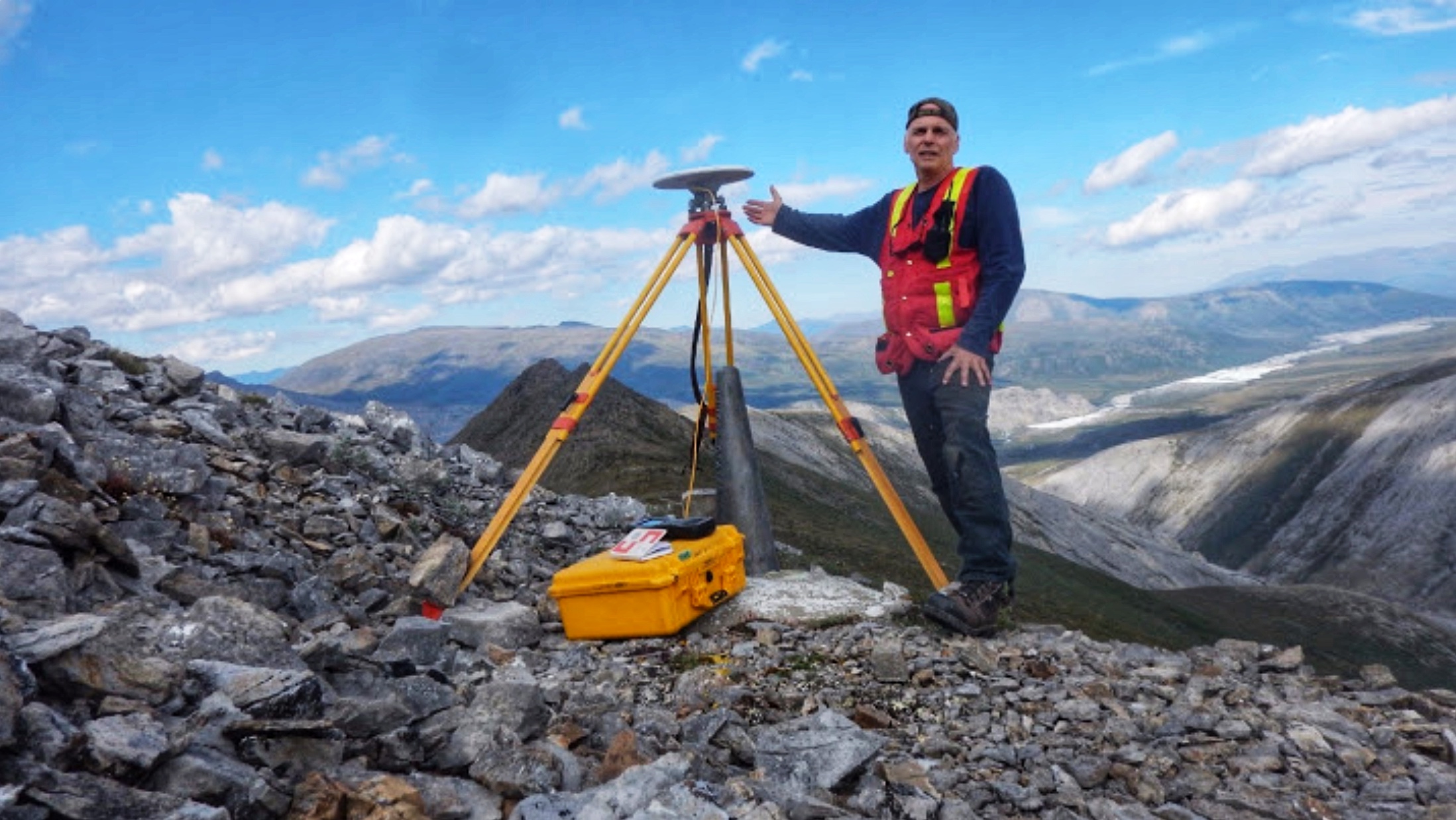
Where’s Joe? Keep looking, he’s on the far right, working the line.
Stretching from the Arctic Ocean to Mount Saint Elias, the 141st meridian of longitude is an unnatural boundary that cuts the landscape without regard to geographical features. Here, at 60 degrees latitude, the Yukon is plunged into 24 hours of darkness, freezing temperatures and snow in the winter and, in the summer, 24 hours of daylight, dry conditions and warm temperatures.
My window was the warm season, June and July, and I had three tasks. The first was to position the boundary from the Beaufort Sea at Boundary Monument 1 to Monument 80 west of Dawson City, Yukon — a total of 85 monuments with survey stations every six to eight monuments. The second was to survey the remaining markers within the project area. And the final task was to connect with the previously surveyed southern segment to Mount Saint Elias.
Everything was ready: the Fuel Easy tank to store fuel, the helicopter pilot, the permits, a satellite radio for our long flights, six Global Navigation Satellite System (GNSS) receivers to process locational coordinates and all the fixings for 24-hour continuous tracking. But the first thing to go in my surveyor’s bag was insect repellent — this part of the country is mosquito heaven in prehistoric proportions.
Joe records the coordinates of the Canada–United States boundary with a GNSS receiver at the Yukon–Alaska border.
The team was small, just myself and the pilot. This gave us some good extended range: since the helicopter could now carry an extra 600 litres of extra fuel, we could work most of the day in the north.
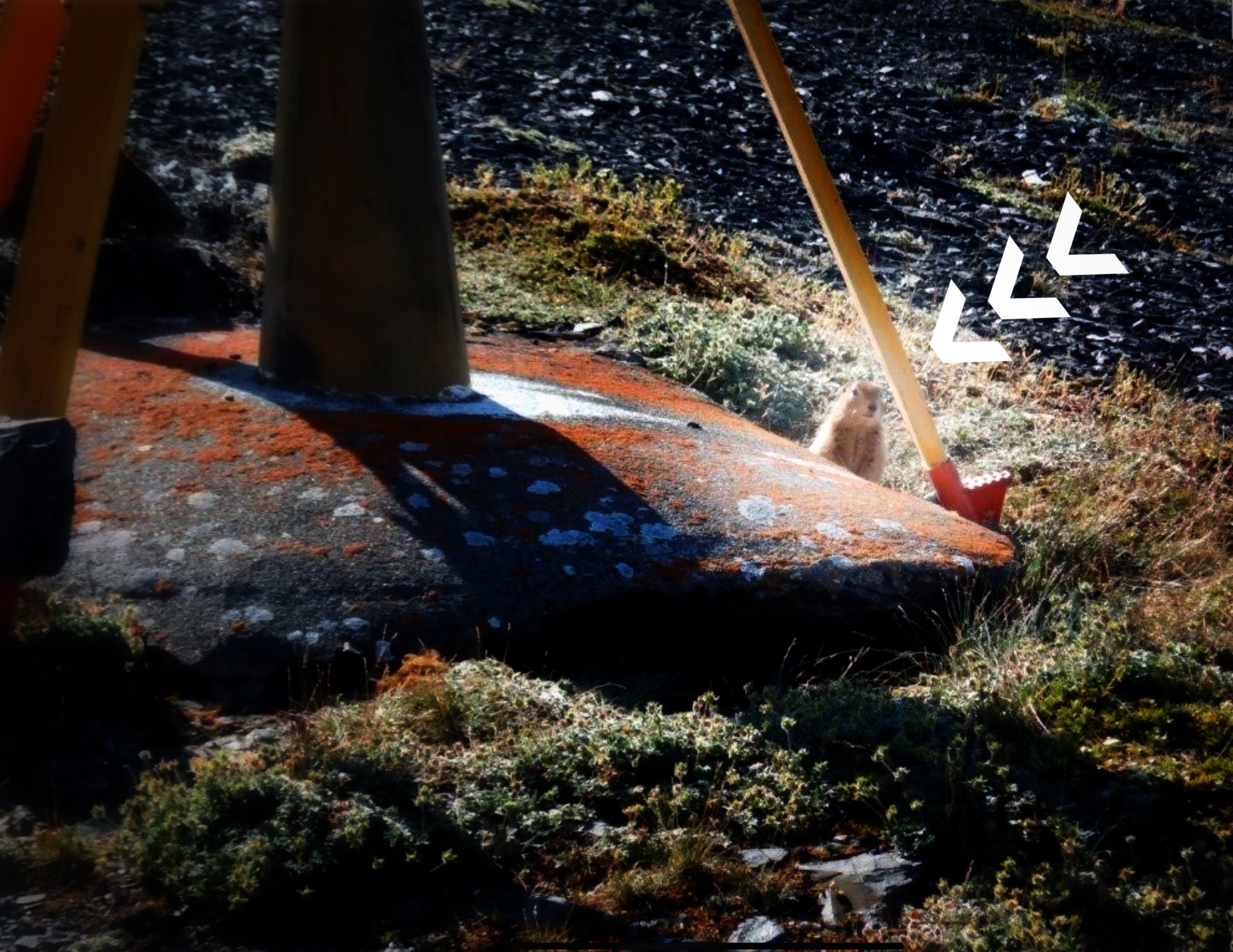
The survey went as planned, with the results processed and the conditions of the monuments recorded. We had no bad weather days but still faced the challenges of emergency equipment fixes in the field resulting from pesky gophers and mountain goats that like to chew on receiver cables.
The helicopter ride was always exciting, with many precarious exits on rocky ridges and side slopes, together with — my least favourite — dragging the equipment down the cut line, through swamps and up steep mountain slopes of loose rock. In the air, we skirted weather systems and forest fires.
But the most thrilling adventure was just being in the magnificent northern landscape. As a person who can say he has “walked the line,” this is among my top experiences with the greatest variety by far of wildlife and truly fantastic geographic formations.
As I spend the coming winter in my office back here on Booth Street in Ottawa, I’m preparing for another adventure on the Canada–U.S. border and wondering, “Where will the boundary take me next time?”, and asking myself — after almost a quarter century of working the line — “Is it time to start over again?” As for the recently completed 141st meridian, it may be “the end of the line” or perhaps only the beginning of another cycle along the Canada–U.S. border for the next generation.


