
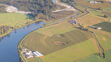
Natural disasters are increasing in frequency and severity. Flooding is Canada’s most costly natural hazard, resulting in over $2 billion in insured catastrophic loss every year. Floods can happen in any season, whether from heavy rain, rapid snowmelt, ice jams, coastal storm surges, or strong onshore winds.
Flood maps help people understand where flooding may occur. They support land-use planning, emergency preparedness, response and mitigation efforts, and give residents and property owners the information they need to make informed decisions about flood risk.
Features
Flood Hazard Identification and Mapping Program
Federal, provincial and territorial partnership to develop flood hazard maps for higher risk areas
Federal Flood Mapping Guidelines Series
Best practices, engagement and support guides and technical bulletins on flood mapping
Additional resources
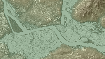
Flood mapping process
Process for flood mapping and types of maps
Emergency flood mapping
Floods and river ice near real time monitoring, mapping, research, and publications
Flood readiness
Get flood ready, know the risks, prepare your home, help your community, and stay informed
The science behind flood mapping
Flood mapping research projects
Flood mapping roles and resources
Provincial, territorial and federal flood mapping roles and links to their resources
Contact us
For more information, please email geoinfo@nrcan-rncan.gc.ca.