
Remote Sensing Applications: Water and Wetlands
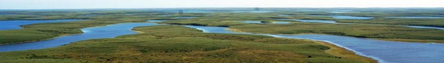
Understanding and monitoring Canada’s water is fundamental to the responsible management of this precious resource. Freshwater covers almost 9% of Canada, while wetlands cover an additional 14%.
Earth observation satellites are considered to be the most promising means of monitoring the seasonal changes in both freshwater and the state of wetlands on a regional and national scale. Satellites have also proven effective at characterizing the vegetation and soil characteristics important in the monitoring of Canada’s groundwater.
Scientists at the Canada Centre for Remote Sensing (CCRS) have developed techniques to use satellite Synthetic Aperture Radar (SAR) to map the extent of surface water, to support characterization and monitoring of wetlands and aquifers, and to monitor the transformation of Canada’s peatlands.
Today, new techniques to measure surface water level are being developed and validated using current and future spaceborne SARs, including the RADARSAT Constellation Mission (RCM). Launched in June 2019, the RCM provides daily coverage of Canada, and new data streams are being applied by CCRS scientists to monitor water, wetlands, permafrost, critical infrastructure and natural hazards (i.e., floods, earthquakes, landslides).
Data Collections
Floods in Canada Map Collection
River Ice State in Canada Map Collection
Land Cover of Canada Map Collection
Water and Wetlands Publications
CCRS Emergency Response Activity Internationally
Find out how SAR techniques are being used to map the extent of seasonal flooding and river ice break-up in Canada and abroad.
Geomatics information for the watershed serving Iqaluit, Nunavut, using EO data and ground survey
Read about how satellite data have been combined with surface measurements to identify and manage community water resources in Canada’s North.
Polarimetric RADARSAT-2 for Monitoring Canadian Wetlands
Discover how advanced SAR-based techniques are being developed and used to help characterize wetlands.These techniques are being further developed to measure the transformation of Canada’s peatlands with current and future SAR satellites.
Page details
- Date modified: