
Polarimetric RADARSAT-2 for Monitoring Canadian Wetlands
PDF Version [PDF, 902.2 kb]
Ridha Touzi, Canada Centre for Remote Sensing, Natural Resources Canada.
Canada’s wetlands cover about 25 percent of the country’s landmass and account for nearly 20 percent of the world’s wetlands. Canada’s wetlands are critical for maintaining healthy hydrological systems - they remove contaminants and excess nutrients, reduce the impact of flooding by acting as mini-reservoirs, prevent soil erosion, and recharge groundwater systems. They provide essential habitat for numerous plant and animal species and are overall indicators of environmental health. Unfortunately, the value of Canada’s wetland is commonly unrecognized, and wetlands in Canada continue to be under threat, with up to 70% loss in some areas. Since the beginning of European settlement they have been drained or otherwise disturbed for land development and industrial activity. For example, over two-thirds of southern Ontario’s original wetlands have been lost.
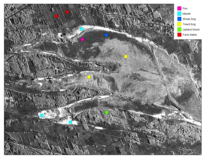
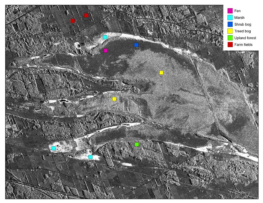
Figure 1: Simulated RADARSAT-1 Image of Mer Bleue wetland study site.
text version
Figure 1
Illustration of a simulated Radarsat-1 image of Mer Bleue, located east of Ottawa. The purpose of the product is shown on the background image, with ten locations represented by six types of ground cover or sites: Fen, marsh, shrub bog, bog woodland, forest and agricultural fields.
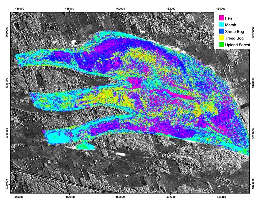
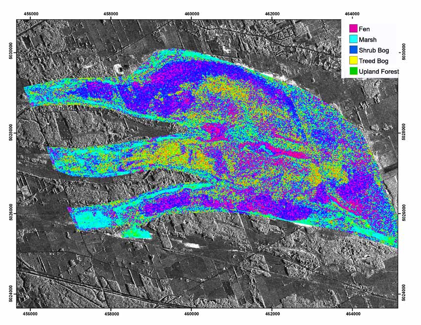
Figure 2: Wetland Classification using the Touzi polarimetric scattering phase.
text version
Figure 2
Illustration of a simulated Radarsat-1 image of Mer Bleue, located east of Ottawa. A classification of wetlands, using the Touzi polarimetric scattering phase, was applied to the radar image. The result is a product with five classes of wetland vegetation that are mapped as: Fen, marsh, shrub bog, bog woodland and forest.
In 2003 National Conference on Canadian Wetlands Stewardship recommended creating a national inventory on type, size, and function of wetlands to aid protection of this enormous resource. Remote sensing or Earth Observation (EO) technologies have long been recognized as essential tools for this undertaking. A partnership between Natural Resources Canada - Earth Science Sector, and Environment Canada - Canadian Wildlife Service (CWS) is underway to develop EO-based methods for mapping the wetland indicators required for the inventory. Improved mapping and monitoring of wetlands through cost-effective methods will contribute greatly to managing and conserving this important resource.
Recently, the Canadian satellite, RADARSAT-2 was launched successfully. It is the first satellite to carry a fully polarimetric Synthetic Aperture Radar (SAR) to provide EO data for ground observation. In collaboration with CWS and Parks Canada, and with support from Canadian Space Agency, this project was established to test and validate the use of RADARSAT-2 data as a primary and cost effective source of information for mapping and monitoring Canada’s wetlands.
The new RADARSAT-2 satellite has unique polarimetric and all-weather capabilities. The purpose of this project is to test the value of RADARSAT-2 data for characterizing and monitoring wetlands. The possibility of bypassing the use of the cloud-sensitive Landsat data is being investigated. A new RADARSAT-2 based methodology, the Touzi Decomposition [Touzi 2007], has been developed by CCRS for wetland mapping and monitoring in support of the Canadian Wetland Inventory (CWI). The new methodology has been applied for wetland classification using simulated RADARSAT-2 data collected with the airborne SAR Convair-580 over the RAMSAR Mer Blue wetland site.
The Touzi phase leads to the classification map of wetland forms shown below. The following wetland classes are easily distinguished: bog, fen, treed bog and marsh. Poor fens are separated from sedge/shrubs bogs; these classes cannot be discriminated with optic sensors and Radarsat-1 HH polarization. Polarimetric information permits also separating conifers treed bogs from deciduous upland forests under leafy conditions. This should promote the increase use of RADARSAT-2 for forest and park monitoring.
In the future, new interpretations based on RADARSAT-2 data will be validated over various RAMSAR wetland sites through collaborative efforts with CWS of Environment Canada. Further validation will be completed through field checking in partnership with Parks Canada. Wetlands are a key ecosystem in many of Canada’s parks, and monitoring these wetlands as well as their surrounding environments, should help Parks Canada fulfilling their mandate in protecting the ecological integrity of Canada’s national parks. A particular focus will be given in this project to Northern parks, and the methodology developed should help Parks Canada fulfilling their mandate in protecting the ecological integrity of Canada’s national parks and improving mitigation of the risk of fragmentation and reduction of northern wildlife habitats caused by impacts from global climate change.
References
Touzi, R. Target scattering decomposition in terms of roll invariant target parameters. IEEE TGRS, Vol. 45, No.1, pp. 73-84. 2007
Touzi, R.; Deschamps, Rother, A. G. Wetland characterization using polarimetric Radarsat-2 capability. Canadian Journal of Remote Sensing Vol. 33, No. 1:S56–S67. 2007
Page details
- Date modified: