
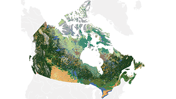
Remote Sensing is the science of capturing information about the earth’s surface using reflected or emitted energy collected by sensors mounted on satellites, aircrafts or drones. This science is vital to effectively measure and manage Canada’s natural resources and infrastructure, to understand and respond to natural hazards, and to monitor land use and the effects of climate change.
Imagery and Data
Find out where to access, download and order satellite imagery, remote sensing data and value-added products.
Land Applications Research
See how remote sensing and Long Term Satellite Data Records (LTSDRs) are used to monitor environmental indicators and changes in land cover and land use.
Forest Applications Research
Discover sensors, methods and applications for monitoring Canada’s forests and biodiversity, wildfires, forest health and for improving forest inventory.
Water Applications Research
Find out how satellites help monitor seasonal changes in freshwater, wetlands and aquifers, and characterize vegetation and soil to measure and track groundwater.
Infrastructure Applications Research
Learn about methods to harness remote sensing observations to help ensure responsible, safe and sustainable mining and energy resource development in Canada.
Natural Hazards Applications Research
Discover how remote sensing helps monitor landslide movements, provide emergency responders with near-real time flood maps, and assess damage after tornados and wildfires.
Canada Centre for Remote Sensing
Connect with the Government of Canada’s Centre of Excellence in remote sensing about working, studying or partnering with us.
Elevation data
Learn about types of elevation data, how it is collected and why it is important.