
Exploring the past to help plan for the future
Researchers in the Northwest Territories (NWT) turn to experts from Natural Resources Canada (NRCan) to help interpret archival satellite images and see how climate change has affected the landscape over time.
December 2020
Climate change is affecting all parts of the planet, and Canada’s North is more vulnerable than almost any other place on Earth.
In fact, according to Canada’s Changing Climate Report, the North — which includes parts of the Yukon, Northwest Territories and Nunavut — is warming at about double the global rate. The signs are real: unprecedented permafrost warming and thaw, coastal erosion and changing ice and snow conditions. These changes are having profound effects on wildlife and local Indigenous communities.
These impacts reach far beyond the local level, and the sense of urgency is direct. “We can look around, see the effects and say, ‘Yes, that’s coastal erosion,’ for example,” says Melanie Desjardins, manager of the Northwest Territories Centre for Geomatics. “But the real question is: What does that mean to someone in Tuktoyaktuk?”
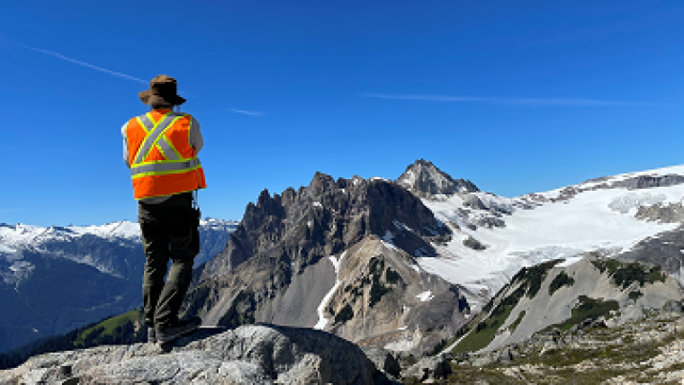
NRCan scientists working with the NWT Geomatics team to learn how climate change is affecting the landscape.
Looking for a bigger picture
There is no easy answer. The Centre has a lot of local knowledge of landscape changes, but for a bigger picture, the team is turning to expertise at NRCan’s Canada Centre for Remote Sensing (CCRS).
CCRS scientists Robert Fraser and Ian Olthof have investigated northern landscape changes for more than 10 years. They focus on natural disturbances such as wildland fires, enhanced shrub growth and other vegetation changes, lake expansion and drainage, and permafrost thaw slumps.
When the NWT Centre first approached Rob and Ian, their response was immediate.
“Back in 2012, we had never applied Landsat satellite change detection methods over such large regions,” says Rob. “It was a really interesting challenge. Trying to distinguish recent climate change impacts from natural landscape variability can be complicated.” The ability to use these multi-decade satellite archives is important, because they provide further, strong evidence that new types of changes have occurred over very large regions.
After scientific analysis, archival satellite images paint a picture of how landscape changes over time.
More than one million square kilometres
While the NWT Centre always had access to these satellite images, CCRS scientists are only now able to provide access to high-performance computing power and advanced expertise in satellite image processing. Working together, they’re combing through archival images from NASA/United States Geological Survey (USGS) Landsat Earth-observing satellites going back to 1984.
The CCRS scientists Robert and Ian showed the NWT Centre how they could adopt their Landsat satellite change-detection algorithms to help identify, map and understand landscape changes specific to northern Canada. They also recommended using Google Earth Engine to process the satellite data for the whole territory. This approach allows the team to study not just small local areas but the entire territory — all 1.3 million square kilometres of it.
A direct impact on community
One of the goals is to provide a planning tool so people and organizations can adapt for future scenarios. Melanie explains: “If we’re better able to predict patterns of landscape change, we can adapt our operations — such as how we manage our forests, how to protect archaeological sites or caribou, where to put infrastructure. This is what will really have an impact on residents.”
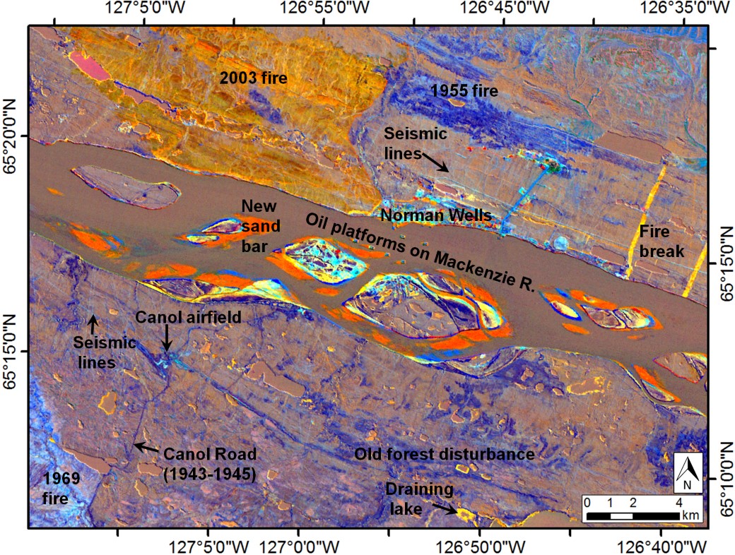
The NWT Centre team got the first complete picture of changes in the territory in December 2019. Now, a year later, with some team members working at home due to COVID-19, they’re still analyzing it. That’s how data-rich these images are. The team has already new vistas, identifying areas of permafrost thaw, old fire scars and drying lakes. They’re able to extract key information about the territory’s fire history from as far back as 70 years ago — a highly useful result, since older fire scars may act as natural firebreaks.
There’s always a surprise
“We’ve been using Landsat satellite images to study changes in Canada’s Arctic for more than 10 years, but there’s always something different to learn, a surprise along the way,” says Rob. “For instance, our most recent study found that widespread thaw ponds have formed in the uplands of Banks Island in the Canadian Arctic Archipelago due to the melting of permafrost ice wedges and subsequent ground subsidence.”
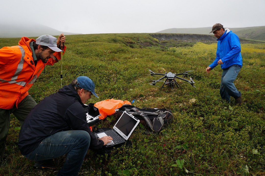
As for the NWT Centre, the newly analyzed images have been immensely useful in showing where to target ongoing research efforts and field-monitoring programs that use remote sensing tools, such as drones.
In fact, this collaboration has proven so valuable that the Centre and CCRS are already looking forward to working together again when a fresh batch of data is released from Canada’s RADARSAT Constellation Mission.
The Northwest Territories Centre for Geomatics
Based in Yellowknife, the Northwest Territories Centre for Geomatics has two main functions: providing geomatics (the gathering, storing, processing and delivering of geographic information) and geographic information systems services to NWT government departments and helping users understand how to use mapping data and tools in everyday decision-making. The Centre conducts geomatics projects, provides access to geomatics and geographic information systems (GIS) and promotes their various applications through training, resources and advice.
- View the profiles of Robert Fraser and Ian Olthof on Researchgate
- Canada’s RADARSAT Constellation Mission
- NRCan’s Canada Centre for Remote Sensing
- Canada’s Changing Climate Report
- Simply Science: Canada as never seen before, the new RADARSAT Constellation Mission
- Permafrost Thaw Slumps
Related stories
Page details
- Date modified: