
Project location: CanmetENERGY Ottawa
Timeline: 5 years (2023-2028)
Program: Carbon Capture, Utilization and Storage (CCUS)
Project description
The infrastructure deployment for CO2 Capture, Utilization and Storage (CCUS) will place pipelines or rail carrying large quantities of CO2 near populated areas. Safety is a concern because of the potential for sickness or asphyxiation if large quantities of CO2—or minor but more toxic impurities such as H2S—are accidentally released. Such an accident occurred near the village of Satartia, Mississippi, in 2020.
The project team utilizes a computational fluid dynamics (CFD) approach to generate models accounting for the key phenomena—CO2 properties, wind (convection and turbulence), terrain, and gravity (displacement of air by heavier CO2).
The project examines key leak scenarios—release-, terrain-, and wind-types—and models the dispersion. It addresses the questions: Over what distance from the release is the threat to human health a concern, where should leak detection and monitoring devices be placed, and what release mitigation measures should be employed?
The project team has used the Satartia, Mississippi, case for model validation, based on information from the USDOT/PHMSA Failure Investigation Report. Under loading from a mudslide, a 24-inch CO2 pipeline ruptured. The pipeline control room began shutting valves approximately 7 minutes later. A plume of carbon dioxide rolled toward the village of 50 people. Emergency personnel evacuated about 200 residents from the village and surrounding area. Forty-five people sought medical attention. Figure 1 illustrates the release location in hilly terrain and the village located on the river plane. Figures 2 and 3 show the CFD model result, where the CO2 plume rolls down into a valley, spills out onto the river plane, and envelopes the village.
It appears that a combination of large CO2 release and gentle wind could be dangerous for people in low lying areas of the terrain. A range of release, wind, and terrain scenarios is being examined
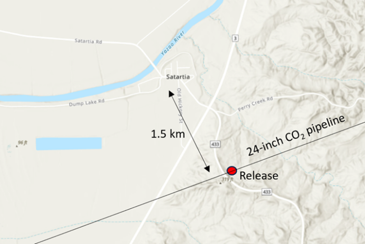
Figure 1: The CO2 pipeline, release location, and village
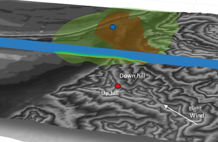
Figure 3: CO2 molar fraction contour slice at 20 minutes from rupture. The CO2 release location is indicated by the red dot. Satartia is indicated by the blue dot. Iso-surfaces using the same color scale show the plume envelope.
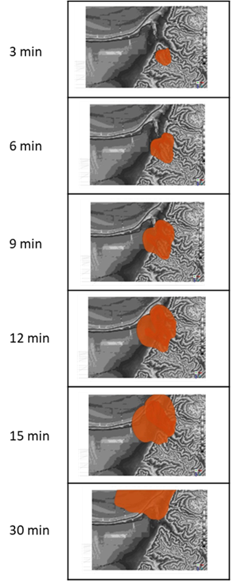
Figure 2: Snapshots of the CO2 plume at progressive times following the release.