
The Natural Resources Canada (NRCan) team has recently expanded the Historical Flood Events layer by adding 123 new events, covering the period from February 29 to September 16, 2024. These events include 47 floods caused by post-tropical storm Debby and seven by tropical cyclone Beryl. In total, over 7,500 flood events are now accessible via the interactive map. In addition, the map symbology has been refined to offer a more user-friendly and intuitive experience.
Thanks to this update, NRCan is ensuring continuous, detailed tracking of the floods that have marked Canada's history since 1696. Keep an eye out for the latest news on our What's New page!
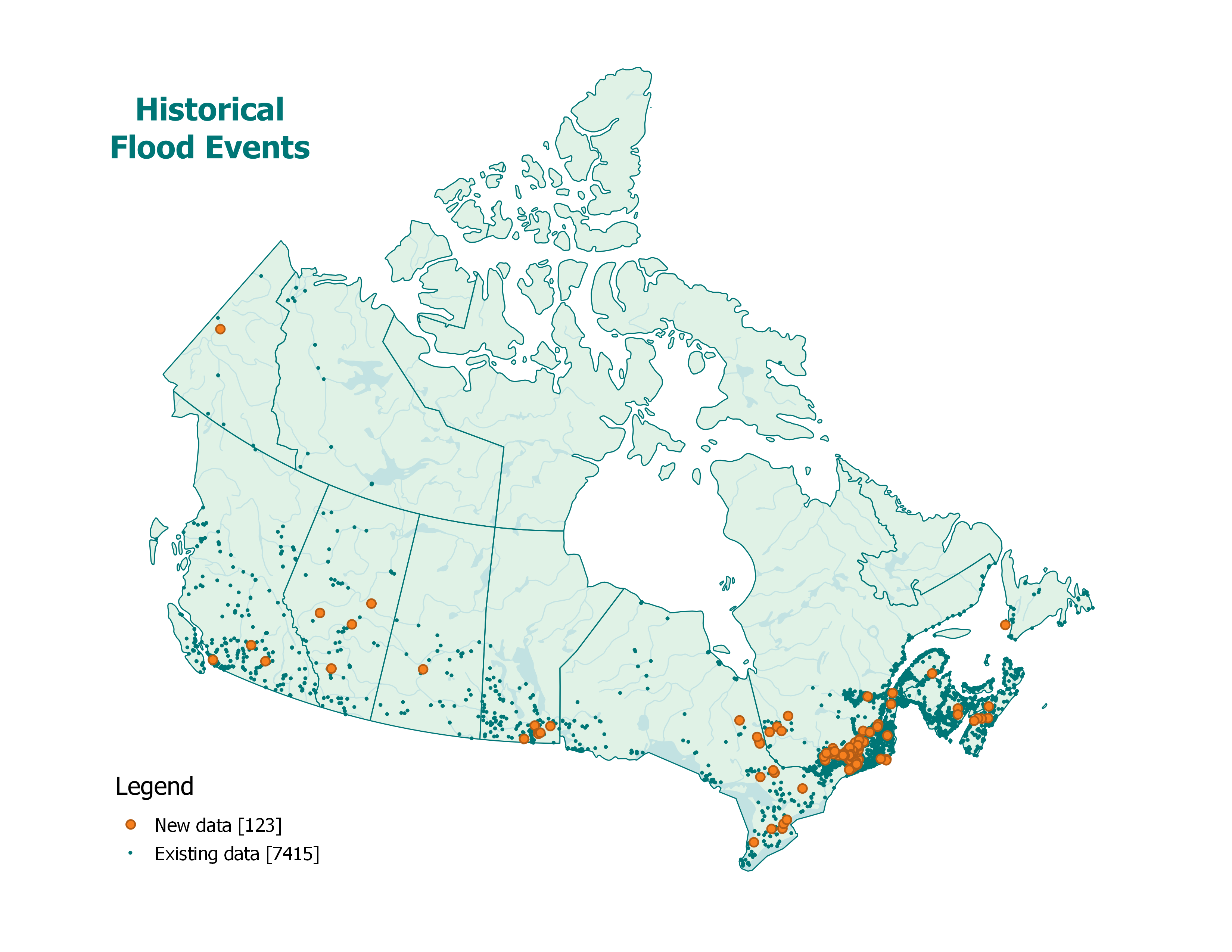
Historical flood events across Canada, spanning from 1696 to 2024. This map includes 123 newly added flood events, covering the period from February 29 to September 16, 2024, in addition to the 7,415 previously documented events.
For more information, please email geoinfo@nrcan-rncan.gc.ca.