
Natural Resources Canada is pleased to share the recent additions to the Canadian Flood Map Inventory (CFM).
Over the past few months, a number of studies funded under the Flood Hazard Identification and Mapping Program (FHIMP) have been integrated into the inventory. A total of 93 FHIMP-funded flood mapping studies are now available.
The most recent update includes 23 new flood zone studies, drawn from contributions from both federal programs and other sources, including:
- 21 studies funded jointly by FHIMP and provincial and territorial partners, including the first studies in British Columbia.
- 2 studies from other contributors or programs, such as the National Disaster Mitigation Program.
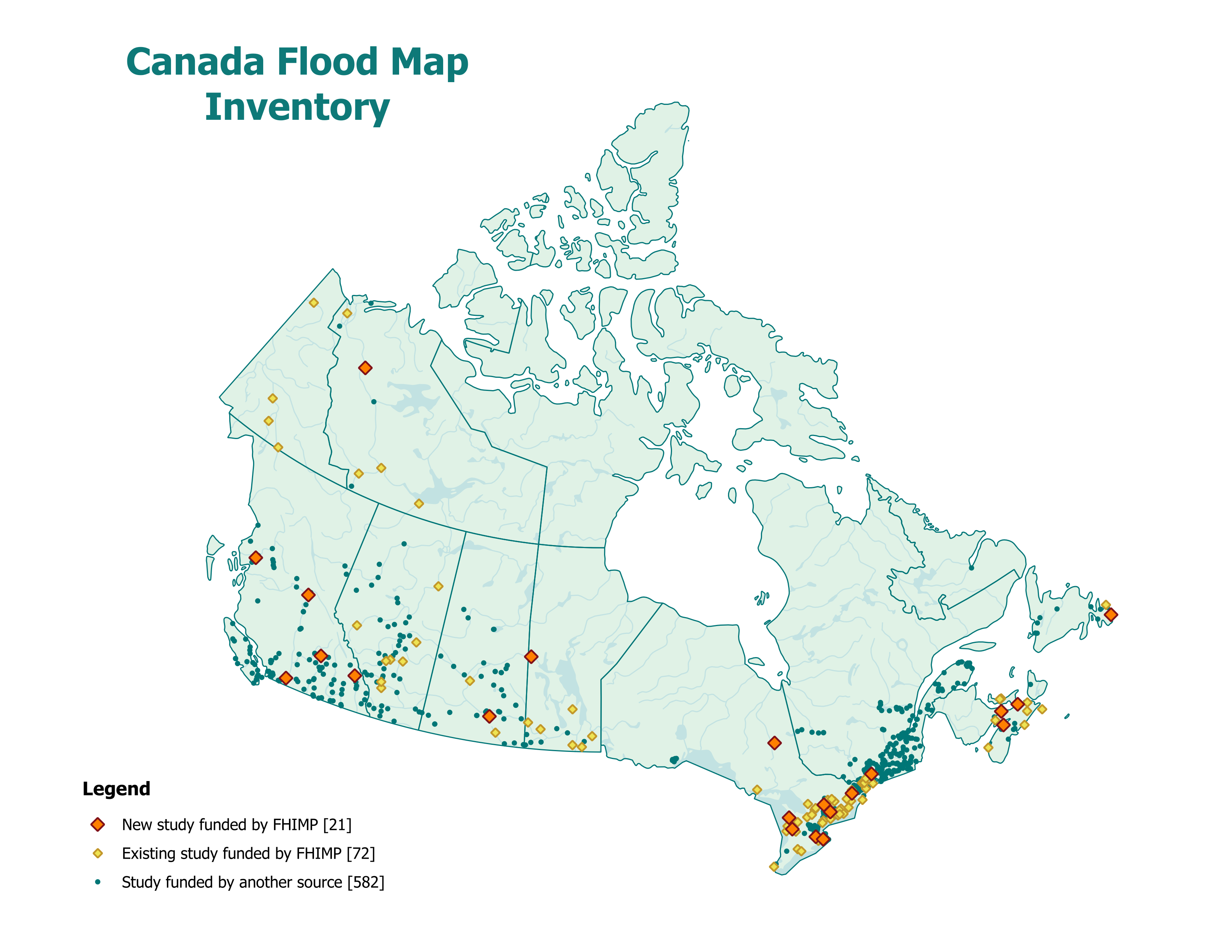
This update illustrates the benefits of the FHIMP and highlights the importance of collaboration between the federal, provincial and territorial governments to continually expand national flood data.
To facilitate access to this information, NRCan has added a new search tool by address. Users can now more easily search for available flood zone studies for a specific location by simply typing an address, street name, city, or the first three characters of a postal code.
These new features help improve the accessibility and use of flood zone data across Canada.
Find out more: