
Natural Resources Canada has recently updated the Historical Flood Events (HFE) layer, adding over 300 new flood events. This includes the major spring flood of 2019 in Quebec, which affected many municipalities and is considered one of the most severe floods in the past 50 years.
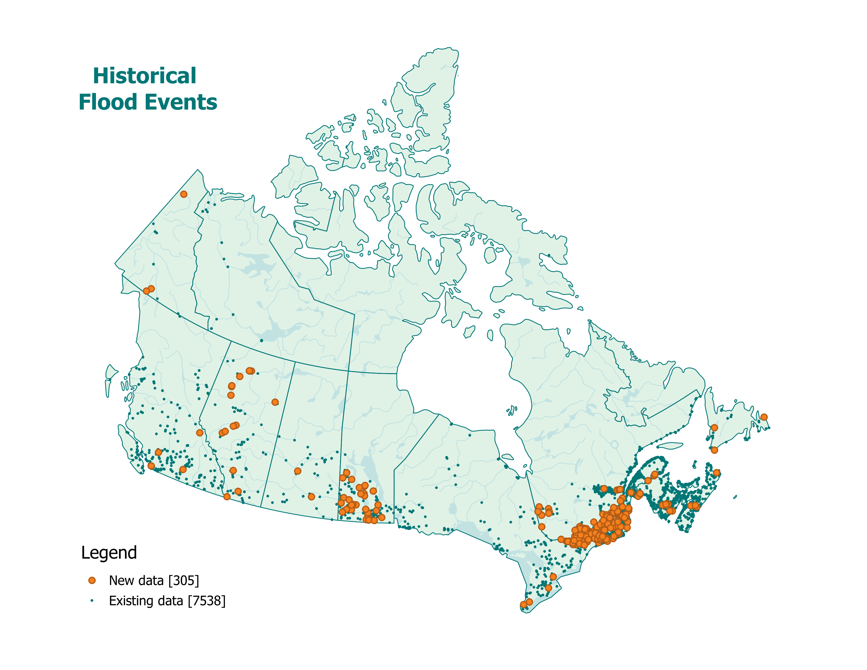
Historical flood events across Canada from 1696 to 2025. This map includes 305 newly added flood events (up to July 22, 2025), in addition to the 7,538 previously documented events.
To improve data completeness, efforts have been made to ensure the inclusion of events mapped using satellite imagery for emergency management by Natural Resources Canada’s Emergency Geomatics Services (EGS) team. Each event in the HFE layer, along with the records of observed precipitation before and during the event, can be linked to the corresponding flooded areas identified by EGS. Together, these datasets offer a more comprehensive understanding of floods, from their meteorological causes to their impacts on the landscape. For example, the April 2022 flood in Manitoba affected 38 municipalities. By combining both datasets, analysis shows that the flood was caused by several days of heavy rainfall in the days leading up to the event.
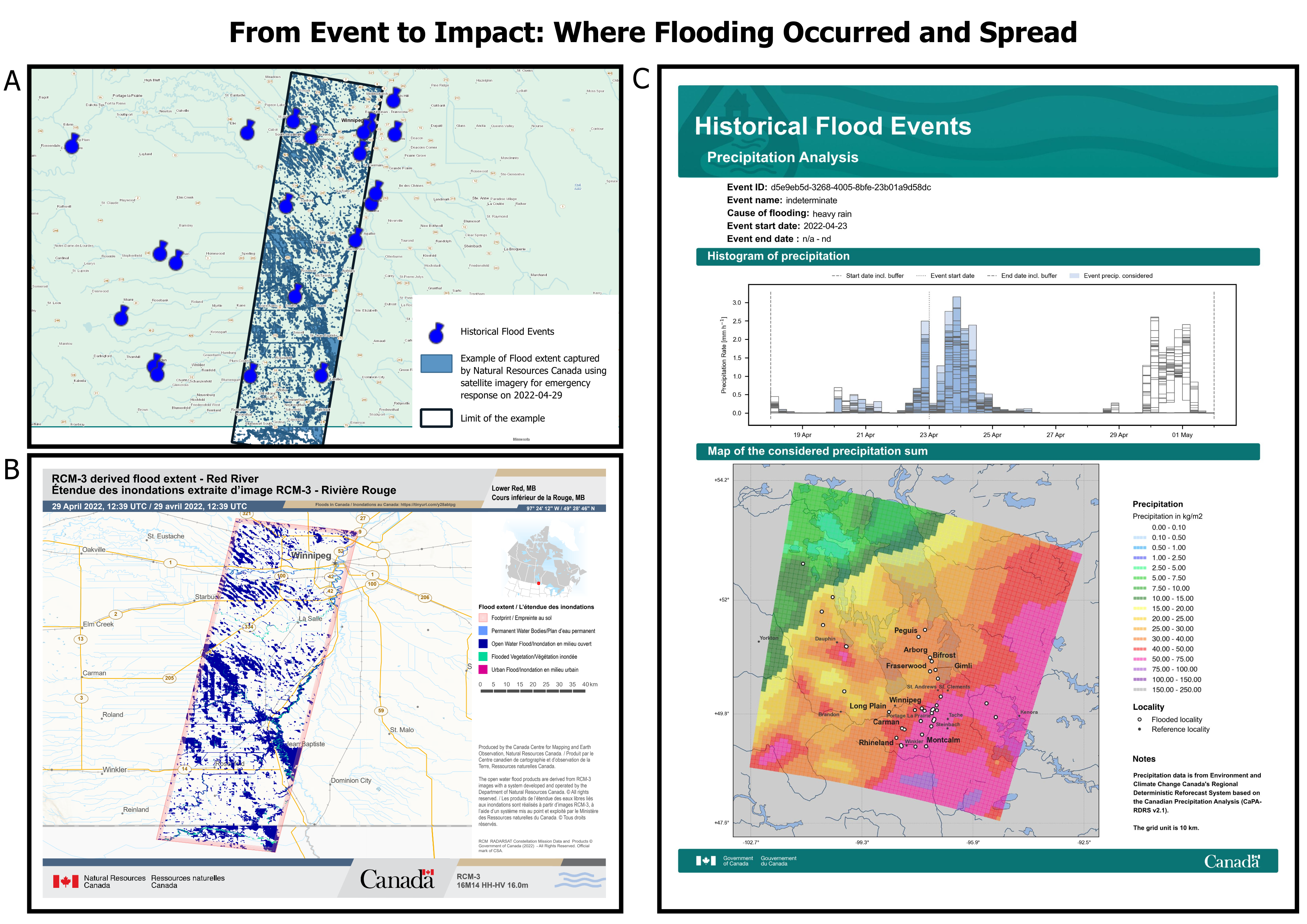
A: Map showing the April 2022 flood in Manitoba, created by overlaying data of April 29th at 12:39 am from the Historical Flood Events dataset with the Emergency Geomatics Services flood extent product.
B: Map produced by the Emergency Geomatics Services for the same flood event.
C: Information card displaying the precipitation analysis included in the Historical Flood Events dataset. The precipitation histogram provides clear insight into the rainfall conditions that contributed to the flood event.
Curious about Canada’s flood history? Visit the following webpages for more details: