
Details
- Publication date
- Author(s)
Natural Resources Canada - ISBN
978-0-662-32225-2 - Catalogue number
M45-161/2026E-PDF
About the GEM-GeoNorth program
The GEM-GeoNorth program, launched in 2020, continues to deliver the authoritative public geoscience about Canada’s North expected of the previous Geo-mapping for Energy and Minerals (GEM) program iterations. This GEM-GeoNorth Mid-program Report showcases the work of the GEM-GeoNorth program, which remains as relevant today as when the GEM program was launched in 2008.
The GEM-GeoNorth program provides public geoscience knowledge so that anyone can better understand the geological context across Canada’s North and its natural resource potential.
The scientists of the Geological Survey of Canada (GSC) within Natural Resources Canada (NRCan) lead and conduct research in collaboration with:
- Canadian provinces and territories
- Canadian and international research institutions
- Northern and Indigenous institutions and organizations
The GEM-GeoNorth program delivers northern and Arctic geoscience that finds potential mineral and energy sources. It also provides essential information for sustainable land use and infrastructure planning to support economic development in Canada’s North in the context of a changing climate. The program aligns with the priorities of Indigenous Peoples and northerners to advance sustainable resource and infrastructure development.
Program goals
- Mobilize the geoscience networks in the provinces, territories and academia to advance regional geoscience in the North.
- Increase industry investment in exploration and sustainable development of natural resources, including critical minerals and energy.
- Contribute new geoscientific knowledge and data for climate-resilient northern infrastructure development, environmental stewardship practices, environmental assessments and climate change adaptation strategies.
- Expand access to northern geoscientific resources and tools to maximize decision-making.
- Provide plain-language geoscience to improve the effectiveness of sharing information with Indigenous communities and governments, stakeholders and the public.
Since the start of the GEM-GeoNorth program, the program team has worked with northern and Indigenous governments and organizations to align program priorities. The objective of this work was to learn about geoscience priorities in the North that could guide GEM-GeoNorth researchers in developing research projects.
Early in GEM-GeoNorth, program information was shared with 78 regional organizations and Indigenous governments by letter. In the first two years, during the COVID-19 pandemic restrictions, virtual meetings occurred with 22 organizations. The goal was to develop a relationship framework or general engagement plan and explore where program priorities could align with those of the organizations.
Since 2020, the GEM-GeoNorth program has supported 83 internal research projects. The program also awarded 38 grants that support initiatives to increase the uptake of geoscience knowledge of Canada’s North and build capacity of northerners.
All science outputs are published in the Open Science & Technology Repository (OSTR).
GEM-GeoNorth science activities 2020-present
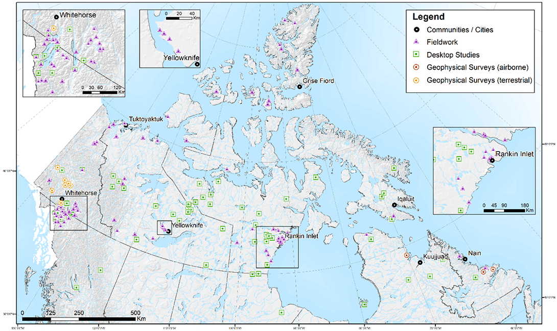
Project research areas from 2020 to present day
Text version
A map of Canada identifying the GEM-GeoNorth’s science activities from 2020-present, in and around the communities or cities of Whitehorse, Yellowknife, Iqaluit, Tuktoyaktuk, Rankin Inlet, Kuujjuaq, Nain, and Grise Fiord. Scientific activities include multiple fieldwork and desktop studies throughout the country, 3 airborne geophysical surveys in the Kuujjuaq and Nain region, and 7 terrestrial geophysical surveys in the area surrounding Whitehorse.
Data sources: Symbols for activities are located in the centre of a polygon or area and may not reflect an exact location to be studied.
Projection: NAD 83 Canada Atlas Lambert
Funding fieldwork
Did you know?
Geophysical surveys are used to collect information about the physical properties of geological materials below the surface of the Earth. This information helps to identify and map geological formations and features that are not visible.
Over the first five years, the GEM-GeoNorth program invested in fieldwork and surveys, which included 3 airborne geophysical surveys and 7 terrestrial geophysical surveys. The 149 program publications that have been published are freely available through the OSTR.
To cover large areas, surveys are done by aircraft that use specialized sensors. An aircraft flies in a grid pattern at safe, lower altitudes. Measurements are taken at regular intervals. The data are then compiled, and a map is generated that geologists interpret to understand the geology of the area. The maps provide useful information for the exploration industry and for communities and governments to make land-use decisions.
The cost of research, especially in the Arctic, continues to increase. Consequently, the GEM-GeoNorth program explores additional efficiencies and cost-saving measures to ensure that funding is used as responsibly as possible.
The fieldwork costs include:
- wildlife protection staff
- field assistants
- trucks
- various rentals
- supplies
- food
- accommodation
- shipping
- permits
- transportation to and from field sites (fixed-wing aircraft, helicopters, all-terrain vehicles, snowmobiles)
Annual program costs
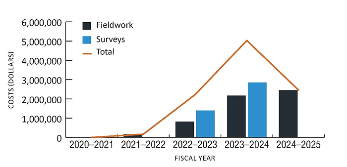
Fieldwork and survey costs during the first five years of the GEM-GeoNorth program
2020-2021
- Fieldwork was cancelled because of the travel restrictions during the COVID-19 pandemic.
2021-2022
- Fieldwork was limited for the same reason. GEM-GeoNorth used the time to cache fuel for future fieldwork.
2022-2023
- GEM-GeoNorth spent $823,000 on fieldwork and $1.4 million on geophysical surveys.
2023-2024
- GEM-GeoNorth spent $2.2 million on fieldwork and $2.9 million on geophysical surveys.
2024-2025
- GEM-GeoNorth spent $2.5 million on fieldwork.
Science highlights
This section highlights some of the GEM-GeoNorth program projects. Contact the program if you would like a complete list of supported activities or additional information on any of the projects highlighted here.
Permafrost mapping in the Slave Geological Province
Did you know?
Permafrost covers approximately 15% of the Northern Hemisphere, and 11% of Earth’s landmass.
This project is examining permafrost (frozen ground) in the Slave Geological Province. Information about ground ice within permafrost is essential for planning and managing infrastructure in permafrost regions, especially where thawing poses significant risks to ground stability and ecosystems.
As ground ice melts, it can cause infrastructure such as roads and buildings to slump, resulting in costly rebuilding and re-engineering much sooner than the expected lifespan.
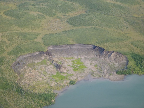
A retrogressive thaw slump
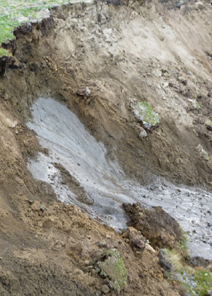
Close-up photo of thawing permafrost
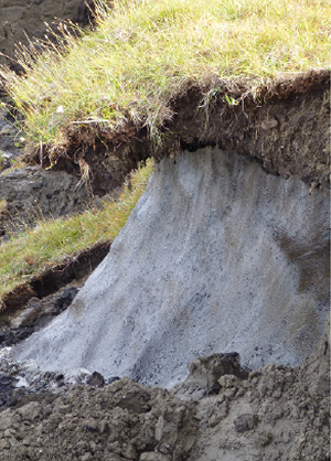
Overhanging turf caused by thawing permafrost
The Slave Geological Province is a mineral-rich region that spans the Northwest Territories (N.W.T.) and Nunavut. It is the focus of the proposed Grays Bay Road and Port Project (part of the Arctic Economic and Security Corridor). The proposed 773-km corridor would connect Nunavut and its deep-water Arctic port to Canada’s national highway and rail systems in the N.W.T. However, planning the route is complicated by many factors, including not knowing enough about where ground ice occurs along the corridor.
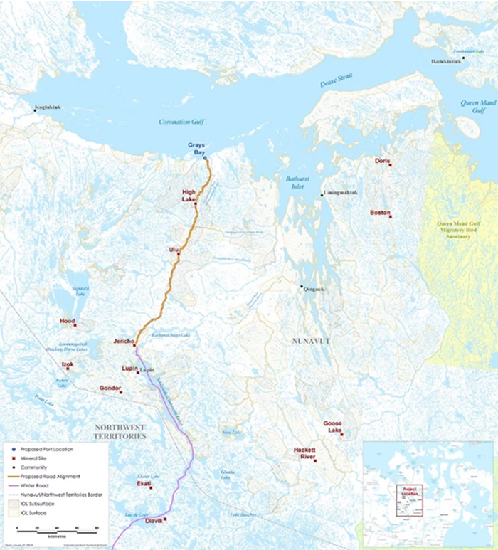
The proposed Grays Bay Road and Port, also known as the Arctic Economic and Security Corridor
Text version
Map showing the proposed Grays Bay Road and deep-water port (Arctic Economic and Security Corridor) in western Nunavut and eastern Northwest Territories. The proposed road runs north–south between the Jericho mineral site and the proposed port at Grays Bay, passing through the High Lake and Ulu mineral sites. Other mineral sites shown include Izok, Lupin, Doris, Boston, Hackett River, Goose Lake, Gondor, Ekati, and Diavik. Nearby communities include Kugluktuk, Qingaut (Bathurst Inlet), Umingmaktok, and Ikaluktutiak (Cambridge Bay). A winter road extends south from Jericho across the Nunavut–Northwest Territories border.
Source: Courtesy of the Kitikmeot Inuit Association, used with permission
Recent research modelled ground ice across the region by using enhanced techniques based on the Ground Ice Map of Canada. This research project developed a tool to analyze and simplify data about frozen ground. The tool groups ice content data that illustrates patterns across areas in a larger region.
This updated method includes detailed mapping of the surface geology at a scale of 1:125,000. The detail helps to identify different types of ground ice, where to find it, and how it might affect buildings, roads and other infrastructure.
The project found that glaciofluvial deposits often contain significant amounts of ice. Some areas have visible ice on up to 60% of the ground surface.
Did you know?
Glaciofluvial deposits are materials left behind by ancient rivers and glaciers.
Data from boreholes and soil samples revealed that the layer of loose material covering the solid bedrock can be as thick as 25.5 m. These findings are crucial because thawing permafrost in the Slave Geological Province can cause unstable ground, which is a problem for infrastructure development and maintenance.
Maps and data help assess the risks caused by ground ice and are used to develop strategies to protect future transportation systems. To better understand the landscape, researchers created digital maps of landforms that are linked to permafrost and of areas where ground ice may be present. They studied an 8,576-km2 area along the proposed corridor and identified 1,393 landforms grouped into three categories:
- forms shaped by freezing and thawing
- water-related features
- forms shaped by ground movement
Researchers found that landform types varied depending on the surface materials. They compared these landforms with soil sample data and records of sand and gravel deposits. The findings highlight the importance of accurately identifying ground ice when planning resilient infrastructure in northern regions.
Postglacial marine limits poster, Keewatin Region, Nunavut
This project describes the glacial rebound and marine processes that affected – and continue to affect – the Keewatin geological region, west of the Hudson Bay, in Nunavut and northern Manitoba. An Inuktut translation of the poster was created. The Inuktut poster and an English version, were shown during community visits in the North in 2024 and helped communicate results to community members.
This poster is an overview of a recent Open File report on the region’s marine history. The report explained how far marine waters and associated landforms and sediments have moved into areas that are now well above sea level.
The report also summarized the current implications of these changes on terrestrial infrastructure and nearshore marine transportation. For example, it is important to understand the composition of the soil when building structures such as power lines, roads or homes. In addition to ice-rich permafrost, both the chemistry of the surface sediments and the physical structure and size of sediment grains can affect the stability of the ground as a construction or foundation material.
An element of the translated poster for local residents in Inuktitut
An element of the translated poster for local residents in Inuktitut
New mineral potential identified in Nunatsiavut
Did you know?
Canada is home to the world’s highest-grade uranium deposits. That means more uranium can be extracted from less rock — making these deposits extremely valuable and efficient to mine.
New radiometric anomalies were discovered on Nunatsiavut Government (NG) lands in Labrador during 2024 by GSC scientists. The discovery occurred during fieldwork for regional geological mapping for the GEM-GeoNorth Hopedale-Makkovik research project.
New uranium mineralization was discovered on the Black Islands, 42 km northeast of Postville, as a direct result of the GEM-GeoNorth airborne radiometric survey. The same survey uncovered another site of interest, 18 km southwest of Rigolet, that shows a previously unknown thorium anomaly, which will require further study for confirmation.
“The NG was extremely pleased with the GSC’s results, and it was exactly what was wanted when this GSC project was initiated in 2022.”
Jim Goudie, the Nunatsiavut Government Deputy Minister of Lands and Natural Resources
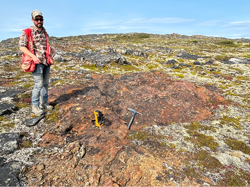
GEM-GeoNorth scientist Jessey Rice at one of the newly discovered mineralization sites in the Black Islands
These anomalous mineralization sites were not present in any provincial databases or literature and represent previously unknown mineral occurrences worthy of further investigation. These finds highlight the value of public geoscience and the importance of collecting high-resolution data in Canada’s North.
New methods for finding gold and copper-gold deposits
Did you know?
Porphyry copper deposits are large areas of rock that contain copper, formed from hydrothermal fluids that come from magma chambers deep underground.
This project developed new methods to apply uranium-lead dating of calcite to brittle fault systems to inform exploration models for gold and copper in the Yukon. The methods will help mineral exploration companies identify potential areas of high-value deposits.
Economic and critical minerals such as gold and copper can concentrate when molten rock (magma) and hot fluids (hydrothermal) move through surrounding, cooled rock. In some types of mineral deposits, such as porphyry deposits, metals deposited during magma emplacement can dissolve back into fluids and be redeposited nearby in later veins. It is not clear whether this recycling happens in one continual, relatively short-lived process or multiple times over several million years.
Carbonate minerals, which form during both magmatic and fluid events, can now be dated using the uranium-lead method to help track these fluid movements over time. Studying when and for how long these mineral-rich fluids moved through the earth will improve our understanding of metals transport and concentration. This knowledge will improve exploration models focused on identifying potential mineral-rich areas.
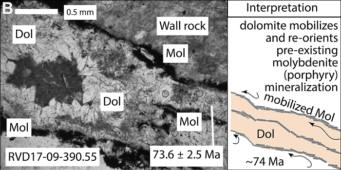
A photomicrograph of a dolomite vein rimmed by molybdenite (not to scale)
Text version
A microscopic image of a rock sample showing dolomite (Dol) and molybdenite (Mol) within a fractured matrix. Dolomite appears as lighter areas, while molybdenite occurs as darker patches along fractures and boundaries. A darker zone at the top is labeled wall rock. The sample includes a 0.5 mm scale bar and is identified as RVD17 09 390.55 with an age of 73.6 ± 2.5 Ma. An adjacent interpretation panel shows that dolomite mobilizes and re orients pre existing molybdenite, illustrated with a simple diagram labeled ~74 Ma. The figure combines microscopic imagery with interpretive graphics to explain how mineral phases have been altered and redistributed within the rock over time.
Source: Mottram, et al. 2024
Researchers analyzed 41 new uranium-lead dates from a mineral-rich system where fluids moved along faults. These dates show that carbonate minerals formed at several intervals from about 77 to 19 million years ago, supporting the idea that the fluids moved in bursts, rather than continuously. Specifically, metal-bearing carbonate was precipitated between 74 and 67 million years ago. This occurred during and for many millions of years after the main period of magma activity that introduced the metals to the region.
Later fluid events dissolved and reprecipitated those metals, contributing further to the concentration of valuable metals over time. Those events occurred from around 62 to 56 million years ago, 51 to 47 million years ago, and after 40 million years ago.
The timing of carbonate formation matches periods of fault activity, when rocks were breaking, and faults were shifting. This suggests that these periods of fault activity were important in creating pathways for fluids to move, helping to transport and concentrate valuable metals.
Ultimately, this work illustrates that using uranium-lead dating of carbonates to study long-lasting magmatic-hydrothermal systems can enhance our understanding of the processes that create mineral deposits. This knowledge can help the mineral exploration industry find new critical and economic mineral deposits.
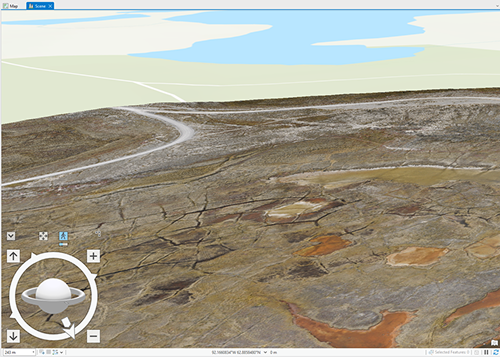
Drones
The GSC is investing in using drones because they can reach otherwise inaccessible or unsafe areas (e.g., cliff side or landslide), enable faster data collection over large areas, and are cost-efficient.
Drones have many uses, including to:
- capture good quality images or videos for communication purposes
- collect data at various scales
- examine bank erosion
- study permafrost for mapping ice wedge polygons
- collect thermal images of the ground
- use LiDAR (light detection and ranging) to create detailed elevation models of the Earth’s surface
We are currently testing drones that have specialized sensors for geophysics, magnetism, geochemical sampling and gamma-ray spectrometry.
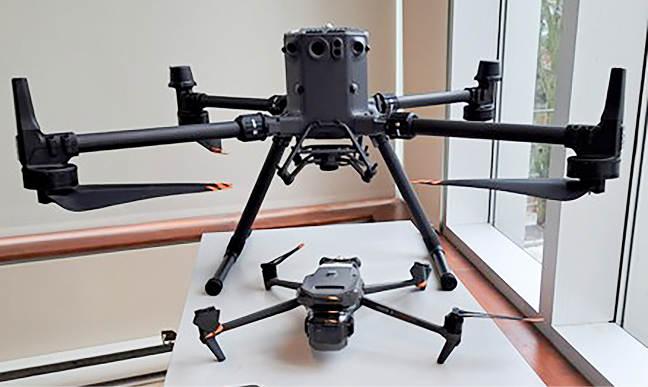
Two drones used to collect information with different types of sensor or accessories. The smaller drone in the foreground is a DJI Mavic 2T equipped with a thermal sensor and camera. The larger drone in the background is a DJI Matrice 350. It can carry up to 2.7 kg and works with different tools such as a regular camera, LiDAR, thermal sensor, water sampler, or magnetometer.
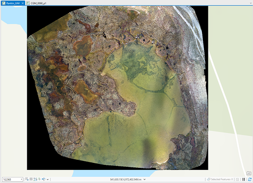
Corrected images are constructed from drone images. Note the ice wedge polygons in the lake close to Rankin Inlet, Nvt.
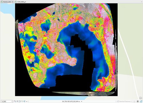
Drone thermal images demonstrate the large differences between rocks (in pink) and rocks covered by vegetation (mostly in yellow and green). Note the ice wedge polygons are not visible in the Rankin Inlet, Nvt.
Reconstruction in 3D from drone images where ice wedge polygons are visible (black line in the left side of image) north of Rankin Inlet, Nvt.
Geological maps lead to a rare fossil discovery
Modern geological maps in the high Arctic helped two American researchers discover an ancient species named Tiktaalik roseae. This animal is an important link between aquatic fish and animals with limbs suited to walking on land. Find their video here.
Significant fossils were discovered during 2023 and 2024 on Ellesmere Island, Nunavut, with the use of bedrock geology maps produced by GEM program iterations.
Both researchers used various GEM and GSC products to narrow their search and help with the discovery of this important species. This discovery illustrates how geological maps serve a wide range of users.
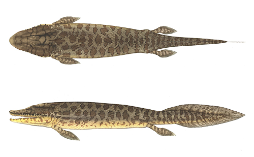
Reconstruction of a Tiktaalik roseae, created by Flick Ford
Photo credit: Academy of Natural Sciences of Drexel University
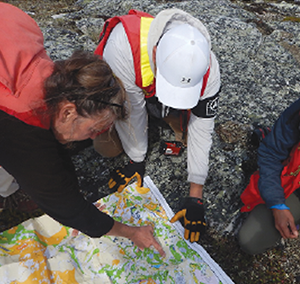
Engaging Indigenous governments and communities
The program dedicated Engagement Officers to coordinate with communities to ensure adequate opportunity for feedback and communication on research activities beyond the required research permitting process. Building relationships and trust with Indigenous governments, organizations and communities continues to be a key approach for the program.
The engagement team is dedicated to long-term relationship building across the North. It is the primary contact with Indigenous governments, organizations and communities to coordinate communications and in-person visits. This coordination streamlines communications to help reduce demand on time and resources for the communities.
The GEM-GeoNorth Indigenous community engagement activities are conducted in recognition of the rights of Indigenous Peoples. This ensures communities have free, prior and informed consent for research activities to take place on their lands and traditional territories and have access to results and potential benefits from the research outcomes.
Since 2020, the GEM-GeoNorth engagement team has completed 45 community visits across the North. The visits involved public events, town hall meetings, information tables, school visits, local call-in radio shows, and specific meetings with representative organizations. Each visit is unique and planned with feedback to best engage the community depending on the scope and type of research proposed.
At the end of the research project, the program follows up with the communities with research sharing sessions. These sessions present the results of the research activities in a plain language format, through open houses, meetings and communications materials such as pamphlets and posters.
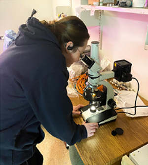
A student is trained in geoscience analysis
Benefits of continuous engagement
- Prioritizes community geoscience interests and priorities to guide future research
- Provides community input that can inform and improve GSC research (e.g. identify local study sites)
- Fosters clarity and trust through in-person discussions and actions
- Identifies local vendors for supplies and logistics and for hiring local wildlife monitors or field assistants
- Identifies year-to-year community concerns and input to the project plans and shares preliminary research results
- Reduces or avoids conflict with Indigenous or treaty rights through changes in scope or logistics for research plans
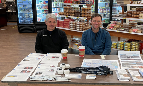
GSC researchers Stephen Day and Duane Petts providing information to community members at a local grocery store, Nvt.
Nunatsiavut Government and GEM-GeoNorth: Building a lasting partnership
In 2021, the Nunatsiavut Government and the GEM-GeoNorth program began a new way of working together – a novel approach for the GSC that was shaped by over 12 years of community engagement.
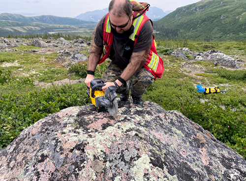
Claude Sheppard of the Nunatsiavut Government working on site near Nain, Nunatsiavut, N.L.
Representatives from the Nunatsiavut Government and the GEM-GeoNorth program collaboratively identified geoscience priorities and established expectations for consultation, engagement, and reporting. This understanding was integrated into guiding documents for GEM-GeoNorth research proposals. Furthermore, the Nunatsiavut Government provided comments and letters of support that were factored into decisions about funding.
This process for aligning priorities set the stage for a collaborative relationship that continues today. The Nunatsiavut Government and the GEM-GeoNorth program have since worked together on three geoscience research projects. A representative from the Nunatsiavut Government has also participated in fieldwork and visits to share research results with communities.
Finding areas of common interest between geoscience knowledge gaps and community priorities is important to developing relevant and impactful research. Aligning research with regional priorities requires including feedback from the Nunatsiavut Government in funding decisions. Ongoing consultation has laid the groundwork for deeper collaboration and co-planning in the future.
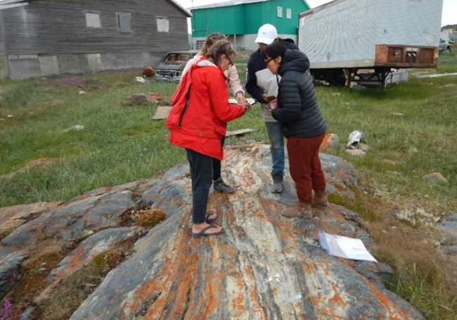
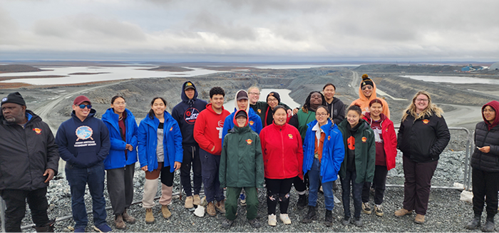
Inuit residents join the Kivalliq Corridor geological mapping project
Between 2023 and 2024, the Kivalliq Community Bedrock Mapping Project hired 27 Inuit residents from Whale Cove and Arviat to take part in geological fieldwork. Working side by side with GSC researchers, Inuit participants made tangible contributions to understanding the bedrock geology of the Kivalliq Corridor. Their involvement strengthened the planning and execution of the mapping and ensured that local perspectives and knowledge were reflected throughout the project.
Work in each community began with workshops where residents of all ages and genders contributed to planning. Participants reviewed satellite imagery, geophysical data, and existing maps, while sharing first-hand observations of the land. Together, they identified promising sites for mapping and developed strategies for fieldwork reconnaissance. Additional sessions included training activities such as aeromagnetic data interpretation, gold panning, local geology field trips, and discussions of how glacial history and ancient shorelines are still visible in today’s landforms.
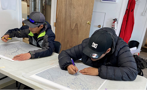
Victor Okatsiak and Curtis Kalaserk use landforms and lake shapes to model the direction of ancient ice flows, Nvt.
Inuit staff worked directly with GSC scientists for fieldwork site visits by helicopter, examining bedrock exposures, recording measurements, taking photographs, and collecting rock samples. Local knowledge and land skills were critical to navigating safely, locating exposures, and documenting features of interest.
In addition to the 27 Inuit residents hired to carry out mapping work, another 12 community members contributed in important ways. They joined field trips and information workshops, provided training support, helped with logistics, and shared country food at meetings. These contributions deepened community involvement and created space for a wider range of residents to guide and participate in the project.
Through two years of collaboration, the project combined scientific expertise with local knowledge and built stronger connections between researchers and communities. Inuit involvement—through fieldwork, planning, and support—has been essential in advancing understanding of the land while ensuring research activities and results remain meaningful and accessible.
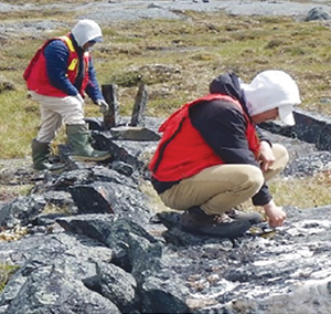
Malachi Kritterdlik and Jeremiah Oklaga examine quartz veins, Nvt.
Mary Sanborn-Barrie, Simeonie Voisey and Lavenia Angutituar update the Kivalliq geology map, Nvt., 2024.
Simeonie Voisey and Lu-Ann Saumik describe an iron formation in Whale Cove, Nvt., for entry into a database by Mary Sanborn-Barrie.
Enhancing digital sharing of geoscience information
The Kivalliq mapping project also piloted new tools for knowledge sharing.
In partnership with the Arctic Eider Society, geoscience functions were added to the SIKU (Indigenous Knowledge Social Network) app. SIKU is an app designed by and for Inuit for sharing information on wildlife sightings, harvesting, and environmental and travel conditions.
The newly added geological profiles make geoscience more accessible to communities, removing barriers such as the requirement for specialized software. As of April 2025, community members have uploaded more than 60 geology-related posts on SIKU, sharing insights and observations. The SIKU app is free to download on both Android and iPhones.
Posts can be created out on the land, outside of network coverage, saved, and later uploaded when the device is back in service range.
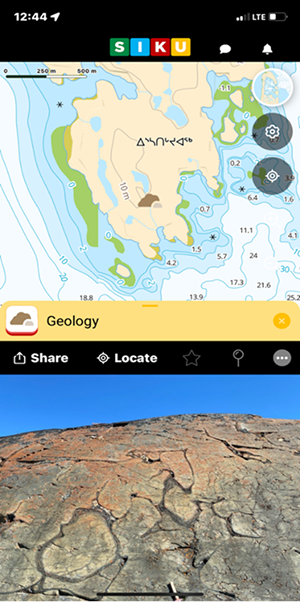
A SIKU geology post on the cellphone app
Co-planning research with Taku River Tlingit First Nation
Building on early geoscience priority discussions and several years of engagement with the Taku River Tlingit First Nation (TRTFN) in northern British Columbia along the Yukon border, GEM-GeoNorth co-planned the 2025 and 2026 summer research activities.
The project’s research objective is to investigate and gain a better understanding of the geological processes that led to the formation for the Cordillera Mountain range. The TRTFN is interested in areas with abundant chert as potential locations of traditional use by their ancestors. The research has identified a zone of broken ancient ocean bedrock slabs, which contain a variety of rock types. One of these rocks, chert, is a glassy sedimentary rock that has been used traditionally for toolmaking.
Together, Department of Heritage staff from the TRTFN and the GEM-GeoNorth scientists identified the overall study area and have visited specific sites of potential cultural significance within the proposed T’akú Tlatsini Indigenous Protected and Conserved Area. Collaborative plans for sharing both the geological and heritage knowledge learned throughout the fieldwork back to the community are being developed.
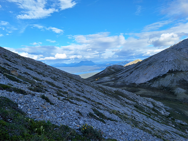
A field camp on Base Mountain, Y.T., 2024
Supporting capacity building and geoscience uptake
The GEM-GeoNorth’s grant program is focused on proposals to develop long-term capacity building in northern and Indigenous communities and to better enable northerners to incorporate GEM-GeoNorth data and knowledge in their decision-making.
The program requests proposals that focus on three categories: geoscience, northern academia, and multidisciplinary. The program’s annual budget for grants is $745,000.
Eligible participants include:
- Canadian and international academic institutions
- Canadian and international not-for-profit organizations
- Indigenous governments and organizations or groups
- provincial, territorial, regional or municipal governments
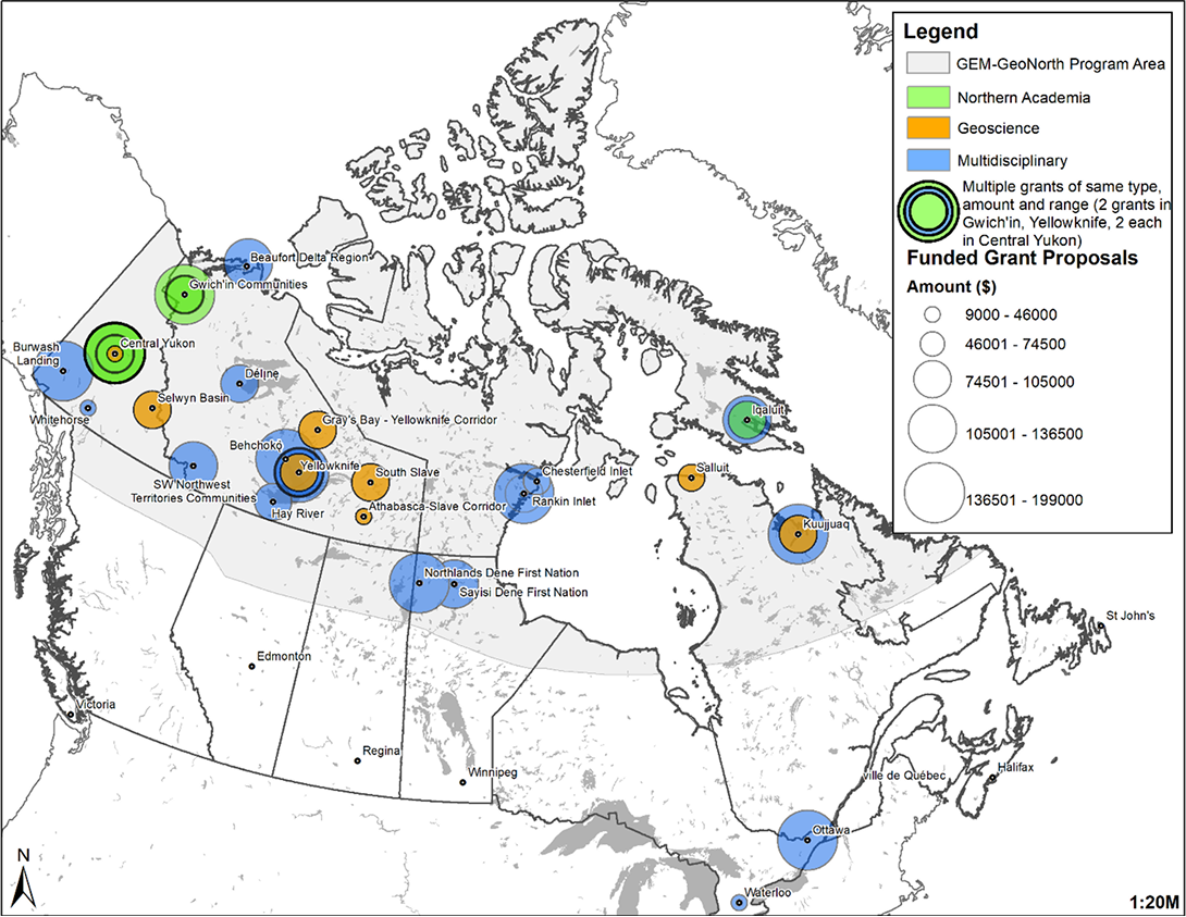
A map of the geographic distribution of grants
Text version
A map of Canada showing the distribution of funded grants across northern and southern regions. Colored circles indicate project types: green for Northern Academia, orange for Geoscience, and blue for Multidisciplinary. Circle size represents funding amount, with larger circles indicating higher funding. Some locations have multiple circles to show more than one grant. Labeled locations include Central Yukon, Beaufort Delta Region, Yellowknife, Rankin Inlet, Kuujjuaq, Iqaluit, and Ottawa. Most funding is concentrated in the Yukon, Northwest Territories, and parts of Nunavut, with additional sites in southern Canada. A legend explains the symbols and funding ranges.
Details about the grants are available here.
As part of the geoscience grants, $590,398 were awarded between 2021 and 2023 to seven Canadian universities to advance our geoscience knowledge in the North. These proposals were to develop research initiatives complementary to the GEM-GeoNorth program.
In the latter half of the GEM-GeoNorth program, there was an increased emphasis on supporting multidisciplinary grants. Of the total $4.1million, $2.3 million was awarded to promote the uptake of geoscience in the North.
Of this amount, almost $1.7 million in multidisciplinary grants was invested in northern and Indigenous organizations for locally run projects to:
- train youth
- advance geoscience education and capacity development, enabling communities to assess mineral potential
- improve databases for land use decision-making
- increase the uptake of geoscience knowledge through conferences and workshops
The program also awarded $612,000 to southern Canadian academic institutions for multidisciplinary initiatives. It funded projects ranging from knowledge and training in geothermal energy to training northerners to prospect for kimberlite pipes, which hold valuable diamonds.
You can access a complete list of the projects that were supported online.
Aurora Research Institute: Geoscience capacity building
The Aurora Research Institute (ARI), part of Aurora College, developed a project to grow the geoscience capacity of Western Arctic community members. They collected, managed, and used geoscience information and tools to develop strategies for climate change adaptation that were community-oriented.
The Gwich'in Tribal Council (GTC) delivered training sessions supported by ARI. The sessions were on geoscience data collection that uses both western scientific methodologies and traditional Indigenous knowledge, known as the Two-Eyed Seeing approach.
Training on data collection and management was held at a permafrost workshop for the Inuvialuit Land Administration community monitors, facilitated by ARI. ARI also developed and hosted workshops on geoscience data management for community-based researchers.
The Northwest Territories Geological Survey (NTGS) trained community monitors on thermokarst mapping methodologies to develop thermokarst maps at the community level. The ARI team and the NTGS developed strategies to inform western Arctic communities on the value of these thermokarst maps and how they can be used to minimize the effects of climate change.
From now until the end of the program in 2027, ARI will continue to grow the geoscience capacity of Western Arctic community members. Community members will be equipped with relevant and current western information and tools to support their traditional ways of developing climate change adaptation and mitigation strategies.
Yukon University: Virtual geology
Yukon University created a geology field trip course that is free, online and virtual.
The digital experiences shown in the course provide access to remote locations and geological information in an engaging format that has low environmental impact. They also show the breadth of the geoscience research occurring in the territory and increase awareness of what geoscience research involves. Data and knowledge from the GEM-GeoNorth program were used in the course material.
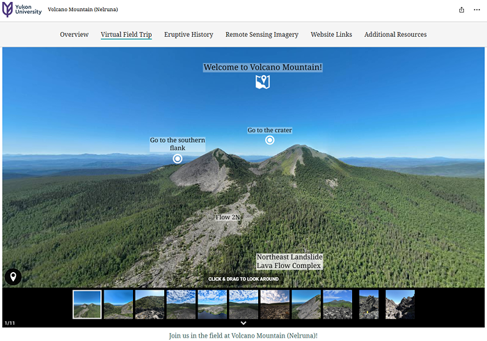
A sample volcano page from the Yukon University’s virtual geology project
An initial grant was awarded (August 2021 to March 2022) to build framework virtual geology field trips in Yukon. Additional grants awarded from 2022 until 2025 built upon this framework to provide content for the various field experiences.
The five virtual field experiences currently available are:
- Whitehorse Copper Belt
- Triassic Reefs and Fossils
- Yukon Volcanism
- Geoscience Research in the North
- St. Elias Icefields
Experiences provide maps, videos, diagrams, photographs, rock descriptions, an overview, and geological history. There are also an interactive geology map and links to additional resources.
From now until the end of the program, Yukon University will expand the virtual geology experiences. These virtual experiences will provide an entry point for non-specialists to engage with geoscience and understand geologic systems and data.
Two new virtual experiences are being developed: Snowball Earth and Klondike and Beringia. After they are released, the university will advertise them and how to interact with the experiences using the project’s virtual reality goggles and other related technologies.
Nunavut Research Institute: Isirvik Research Portal
The Nunavut Research Institute (NRI) of the Nunavut Arctic College launched a public, web-based research portal in December 2023 called the Isirvik Research Portal.
The portal was developed with support from McMaster University and Carleton University. It provides open access to information about research conducted in Nunavut, including geoscience and climate change research. The portal and the interactive map house all the research licensed by the NRI since 2004. All research into health, social, and natural and physical sciences conducted in Nunavut must have a scientific research licence from the NRI.
The Isirvik Research Portal (available in English, ᐃᓄᒃᑎᑐᑦ, and Innuinnaqtun) makes research information searchable and readily available to Nunavummiut (residents of Nunavut) via either a map view or table view. Better integration of research activities between scientists is a longstanding request of northerners.
The portal provides the details about every research project that was in the licence application. The details include research locations, project leadership, team members, affiliations, and contact information.
The portal is also a valuable resource for researchers and institutions interested in undertaking future studies in Nunavut. Its purpose is to reduce duplication of effort, facilitate partnerships, and encourage interdisciplinary collaboration and knowledge sharing by providing a centralized platform that consolidates information on past and ongoing research.
The GEM-GeoNorth program’s grant provided the financial resources to allow the NRI to make a cell phone app for the portal in addition to the computer version.
New ways of tracking outputs and metadata from geoscience and climate change research projects have been added, making it easier to find information.
Kivalliq Science Educators Community: Hard Rock Camp
The Kivalliq Science Educators Community (KSEC) hosted the week-long Kivalliq (Nunavut) Regional Science Cultural Camp: Hard Rock Camp for youth from across the region in 2022.
The students spent time on the land, learning about geology from a geologist and about traditional knowledge from Elders.
The camp was well received and had persevered through delays caused by the COVID-19 pandemic. The supplies that were obtained for this project have remained with the communities to allow them to offer similar on the land geoscience programming in subsequent years.
Participants in the KSEC Hard Rock Camp Nvt.
Grants to the end of the GEM-GeoNorth program
The third and final call for grant proposals for this iteration of the program occurred in the fall of 2024. Of the 21 proposals submitted, 8 projects were supported, for an investment of $744,988 and $659,500 for the 2025–2026 and 2026–2027 fiscal years, respectively.
From 2025 forward
From this point in 2025, the GEM-GeoNorth program will continue to deliver geoscience outputs that increase our geological knowledge and inform the natural resources potential of the North. The program will also continue to build relationships with northerners through meaningful engagement and ensure the access and use of new and improved geoscience data.
“Canada is, and forever will be, an Arctic nation, and we can never take our sovereignty and security in the region for granted. Our government will strengthen Canada’s Arctic security, bolster partnerships with our closest Allies, unleash the North’s economic potential, and reaffirm reconciliation with Indigenous Peoples. Canada will remain a strong, secure, and sovereign nation.”
The Rt. Hon. Mark Carney, Prime Minister of Canada