
For the first time, new detailed ground plot data on Canada’s forests will be available annually — but what can it tell us about forest resources, biodiversity and the impacts of climate change?
September 2022
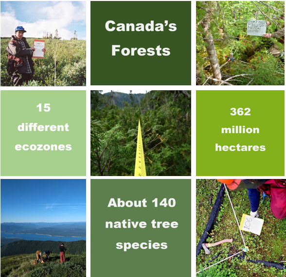
In a patchwork quilt of vivid colours, diverse species and unique formations stitched across 15 different ecozones, Canada’s forests represent one of the largest natural landscapes in the world. How large? About 40 percent of the country is blanketed by forests.
Canada has more than 362 million hectares, or nine percent of the world’s forests, and taking stock of this vast resource is a big job. It takes all levels of government working together to collect and analyze data, as almost all of Canada’s forests are on publicly owned land, either provincial, territorial or federal. Depending on where you live, forests may cover over 80 percent of your region, such as in the Atlantic Maritime ecozone, or only three percent as in the Prairies.
How do they do it? On the ground… and from space
Since 2000, the Canadian Forest Service’s National Forest Inventory (NFI) has compiled and managed forest inventory data collected by teams across the country. There are different ways teams can access forest measurements. One is through a network of 1,114 permanent ground plots where researchers assess forest characteristics like tree age, health, growth rate and species compositions. They also collect samples to determine soil nutrients, carbon content and the depth of the forest floor.
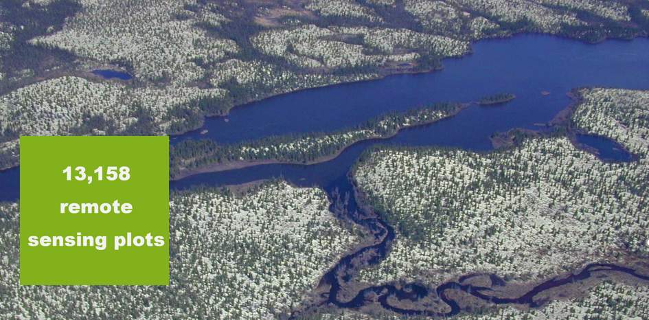
Another way Canada measures its forests is through 13,158 remote sensing plots. Many of these plots are in hard-to-reach areas, so researchers and scientists rely on images collected from aircraft or satellites. The Canadian Forest Service (CFS) analyzes this information to paint a clear picture of our forests and how they’re changing over time.
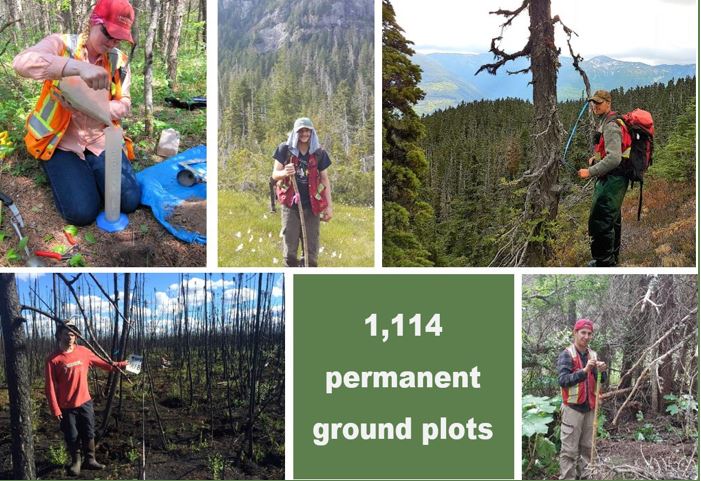
A portion of the 1,114 permanent ground plots are remeasured throughout the country every year.
A game changer for Canada’s northern forests
Starting this year, for the first time, NFI ground plot data will be released annually. Scientists will no longer have to rely on data released only once a decade. Being able to work with new data every year will help scientists monitor rates of vegetation change, like growth and decay, which can help answer important questions related to sustainable forest management, forest biodiversity and the impacts of climate change.
Luc Guindon, research scientist in Remote Sensing and Forest Ecology at the Laurentian Forestry Centre, says having access to both ground plot and remote sensing data is a game changer for his work mapping northern forest regions.
“The NFI systematic sample design and use of high-resolution data interpreted from photos are an excellent choice for inventorying remote hard-to-access northern locations,” says Luc. “For species composition and undergrowth vegetation, this is the first rigorous pan-Canadian database — it’s a huge asset for scientific studies on Canada's vast northern forests.”
Understanding the impacts of climate change
Access to extensive, quality information in remote regions is especially important for scientists monitoring changes in Canada’s boreal forest. The effects of climate change are altering natural disturbance patterns and forest dynamics in northern forests. Measuring and monitoring the impacts of disturbances like fire, insects, disease, drought, wind throw, floods and extreme temperature variations is vitally important.
While northern forests may be hard to reach, they can provide answers to important questions around climate change, such as which species are most affected or most resilient, impacts of permafrost melt, the migration paths of invasive pests and wildland fire spread.
“The NFI data is helping us learn more about how climate change is affecting northern forests,” says Lisa Smith, Inventory and Planning Forester, Government of the Northwest Territories. “We’re able to increase our forest knowledge in areas that are ordinarily only accessible by helicopter.”
At home and around the world
NFI data is also helping scientists around the world. High-quality forest data is exactly what Jonathan Wang, PhD, Postdoctoral Scholar at the University of California, needed in order to map the density of above-ground biomass in the western portions of North America’s boreal forests.
“Having the most accurate and consistent data is especially important for evaluating our estimated changes in the above-ground carbon sink over time,” says Jonathan. “It is simply not possible for us to go back in time to develop new measurements.”
With validation from NFI’s data, Jonathan is now planning to expand his research to include all of Canada and Alaska by leveraging advances in new technologies — a method also used by CFS.
Céline Boisvenue, PhD and research scientist at CFS, uses the NFI data as a close-up lens to see the effects of all the moving pieces influencing forest dynamics.
“All the data collected on forests across spatial scales — from global satellite data to instruments flown over the forests from airplanes to tree measurements that NFI provides — are like lenses that give us a picture of our forests,” she says. “The close-up information provided by NFI is crucial. We use that level of data to make sure we interpret the other types of data, at other spatial scales, correctly.”
Looking forward to the future of our forests
As Canada’s forests face the realities of a changing climate and ecosystem dynamics, our researchers are there — watching and interpreting — to ensure the long-term protection of our environment. With ground plot data now released annually, NRCan science is helping to better our understanding of how our forests are changing year to year to help create a better future for all Canadians and for our forest friends.
Explore:
The State of Canada’s Forests Annual Report 2021
Canada’s National Forest Inventory
What space technology can reveal about Canadian Forests (Simply Science article)