
Terrestrial or ground-based LiDAR systems are used for close-range, high-accuracy applications. They provide three-dimensional images similar to those provided by aerial LiDAR systems, but they use a laser to map objects from distances of 1 to 100 metres on the ground rather than from an airplane, resulting in accuracy within millimetres or centimetres.
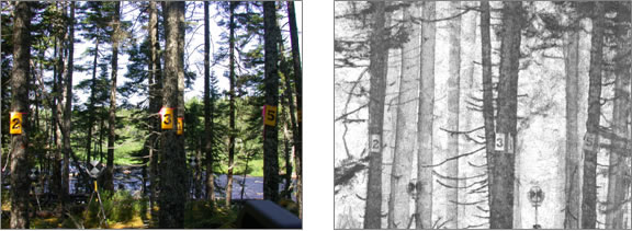
Example of a TLiDAR scan taken in Newfoundland forest environment
Ground-based LiDAR systems are either dynamic (on a moving vehicle) or static (on a stationary platform such as a tripod or mast). They can also rotate 360 degrees horizontally and scan vertically as well to produce a hemispherical “snapshot” of their surrounding environment.
L-Architect: Using terrestrial LiDAR to improve forest inventory accuracy
Researchers from the Canadian Forest Service (CFS) are using terrestrial LiDAR (TLiDAR) to produce three-dimensional tree representations.
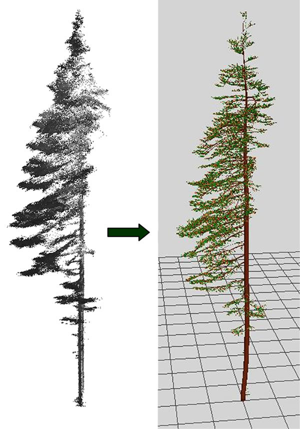
Co-registered scans of a balsam fir and its 3-D representation build with L-Architect.
A key challenge associated with the use of TLiDAR in natural forest environments is that objects lying behind the first object encountered by the laser pulses are often occluded or hidden from view and are not detected. To mitigate the effect of occlusion, TLiDAR scans are taken from several view points around each tree.
TLiDAR pulse returns vary in intensity depending on the vegetative structures they encounter, making it possible to separate, to some extent, the different vegetative components (stem, branches, foliage). This allows using the pulse returns from the wood portions of the scan to generate a skeleton (i.e., the trunk and the main branches) for the tree. The returns from the foliage are used to add finer branches to the initial tree skeleton. Finally, a light availability model is used to distribute additional foliage within the interior of the tree crown. The result is a set of digital tree models that closely resemble the scanned tree.
LiDAR data to tree architecture (L-Architect) is an architectural model developed by a CFS researcher that is designed to synthesize and quantify the spatial distribution of tree components from TLiDAR point clouds. The main strength of the model is its ability to generate plausible tree architectures, even when scans are taken under less than ideal conditions (e.g., occlusions and wind).
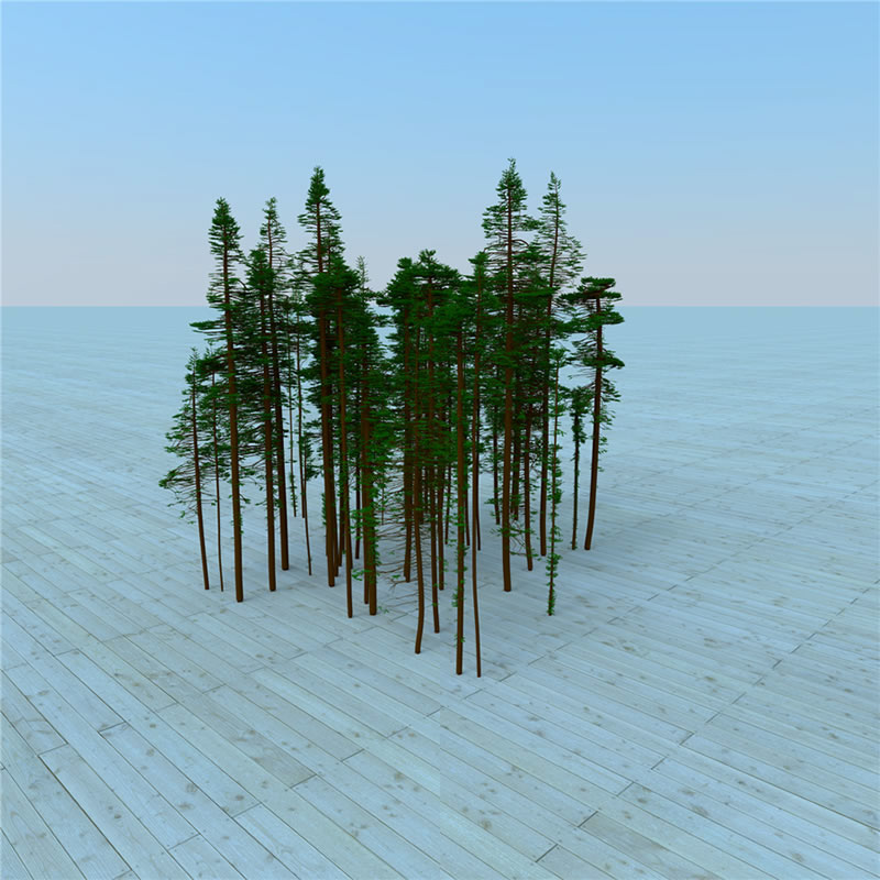
The capabilities of L-Architect were recently expanded beyond the mapping of individual trees to the reconstruction of forest plots, reproducing the overall forest structural characteristics with very high accuracy.
Reconstructed permanent sample plot (PSP) of balsam fir using L-Architect and tree map inventory data.
The data obtained with L-Architect largely surpass the 3D structural information retrievable from current remote sensing technology and are a major improvement over measurements obtained from ground plots with traditional inventories. The L-Architect model, when used in conjunction with other inventory tools, including aerial LiDAR, could significantly improve the quality of the information that can be obtained from forest inventory. This in turn will enhance planning for the best use of forest resources across Canada.
Canadian Forest Service key contact
Jean-François Côté, Research Scientist - Forest Inventory