
Remote Sensing Applications: Infrastructure and Resource Development
Remote sensing science has a central role to play in the responsible development of Canada’s natural resources during their discovery, development, regulation, production and remediation.
Scientists at the Canada Centre for Remote Sensing (CCRS) are developing methods of harnessing these spaceborne observations to help ensure resource development is done in a safe, sustainable way across Canada, including monitoring:
- Land cover and infrastructure change
- Water and wetland transformation
- Permafrost, river ice and snow dynamics
- Ground subsidence and heave related to mining activities
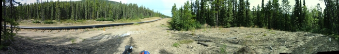
In Canada’s North, infrastructure important to resource development (e.g., highways, ice roads, buildings) are particularly vulnerable to the seasonal melt of freshwater ice,including permafrost, which is further accelerated today due to the warming of Canada’s Arctic. Working with the Geological Survey of Canada, CCRS scientists are developing methods using Synthetic Aperture Radar (SAR) to measure permafrost-related terrain stability near critical infrastructure.
Infrastructure and Resource Development Publications
InSAR Measurements of Terrain Stability in Canada's North
Find out more about techniques developed at CCRS to monitor terrain stability, permafrost activity and critical infrastructure.
Hyperspectral Data for Arctic Geology and Mineral Resources
Contaminated Site Remediation Monitoring
Read about research focused on the potential for hyperspectral data to support the discovery of minerals in Canada’s north and in the remediation of contaminated mine sites.
Page details
- Date modified: