
Help us improve!
Take our short survey to share your thoughts on the Atlas of Canada.
The reference maps include international, national and provincial maps in addition to basic black and white outline maps with capital city locations and/or names. Both teachers and students will find these maps useful in the classroom, as well as for special projects.
View the metadata on Open Government for all reference maps.
On this page
Canada
Political divisions
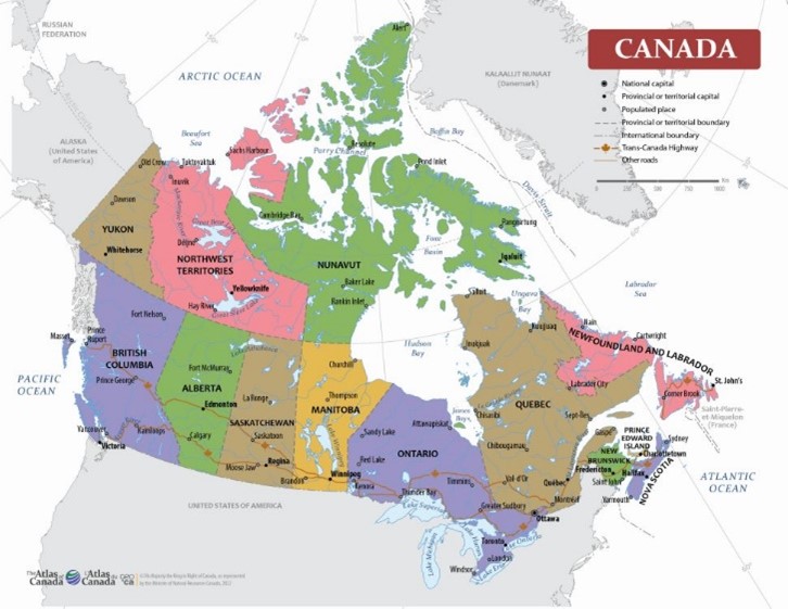
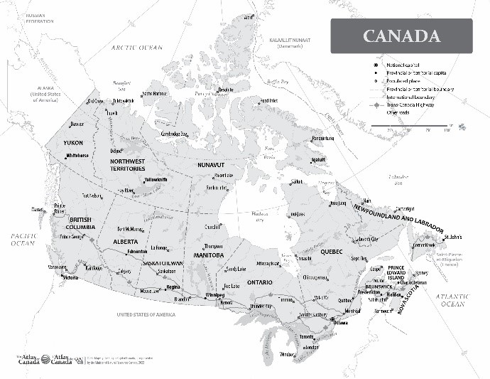
Canada Political Division
Date of publication: 2022
Download the map (PDF, 1.79 MB)
Download the map (JPG, 4.26 MB)
This map of Canada shows boundaries, capitals, selected place names, selected lakes and rivers, the Arctic Circle, and adjacent foreign areas.
Relief
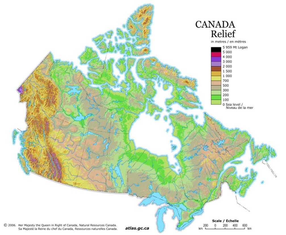
Canada Relief
Date of publication: 2006
Download the map (PDF, 9.01 MB)
Download the map (JPG, 0.13 MB)
This relief map of Canada shows elevation by hypsometric tints (a gradation of different colours) as well as major lakes. The map legend includes elevation ranges.
Standard time zones
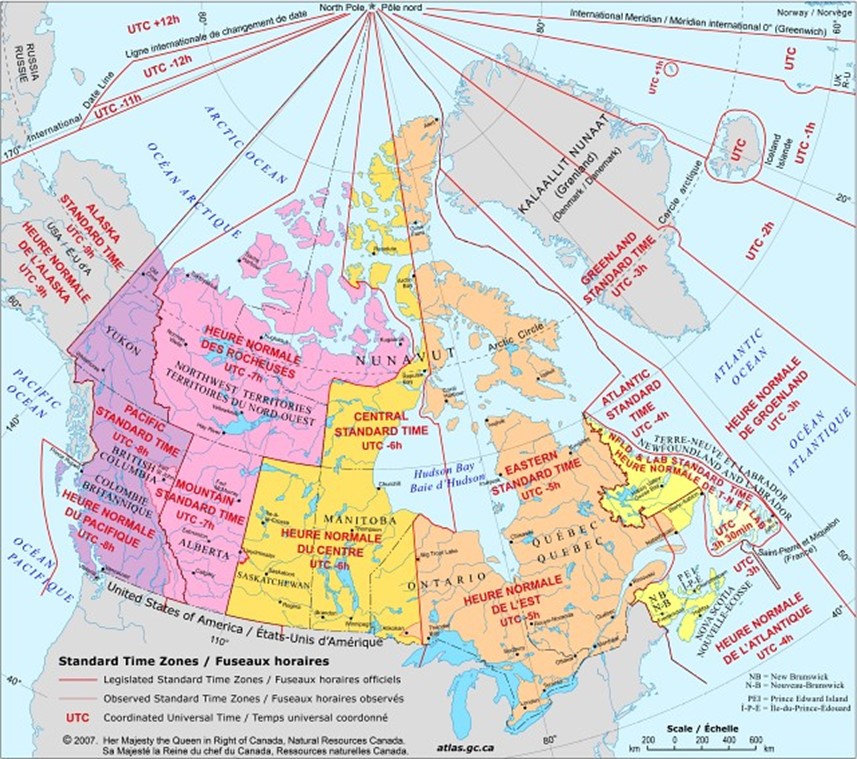
Standard Time Zones
Date of publication: 2007
Download the map (PDF, 2.51 MB)
Download the map (JPG, 0.16 MB)
This map shows Canada's six time zones as legislated and as observed. It also gives internationally accepted names and designators. The time zones are only accurate to the date published, 2007. More information about time zones is available from:
Drainage basins
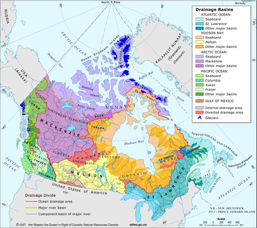
Drainage Basins
Date of publication: 2007
Download the map (PDF, 3.57 MB)
Download the map (JPG, 0.14 MB)
This map shows the five ocean drainage areas in Canada, the major river basins, the internal drainage areas, and the diverted drainage areas. A drainage basin, sometimes called a watershed, is an area where all surface water shares the same drainage outlet. Surface water consists of the tiny trickles of water flowing on the surface of the earth that develop into larger streams and eventually combine to form a river. The boundary of a watershed is called a drainage divide.
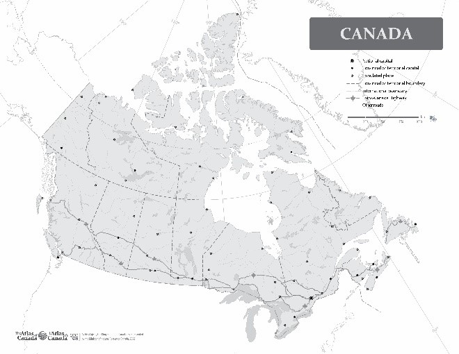
Outline with names
Canada with Names
Date of publication: 2022
Download the map (PDF, 1.79 MB)
Download the map (JPG, 3.22 MB)
This outline map of Canada shows the coastline, boundaries and major lakes and rivers for Canada and nearby countries, capitals, and populated places with named features.
Outline without names
Canada without Names
Date of publication: 2022
Download the map (PDF, 1.65 MB)
Download the map (JPG, 2.25 MB)
This outline map of Canada shows the coastline, boundaries and major lakes and rivers for Canada and nearby countries, capitals, and populated places without named features.
Provinces and Territories
- Alberta
- British Columbia
- Manitoba
- New Brunswick
- Newfoundland and Labrador
- Northwest Territories
- Nova Scotia
- Nunavut
- Ontario
- Prince Edward Island
- Quebec
- Saskatchewan
- Yukon
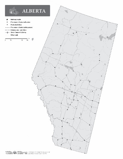
Alberta
Political
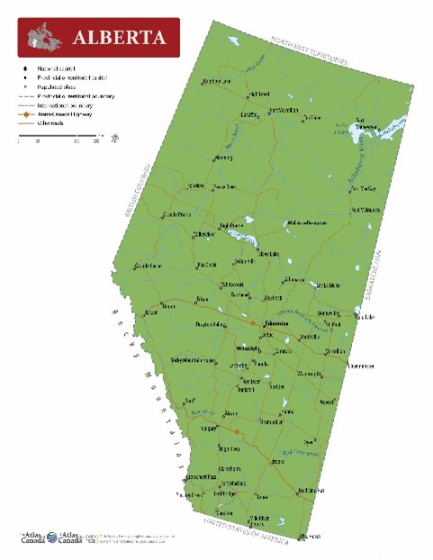
Alberta
Date of publication: 2022
Download the map (PDF, 0.69 MB)
Download the map (JPG, 3.0 MB)
This political map of Alberta shows boundaries, the provincial capital, selected populated places with names, selected drainage with names and selected roads.
Outline with names
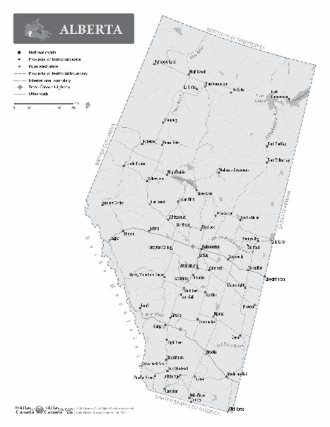
Alberta with Names
Date of publication: 2022
Download the map (PDF, 0.82 MB)
Download the map (JPG, 2.32 MB)
This outline map shows the boundary and the major lakes and rivers of Alberta with names for major political and geographical features.
Outline without names
Alberta without Names
Date of publication: 2022
Download the map (PDF, 0.74 MB)
Download the map (JPG, 1.62 MB)
This outline map shows the boundary and the major lakes and rivers of Alberta without the names for major political and geographical features.
Relief
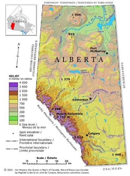
Alberta Relief
Date of publication: 2002
Download the map (PDF, 0.27 MB)
Download the map (JPG, 0.15 MB)
This relief map of Alberta shows elevation by hypsometric tints (a gradation of different colours), spot elevations, and major lakes. Elevation ranges are included in the map legend. The elevation data were derived from the map Canada-Relief, Fifth Edition, National Atlas of Canada published in 1986.
British Columbia
Political
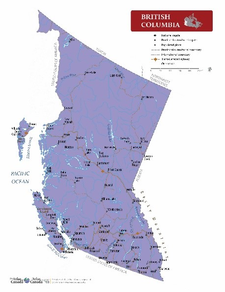
British Columbia
Date of publication: 2022
Download the map (PDF, 1.11 MB)
Download the map (JPG, 3.09 MB)
This political map of British Columbia shows boundaries, the provincial capital, selected populated places with names, selected drainage with names and selected roads.
Outline with names
British Columbia with Names
Date of publication: 2022
Download the map (PDF, 1.26 MB)
Download the map (JPG, 3.05 MB)
This outline map shows the boundary, coastline, and major lakes and rivers of British Columbia with the names for major political and geographical features.
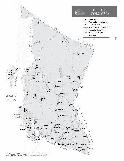
Outline without names
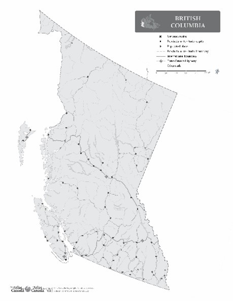
British Columbia without Names
Date of publication: 2022
Download the map (PDF, 1.01 MB)
Download the map (JPG, 2.18 MB)
This outline map shows the boundary, coastline, and major lakes and rivers of British Columbia without the names for major political and geographical features.
Relief
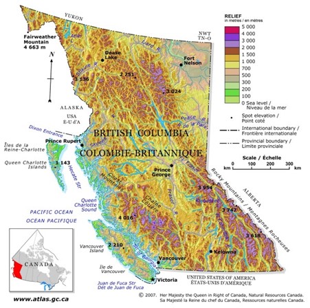
British Columbia Relief
Date of publication: 2007
Download the map (PDF, 2.15 MB)
Download the map (JPG, 0.12 MB)
This relief map of British Columbia shows elevation by hypsometric tints (a gradation of different colours), spot elevations, and major lakes. Elevation ranges are included in the map legend. The elevation data were derived from the map Canada-Relief, Fifth Edition, National Atlas of Canada published in 1986.
Manitoba
Political
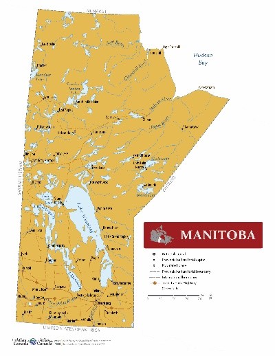
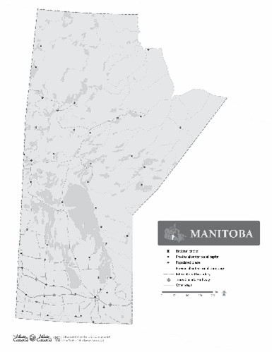
Manitoba
Date of publication: 2022
Download the map (PDF, 0.73 MB)
Download the map (JPG, 3.21 MB)
This political map of Manitoba shows boundaries, the provincial capital, selected populated places with names, selected drainage with names and selected roads.
Outline with names
Manitoba with Names
Date of publication: 2022
Download the map (PDF, 0.88 MB)
Download the map (JPG, 2.35 MB)
This outline map shows the boundary, coastline, and major lakes and rivers of Manitoba with the names for major political and geographical features.
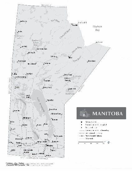
Outline without names
Manitoba without Names
Date of publication: 2022
Download the map (PDF, 0.79 MB)
Download the map (JPG, 1.62 MB)
This outline map shows the boundary, coastline, and major lakes and rivers of Manitoba without the names for major political and geographical features.
Relief
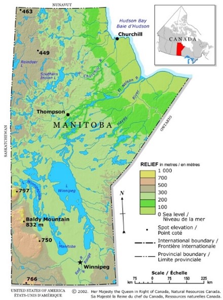
Manitoba Relief
Date of publication: 2002
Download the map (PDF, 0.29 MB)
Download the map (JPG, 0.14 MB)
This relief map of Manitoba shows elevation by hypsometric tints (a gradation of different colours), spot elevations, and major lakes . Elevation ranges are included in the map legend. The elevation data were derived from the map Canada-Relief, Fifth Edition, National Atlas of Canada published in 1986.
New Brunswick
Political

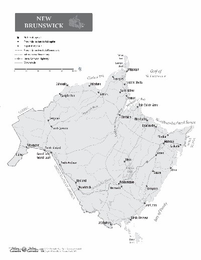
New Brunswick
Date of publication: 2022
Download the map (PDF, 0.94 MB)
Download the map (JPG, 2.77 MB)
This political map of New Brunswick shows boundaries, the provincial capital, selected populated places with names, selected drainage with names, and selected roads.
Outline with names
New Brunswick with Names
Date of publication: 2022
Download the map (PDF, 0.95 MB)
Download the map (JPG, 2.56 MB)
This political map of New Brunswick shows boundaries, the provincial capital, selected populated places with names, selected drainage with names, and selected roads.
Outline without names

New Brunswick without Names
Date of publication: 2022
Download the map (PDF, 0.89 MB)
Download the map (JPG, 1.91 MB)
This outline map shows the boundary, coastline, and major lakes and rivers of New Brunswick without the names for major political and geographical features.
Relief
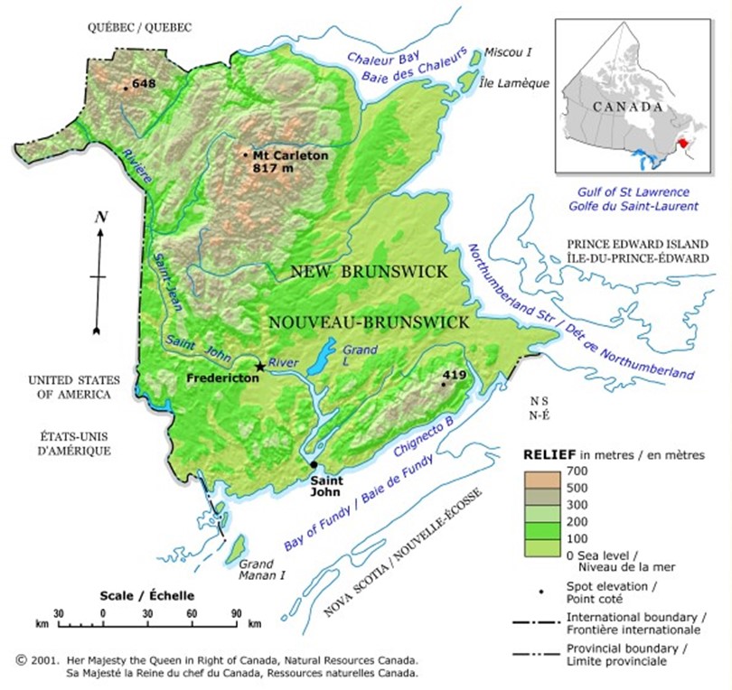
New Brunswick Relief
Date of publication: 2001
Download the map (PDF, 0.14 MB)
Download the map (JPG, 0.1 MB)
This relief map of New Brunswick shows elevation by hypsometric tints (a gradation of different colours), spot elevations, and major lakes. Elevation ranges are included in the map legend. The elevation data were derived from the map Canada-Relief, Fifth Edition, National Atlas of Canada published in 1986.
Newfoundland and Labrador
Political
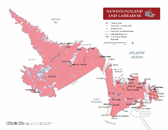
Newfoundland and Labrador
Date of publication: 2022
Download the map (PDF, 0.72 MB)
Download the map (JPG, 3.07 MB)
This political map of Newfoundland and Labrador shows boundaries, the provincial capital, selected populated places with names, selected drainage with names, and selected roads.
Outline with names
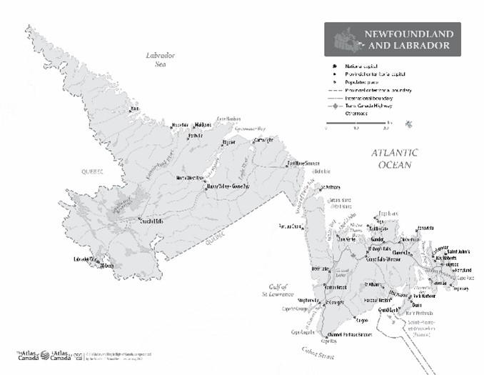
Newfoundland and Labrador with Names
Date of publication: 2022
Download the map (PDF, 0.80 MB)
Download the map (JPG, 3.02 MB)
This outline map shows the boundary, coastline, and major lakes and rivers of Newfoundland and Labrador with the names for major political and geographical features.
Outline without names
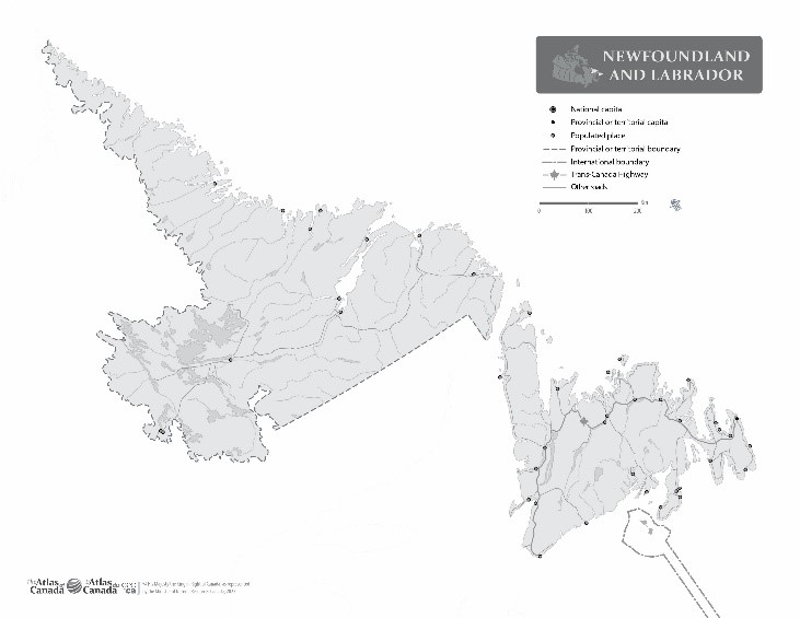
Newfoundland and Labrador without Names
Date of publication: 2022
Download the map (PDF, 0.70 MB)
Download the map (JPG, 2.29 MB)
This outline map shows the boundary, coastline, and major lakes and rivers of Newfoundland and Labrador without the names for major political and geographical features.
Relief
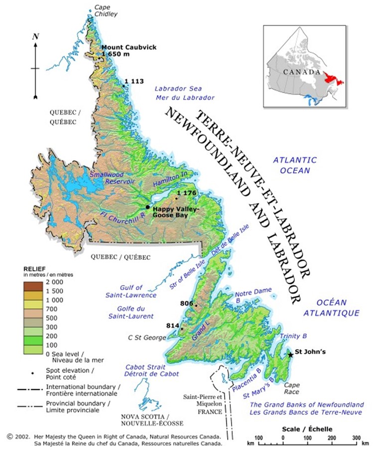
Newfoundland and Labrador Relief
Date of publication: 2002
Download the map (PDF, 1.88 MB)
Download the map (JPG, 0.11 MB)
This relief map of Newfoundland and Labrador shows elevation by hypsometric tints (a gradation of different colours), spot elevations, and major lakes. Elevation ranges are included in the map legend. The elevation data were derived from the map Canada-Relief, Fifth Edition, National Atlas of Canada published in 1986.
Northwest Territories
Political
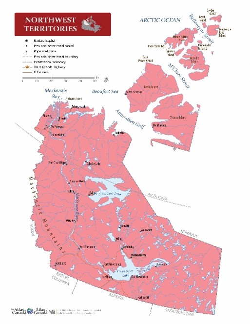
Northwest Territories
Date of publication: 2022
Download the map (PDF, 1.16 MB)
Download the map (JPG, 3.36 MB)
This political map of Northwest Territories shows boundaries, the territorial capital, selected populated places with names, selected drainage with names, and selected roads.
Outline with names
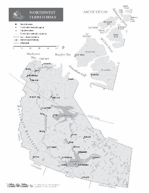
Northwest Territories with Names
Date of publication: 2022
Download the map (PDF, 1.26 MB)
Download the map (JPG, 3.19 MB)
This outline map shows the boundary, coastline, and major lakes and rivers of the Northwest Territories with the names for major political and geographical features.
Outline without names
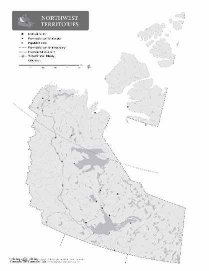
Northwest Territories without Names
Date of publication: 2022
Download the map (PDF, 1.19 MB)
Download the map (JPG, 2.60 MB)
This outline map shows the boundary, coastline, and major lakes and rivers of the Northwest Territories without the names for major political and geographical features.
Relief
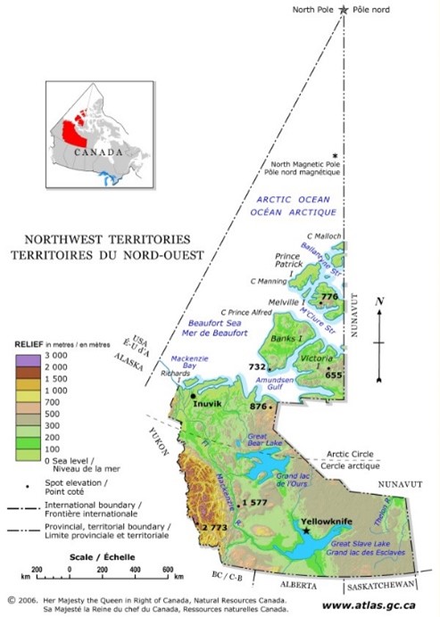
Northwest Territories Relief
Date of publication: 2006
Download the map (PDF, 2.13 MB)
Download the map (JPG, 0.11 MB)
This relief map of Northwest Territories shows elevation by hypsometric tints (a gradation of different colours), spot elevations, and major lakes. Elevation ranges are included in the map legend. The elevation data were derived from the map Canada-Relief, Fifth Edition, National Atlas of Canada published in 1986.
Nova Scotia
Political
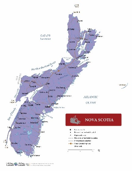
Nova Scotia
Date of publication: 2022
Download the map (PDF, 1.02 MB)
Download the map (JPG, 2.64 MB)
This political map of Nova Scotia shows boundaries, the provincial capital, selected populated places with names, selected drainage with names, and selected roads.
Outline with names
Nova Scotia with Names
Date of publication: 2022
Download the map (PDF, 1.01 MB)
Download the map (JPG, 2.25 MB)
This outline map shows the boundary, coastline, and major lakes and rivers of Nova Scotia with the names for major political and geographical features.
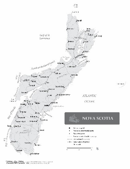
Outline without names

Nova Scotia without Names
Date of publication: 2022
Download the map (PDF, 0.94 MB)
Download the map (JPG, 1.49 MB)
This outline map shows the boundary, coastline, and major lakes and rivers of Nova Scotia without the names for major political and geographical features.
Relief
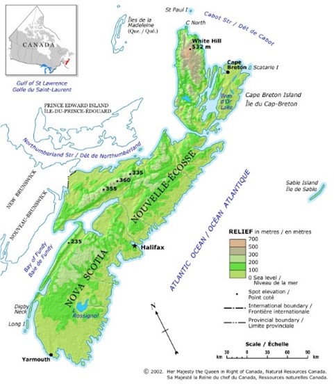
Nova Scotia Relief
Date of publication: 2002
Download the map (PDF, 1.05 MB)
Download the map (JPG, 0.11 MB)
This relief map of Nova Scotia shows elevation by hypsometric tints (a gradation of different colours), spot elevations, and major lakes. Elevation ranges are included in the map legend. The elevation data were derived from the map Canada-Relief, Fifth Edition, National Atlas of Canada published in 1986.
Nunavut
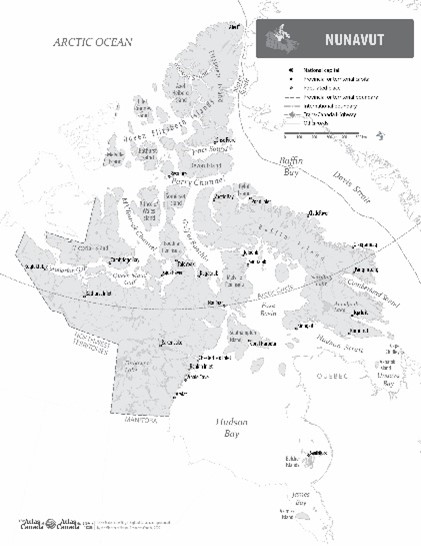
Political
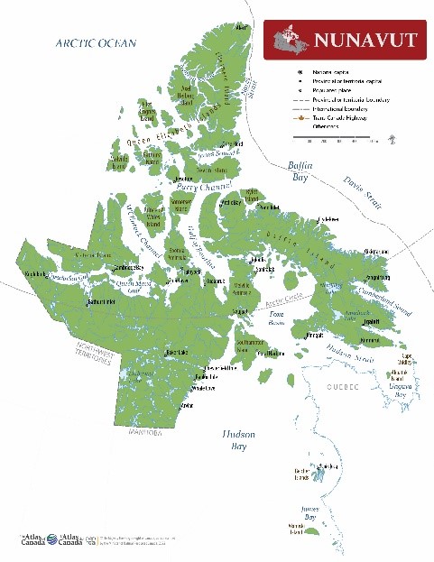
Nunavut
Date of publication: 2022
Download the map (PDF, 2.32 MB)
Download the map (JPG, 3.57 MB)
This political map of Nunavut shows boundaries, the territorial capital, selected populated places with names, selected drainage with names, and selected roads.
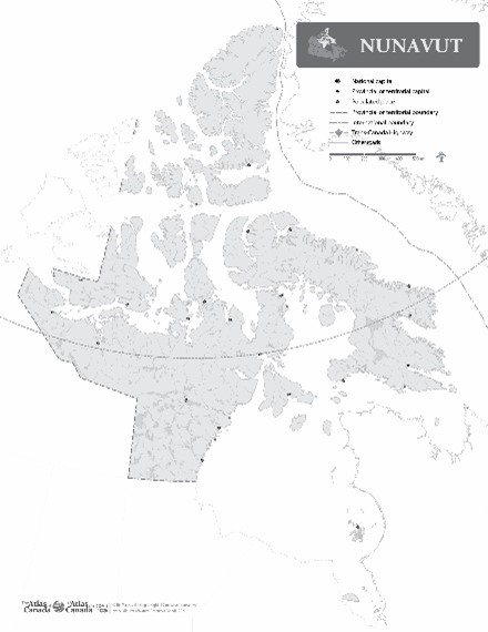
Outline with names
Nunavut with Names
Date of publication: 2022
Download the map (PDF, 2.35 MB)
Download the map (JPG, 3.63 MB)
This outline map shows the coastline, boundaries and major lakes and rivers for Nunavut with the names for major political and geographical features.
Outline without names
Nunavut without Names
Date of publication: 2022
Download the map (PDF, 2.25 MB)
Download the map (JPG, 2.59 MB)
This outline map shows the coastline, boundaries and major lakes and rivers for Nunavut without the names for major political and geographical features.
Relief
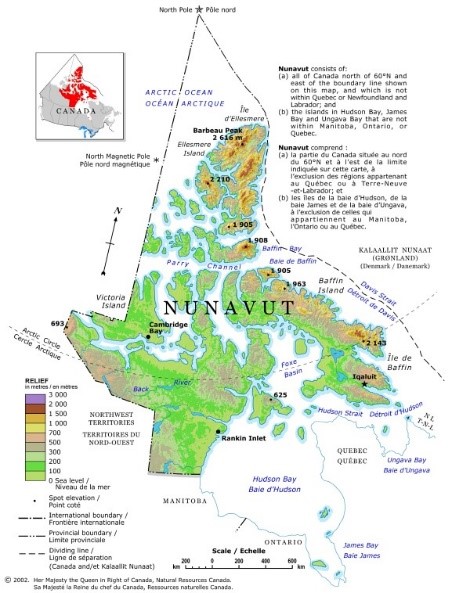
Nunavut Relief
Date of publication: 2002
Download the map (PDF, 2.2 MB)
Download the map (JPG, 0.12 MB)
This relief map of Nunavut shows elevation by hypsometric tints (a gradation of different colours), spot elevations, and major lakes. Elevation ranges are included in the map legend. The elevation data were derived from the map Canada-Relief, Fifth Edition, National Atlas of Canada published in 1986.
Ontario
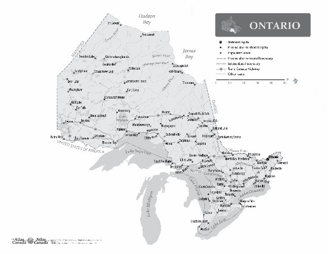
Political
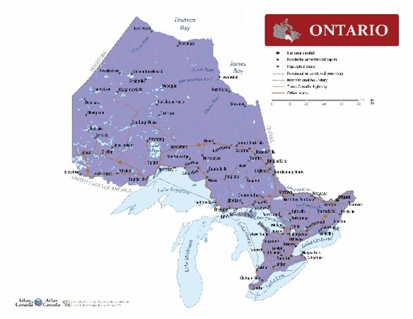
Ontario
Date of publication: 2022
Download the map (PDF, 1.25 MB)
Download the map (JPG, 3.17 MB)
This political map of Ontario shows boundaries, the provincial and national capitals, selected populated places with names, selected drainage with names, and selected roads.
Outline with names
Ontario with Names
Date of publication: 2022
Download the map (PDF, 1.44 MB)
Download the map (JPG, 3.13 MB)
This outline map shows the boundary, coastline, and major lakes and rivers of Ontario with the names for major political and geographical features.
Outline without names
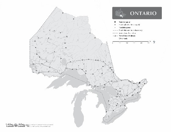
Ontario without Names
Date of publication: 2022
Download the map (PDF, 1.31 MB)
Download the map (JPG, 2.21 MB)
This outline map shows the boundary, coastline, and major lakes and rivers of Ontario without the names for major political and geographical features.
Relief
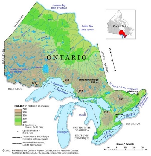
Ontario Relief
Date of publication: 2002
Download the map (PDF, 1.61 MB)
Download the map (JPG, 0.11 MB)
This relief map of Ontario shows elevation by hypsometric tints (a gradation of different colours), spot elevations, and major lakes. Elevation ranges are included in the map legend. The elevation data were derived from the map Canada-Relief, Fifth Edition, National Atlas of Canada published in 1986.
Prince Edward Island
Political
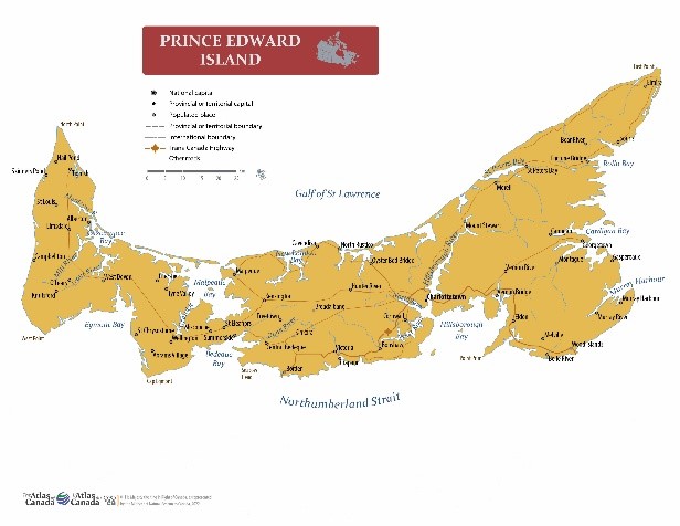
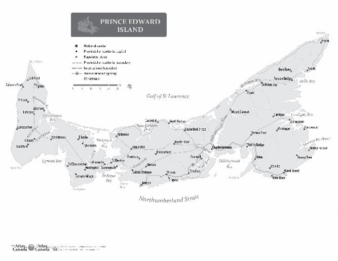
Prince Edward Island
Date of publication: 2022
Download the map (PDF, 0.59 MB)
Download the map (JPG, 2.36 MB)
This political map of Prince Edward Island shows boundaries, the provincial capital, selected populated places with names, selected drainage with names, and selected roads.
Outline with names
Prince Edward Island with Names
Date of publication: 2022
Download the map (PDF, 0.68 MB)
Download the map (JPG, 1.97 MB)
This outline map shows the boundary, coastline, and major lakes and rivers of Prince Edward Island with the names for major political and geographical features.
Outline without names
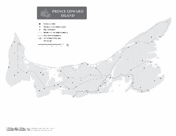
Prince Edward Island without Names
Date of publication: 2022
Download the map (PDF, 0.59 MB)
Download the map (JPG, 1.38 MB)
This outline map shows the boundary, coastline, and major lakes and rivers of Prince Edward Island without the names for major political and geographical features.
Relief
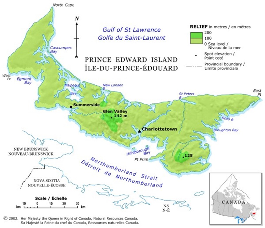
Prince Edward Island Relief
Date of publication: 2002
Download the map (PDF, 1.08 MB)
Download the map (JPG, 0.1 MB)
This relief map of Prince Edward Island shows elevation by hypsometric tints (a gradation of different colours),spot elevations, and major lakes. Elevation ranges are included in the map legend. Elevation ranges are included in the map legend. The elevation data were derived from the map Canada-Relief, Fifth Edition, National Atlas of Canada published in 1986.
Quebec
Political
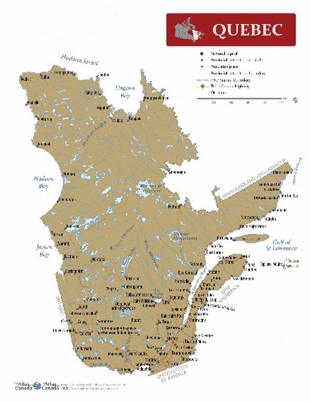
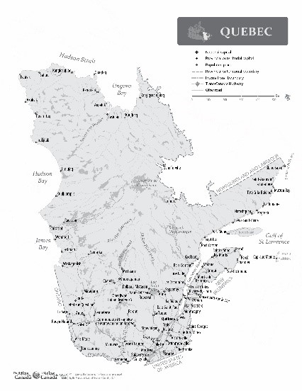
Quebec
Date of publication: 2022
Download the map (PDF, 1.02 MB)
Download the map (JPG, 4.03 MB)
This political map of Quebec shows boundaries, the provincial capital, selected populated places with names, selected drainage with names, and selected roads.
Outline with names
Quebec with Names
Date of publication: 2022
Download the map (PDF, 1.34 MB)
Download the map (JPG, 3.73 MB)
This outline map shows the boundary, coastline, and major lakes and rivers of Quebec with the names for major political and geographical features.
Outline without names
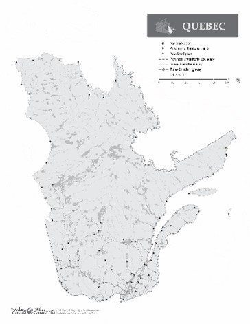
Quebec without Names
Date of publication: 2022
Download the map (PDF, 1.24 MB)
Download the map (JPG, 2.55 MB)
This outline map shows the boundary, coastline, and major lakes and rivers of Quebec without the names for major political and geographical features.
Relief
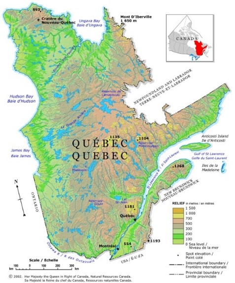
Quebec Relief
Date of publication: 2002
Download the map (PDF, 2.67 MB)
Download the map (JPG, 0.15 MB)
This relief map of Quebec shows elevation by hypsometric tints (a gradation of different colours), spot elevations, andmajor lakes. Elevation ranges are included in the map legend. The elevation data were derived from the map Canada-Relief, Fifth Edition, National Atlas of Canada published in 1986.
Saskatchewan
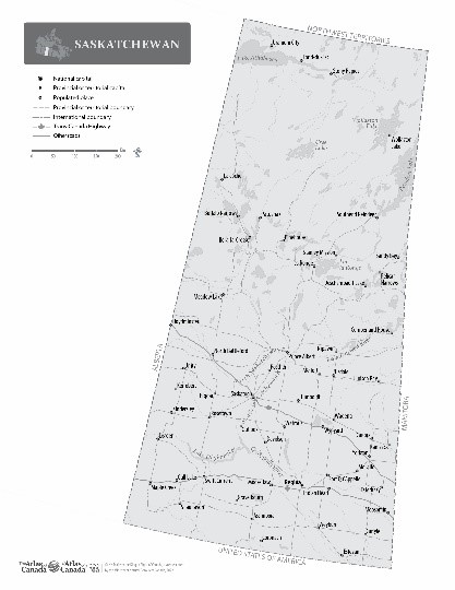
Political
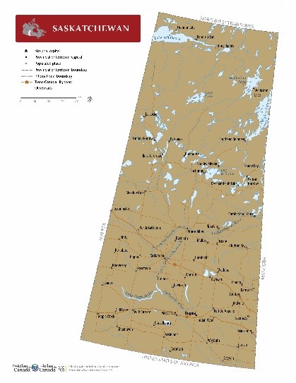
Saskatchewan
Date of publication: 2022
Download the map (PDF, 0.67 MB)
Download the map (JPG, 3.15 MB)
This political map of Saskatchewan shows boundaries, the provincial capital, selected populated places with names, selected drainage with names, and selected roads.
Outline with names
Saskatchewan with Names
Date of publication: 2022
Download the map (PDF, 0.79 MB)
Download the map (JPG, 2.32 MB)
This outline map shows the boundary and major lakes and rivers of Saskatchewan with the names for major political and geographical features.
Outline without names
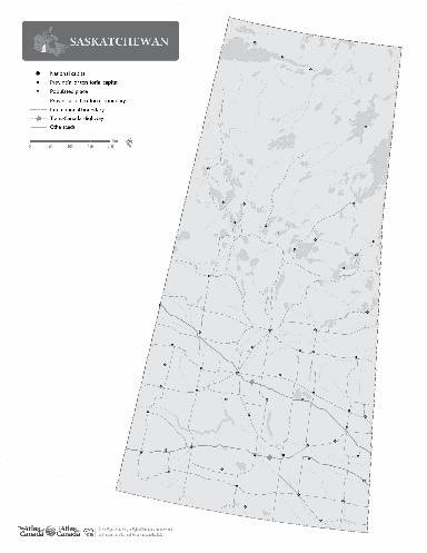
Saskatchewan without Names
Date of publication: 2022
Download the map (PDF, 0.72 MB)
Download the map (JPG, 1.68 MB)
This outline map shows the boundary and major lakes and rivers of Saskatchewan without the names for major political and geographical features.
Relief
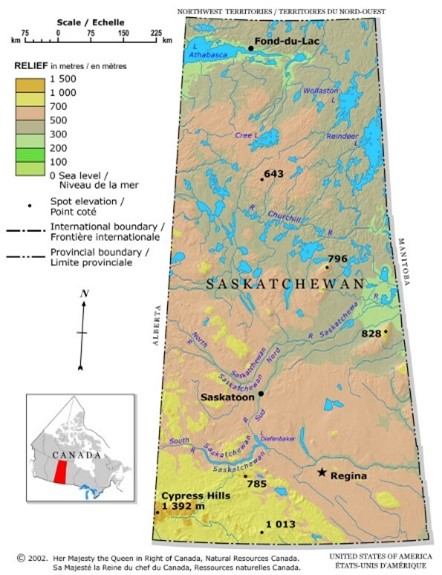
Saskatchewan Relief
Date of publication: 2002
Download the map (PDF, 0.25 MB)
Download the map (JPG, 0.13 MB)
This relief map of Saskatchewan shows elevation by hypsometric tints (a gradation of different colours),spot elevations, and major lakes. Elevation ranges are included in the map legend. The elevation data were derived from the map Canada-Relief, Fifth Edition, National Atlas of Canada published in 1986.
Yukon
Political
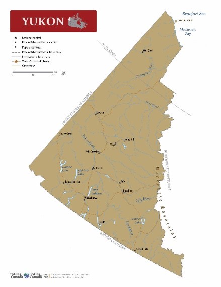
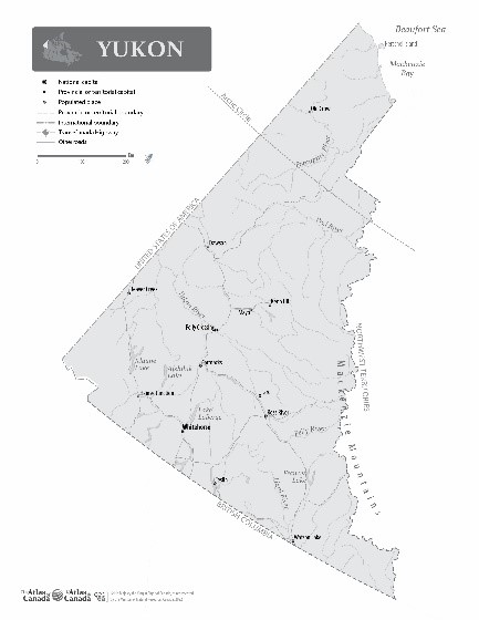
Yukon
Date of publication: 2022
Download the map (PDF, 0.56 MB)
Download the map (JPG, 2.26 MB)
This political map of Yukon shows boundaries, the territorial capital, selected populated places with names, selected drainage with names, and selected roads.
Outline with names
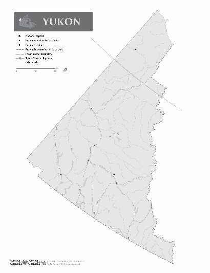
Yukon with Names
Date of publication: 2022
Download the map (PDF, 0.69 MB)
Download the map (JPG, 2.20 MB)
This outline map shows the boundaries, coastline, and major lakes and rivers of Yukon with the names for major political and geographical features.
Outline without names
Yukon without Names
Date of publication: 2022
Download the map (PDF, 0.63 MB)
Download the map (JPG, 1.84 MB)
This outline map shows the boundaries, coastline, and major lakes and rivers of Yukon with the names for major political and geographical features.
Relief
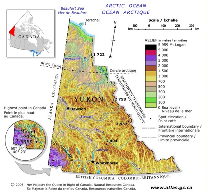
Yukon Relief
Date of publication: 2006
Download the map (PDF, 1.14 MB)
Download the map (JPG, 0.11 MB)
This relief map of Yukon shows elevation by hypsometric tints (a gradation of different colours), spot elevations, and major lakes. Elevation ranges are included in the map legend. The elevation data were derived from the map Canada-Relief, Fifth Edition, National Atlas of Canada published in 1986.
Circumpolar
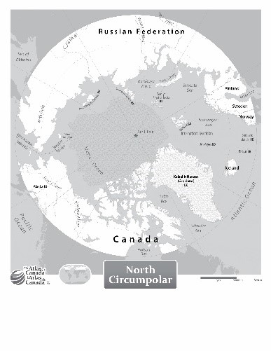
North Circumpolar Region
Political
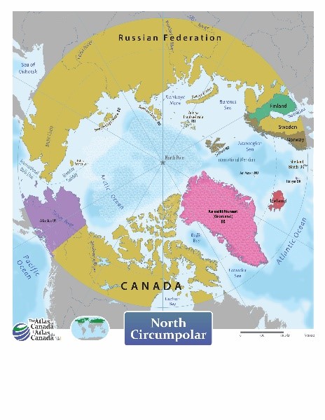
North Circumpolar Region
Date of publication: 2022
Download the map (PDF, 14.32 MB)
Download the map (JPG, 3.36 MB)
A political map of the North Circumpolar Region with national boundaries and country names north of 60 degrees latitude.
Outline with names
North Circumpolar Region with Names
Date of publication: 2022
Download the map (PDF, 14.42 MB)
Download the map (JPG, 3.15 MB)
An outline map of the Northern Circumpolar Region north of 60 degrees latitude with names for countries and other major features.
Outline without names
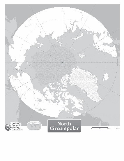
North Circumpolar Region without Names
Date of publication: 2022
Download the map (PDF, 14.38 MB)
Download the map (JPG, 2.67 MB)
An outline map of the Northern Circumpolar Region north of 60 degrees latitude without names for countries and other major features.
Antarctica
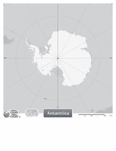
Political
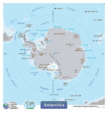
Antarctica
Date of publication: 2022
Download the map (PDF, 6.61 MB)
Download the map (JPG, 2.65 MB)
This general map of Antarctica shows surrounding islands and major physical features including ice shelves.
Outline with names
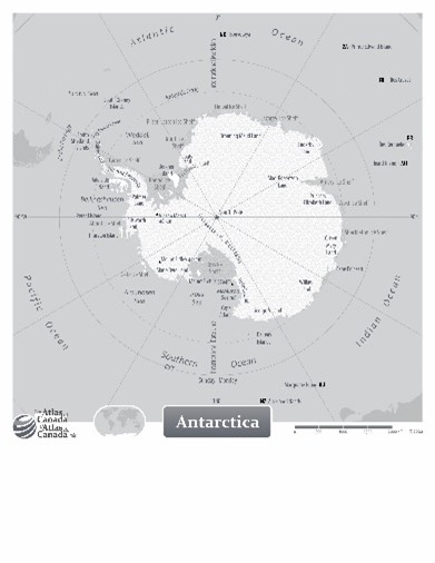
Antarctica with Names
Date of publication: 2022
Download the map (PDF, 6.92 MB)
Download the map (JPG, 1.69 MB)
An outline map of Antarctica with names for major physical features including ice shelves.
Outline without names
Antarctica without Names
Date of publication: 2022
Download the map (PDF, 6.21 MB)
Download the map (JPG, 1.28 MB)
An outline map of Antarctica without names for major physical features including ice shelves.
International
- The World
- Africa
- Asia
- Caribbean
- Europe
- Mexico and Central America
- North America
- Oceania
- South America
The World
Political
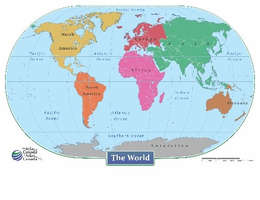
The World – Continents
Date of publication: 2022
Download the map (PDF, 33.22 MB)
Download the map (JPG, 2.82 MB)
This political map of the World shows national boundaries, continents, and oceans.
Outline with names
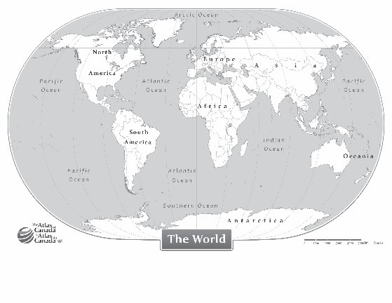
The World with Names
Date of publication: 2022
Download the map (PDF, 32.66 MB)
Download the map (JPG, 2.46 MB)
This outline map shows the World with names for continents and oceans.
Outline without names
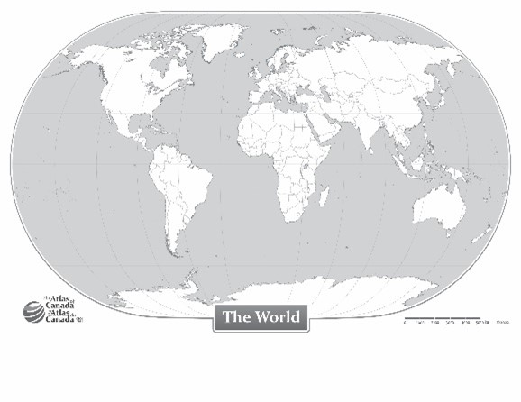
The World without Names
Date of publication: 2022
Download the map (PDF, 32.63 MB)
Download the map (JPG, 2.31 MB)
This outline map shows the World without names for continents and oceans.
Africa
Political
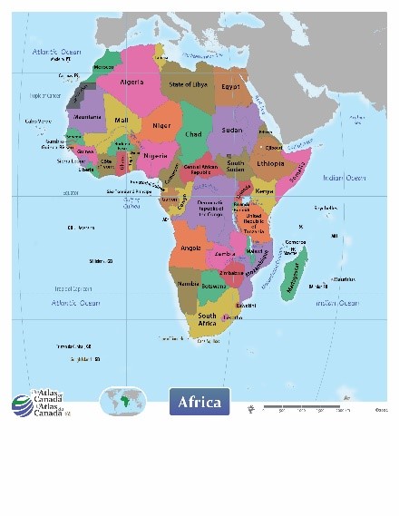
Africa
Date of publication: 2022
Download the map (PDF, 7.24 MB)
Download the map (JPG, 2.50 MB)
This political map of Africa shows national boundaries and country names.
Outline with names
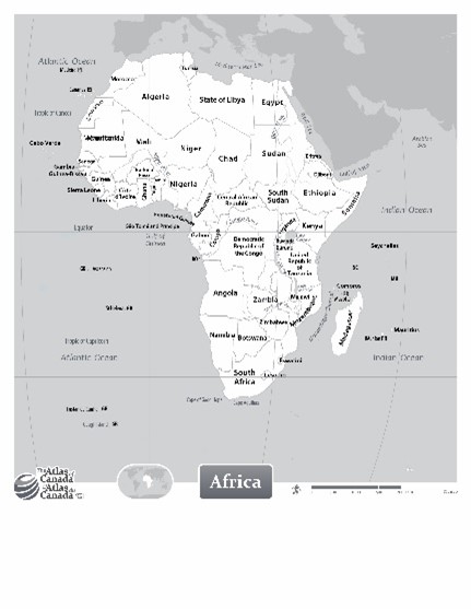
Africa with Names
Date of publication: 2022
Download the map (PDF, 7.52 MB)
Download the map (JPG, 2.0 MB)
This outline map shows Africa with names for countries and other major features.
Outline without names
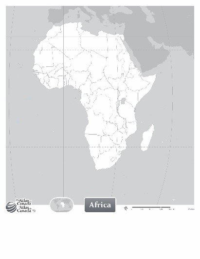
Africa without Names
Date of publication: 2022
Download the map (PDF, 7.52 MB)
Download the map (JPG, 2.0 MB)
This outline map shows Africa without names for countries and other major features.
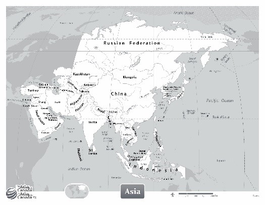
Asia
Political
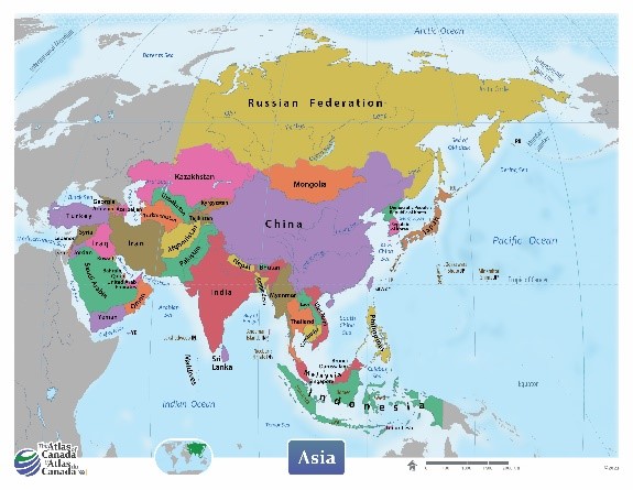
Asia
Date of publication: 2022
Download the map (PDF, 8.0 MB)
Download the map (JPG, 3.41 MB)
This political map of Asia shows national boundaries, country names, and oceans.
Outline with names
Asia with Names
Date of publication: 2022
Download the map (PDF, 6.72 MB)
Download the map (JPG, 3.30 MB)
This outline map shows Asia with names for countries and other major features.
Outline without names
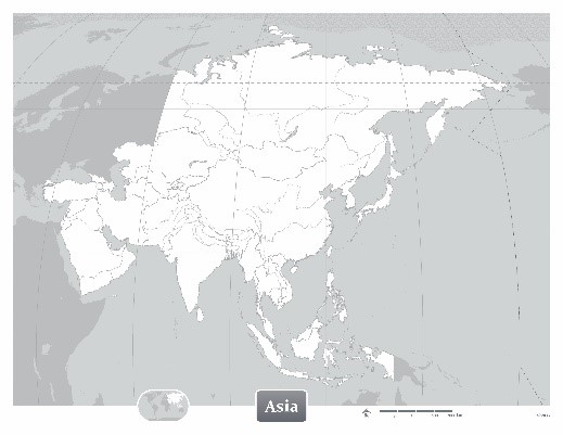
Asia without Names
Date of publication: 2022
Download the map (PDF, 6.66 MB)
Download the map (JPG, 2.33 MB)
This outline map shows Asia without names for countries and other major features.
Caribbean
Political
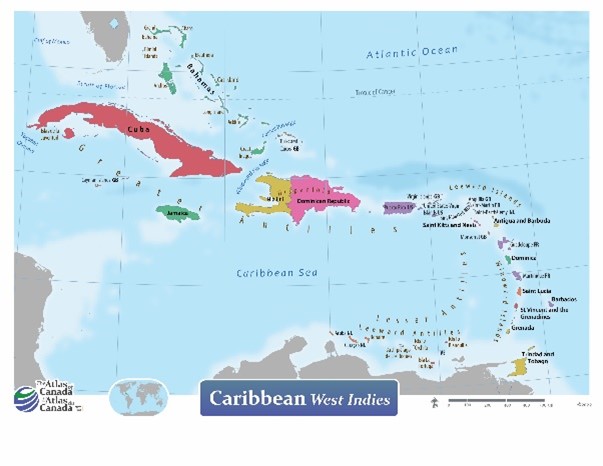
Caribbean
Date of publication: 2022
Download the map (PDF, 9.14 MB)
Download the map (JPG, 2.47 MB)
This political map of the Caribbean shows national boundaries, country names, and oceans.
Outline with names
The Caribbean with Names
Date of publication: 2022
Download the map (PDF, 5.21 MB)
Download the map (JPG, 2.01 MB)
This outline map shows the Caribbean with names for countries and other major features.
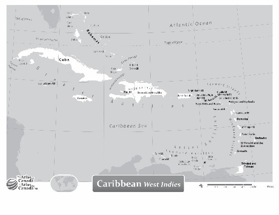
Outline without names
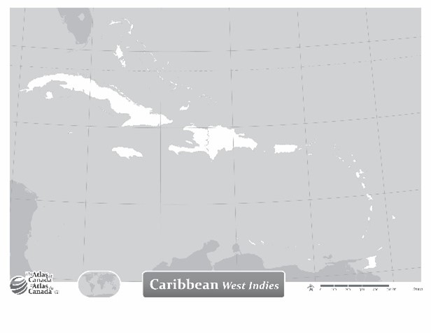
The Caribbean without Names
Date of publication: 2022
Download the map (PDF, 32.63 MB)
Download the map (JPG, 2.31 MB)
This outline map shows the Caribbean without names for countries and other major features.
Europe
Political
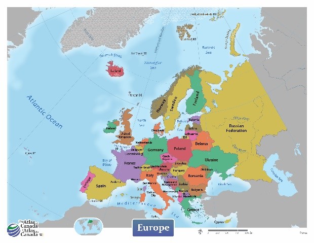
Europe
Date of publication: 2022
Download the map (PDF, 8.35 MB)
Download the map (JPG, 3.18 MB)
This political map of Europe shows national boundaries, country names, and oceans.
Outline with names
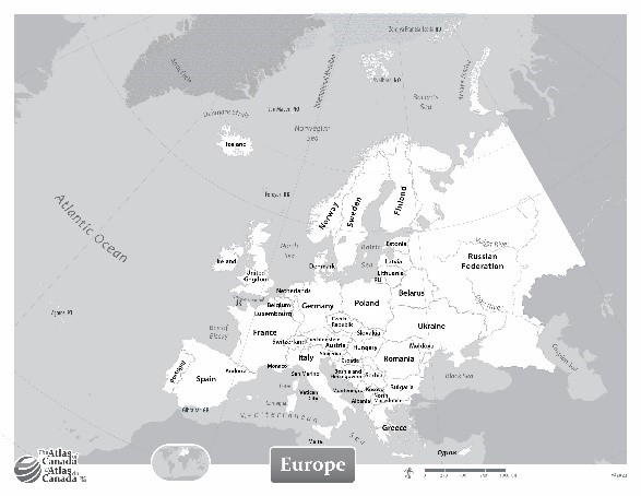
Europe with Names
Date of publication: 2022
Download the map (PDF, 6.59 MB)
Download the map (JPG, 2.84 MB)
This outline map shows Europe with names for countries and other major features.
Outline without names
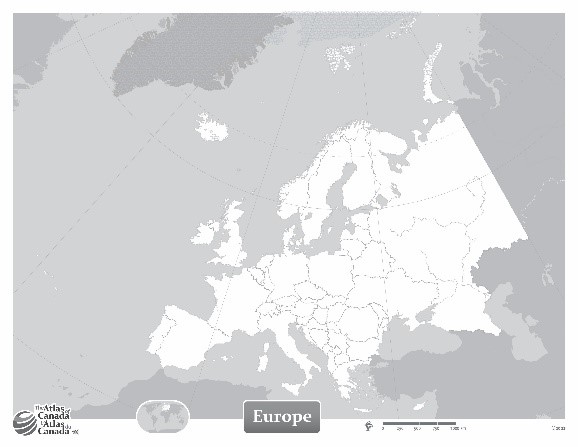
Europe without Names
Date of publication: 2022
Download the map (PDF, 6.47 MB)
Download the map (JPG, 2.18 MB)
This outline map shows Europe without names for countries and other major features.
Mexico and Central America
Political
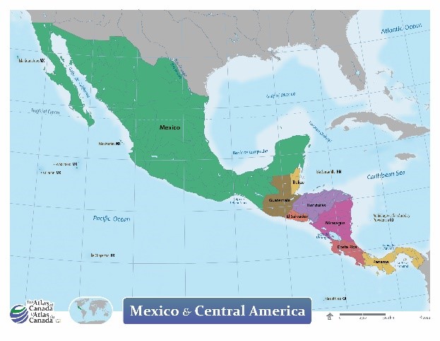
Mexico and Central America
Date of publication: 2022
Download the map (PDF, 7.96 MB)
Download the map (JPG, 2.76 MB)
This political map of Mexico and Central America shows national and state boundaries, country names, and oceans.
Outline with names
Mexico and Central America with Names
Date of publication: 2022
Download the map (PDF, 7.78 MB)
Download the map (JPG, 2.63 MB)
This outline map shows Mexico and Central America with names for countries and other major features.
Outline without names
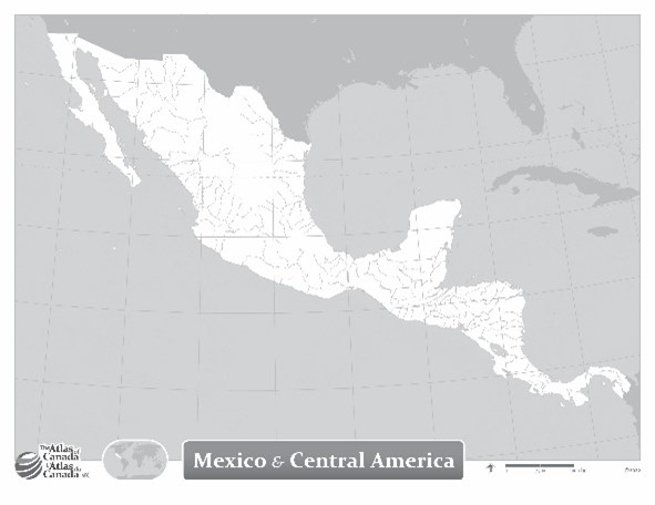
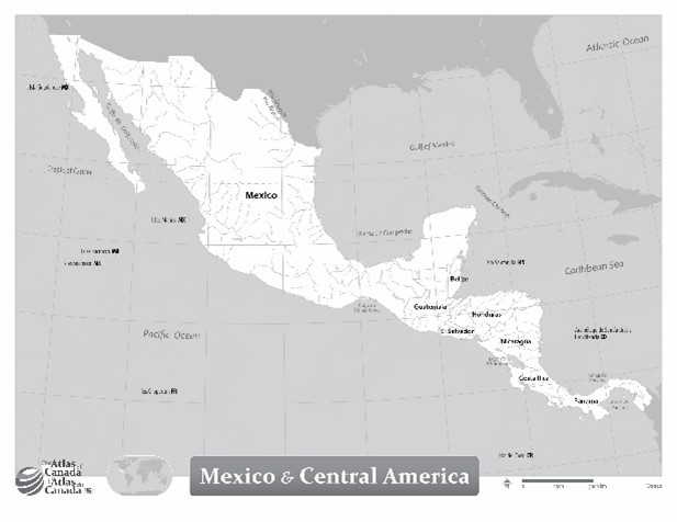
Mexico and Central America without Names
Date of publication: 2022
Download the map (PDF, 7.74 MB)
Download the map (JPG, 2.28 MB)
This outline map shows Mexico and Central America without names for countries and other major features.
North America
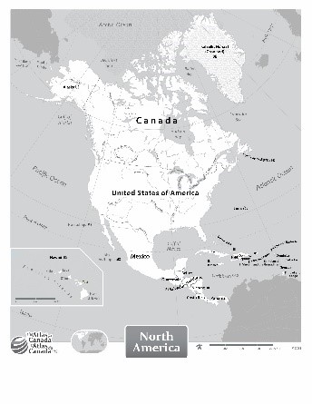
Political
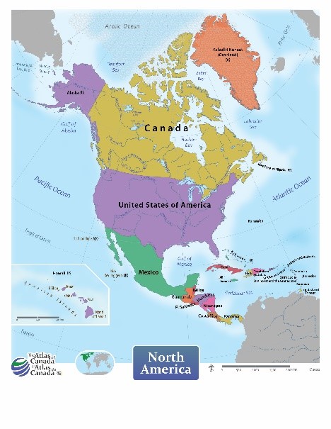
North America
Date of publication: 2022
Download the map (PDF, 8.38 MB)
Download the map (JPG, 3.44 MB)
This political map of North America shows national boundaries, country names, and oceans.
Outline with names
North America with Names
Date of publication: 2022
Download the map (PDF, 7.2 MB)
Download the map (JPG, 3.07 MB)
This outline map shows North America with names for countries and other major features.
Outline without names
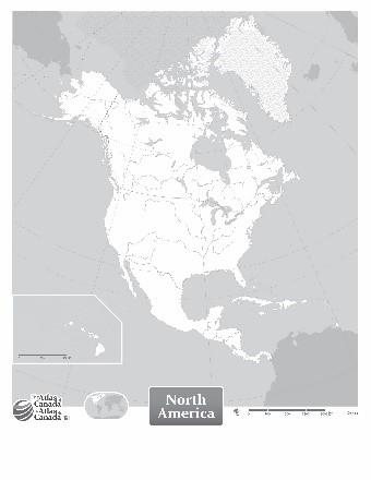
North America without Names
Date of publication: 2022
Download the map (PDF, 6.97 MB)
Download the map (JPG, 2.38 MB)
This outline map shows North America without names for countries and other major features.
Oceania
Political
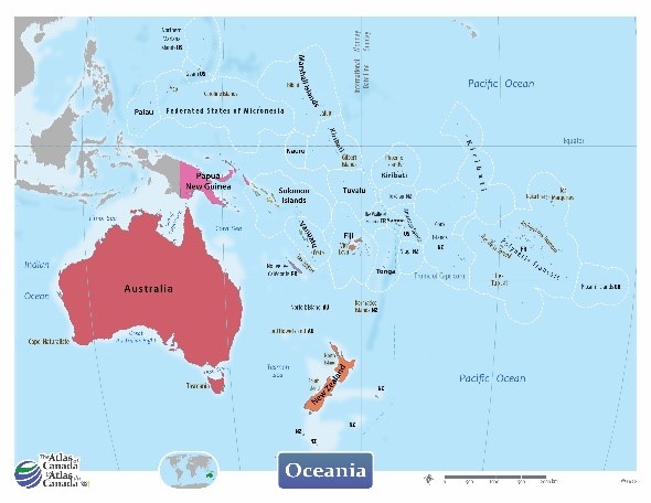
Oceania
Date of publication: 2022
Download the map (PDF, 8.12 MB)
Download the map (JPG, 2.34 MB)
This political map of Oceania shows national boundaries, country names, and oceans.
Outline with names
Oceania with Names
Date of publication: 2022
Download the map (PDF, 5.72 MB)
Download the map (JPG, 2.23 MB)
This outline map shows Oceania with names for countries and other major features.
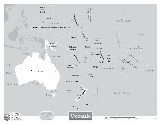
Outline without names
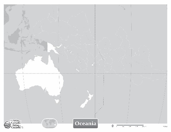
Oceania without Names
Date of publication: 2022
Download the map (PDF, 5.66 MB)
Download the map (JPG, 1.56 MB)
This outline map shows Oceania without names for countries and other major features.
South America
Political
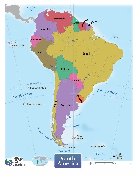
South America
Date of publication: 2022
Download the map (PDF, 6.52 MB)
Download the map (JPG, 2.31 MB)
This political map of South America shows national boundaries, country names, and oceans.
Outline with names
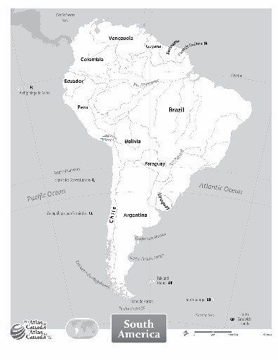
South America with Names
Date of publication: 2022
Download the map (PDF, 5.35 MB)
Download the map (JPG, 2.17 MB)
This outline map shows South America with names for countries and other major features.
Outline without names
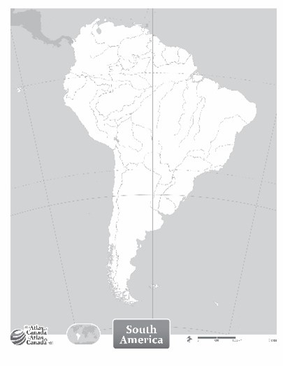
South America without Names
Date of publication: 2022
Download the map (PDF, 5.25 MB)
Download the map (JPG, 1.67 MB)
This outline map shows South America without names for countries and other major features.