
On this page
Communication
Internet
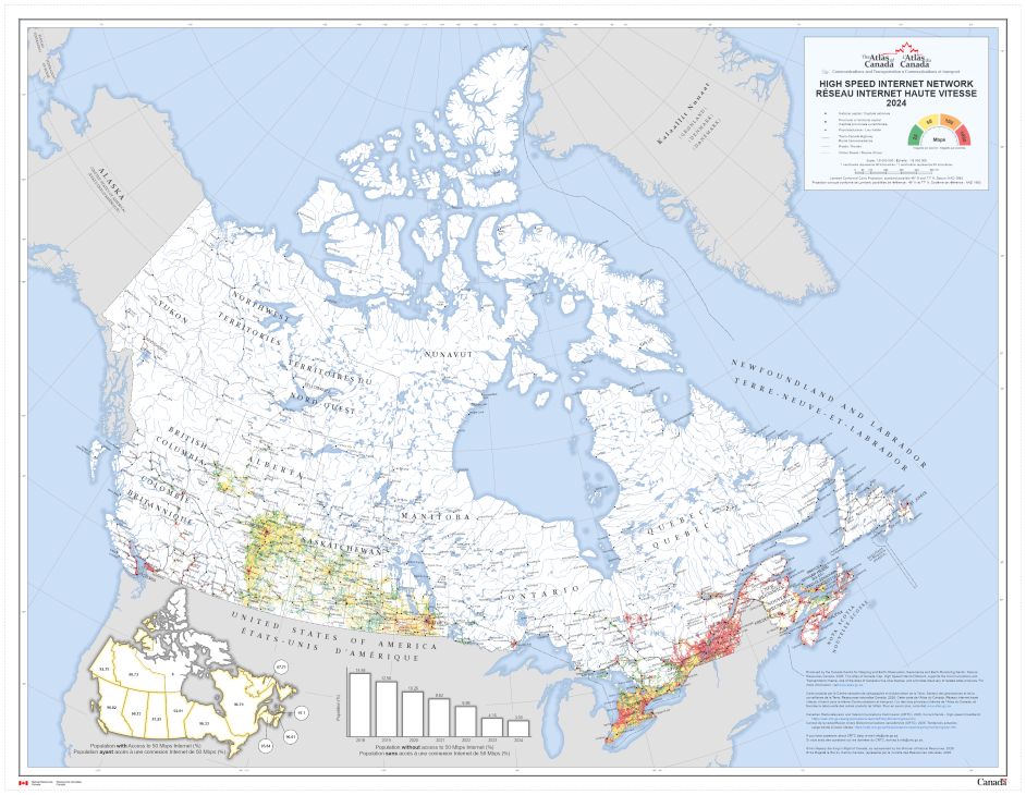
CommunicationHigh Speed Internet Network
Date of publication: 2026
Download the map (PDF, 46.7 MB)
The High Speed Internet Network map shows the coverage of high-speed internet, from 25 megabits per second (Mbps) to 1000 Mbps, across Canada from 2018 to 2024. The printable version (PDF) shows the coverage in 2024.
Mobile network
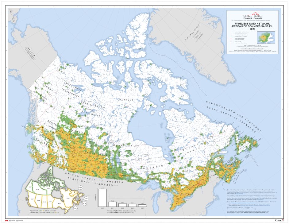
Wireless Data Network
Date of publication: 2026
Download the map (PDF, 47.7 MB)
The Wireless Data Network map shows the coverage of the 5G and LTE networks across Canada from 2013 to 2024. The printable version (PDF) shows the 2024 coverage.
Download previous editions:
- 5th edition, Canada, Telecommunications Systems, 1987 (PDF, 8.79 MB)
- 4th edition, Communications, Eastern Canada, 1972 (PDF, 3.13 MB)
- 4th edition, Communication, Western Canada, 1972 (PDF, 3.09 MB)
- 1st edition, Telephones Maritime Provinces and Quebec, 1906 (PDF, 2.02 MB)
- 1st edition, Telephones Ontario, Quebec, Manitoba, Saskatchewan, Alberta, British Columbia and Yukon, 1906 (PDF, 2.38 MB)
Roads
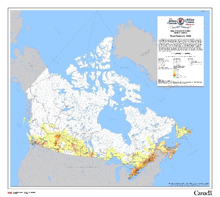
Road Network, 2006
Date of publication: 2010, 6th edition
Download the map (ZIP - PDF/JPG, 9.95 MB)
View the metadata on Open Government
This map shows the 1.1 million kilometres of roads connecting people and goods from one community to another in Canada, and to the rest of the continent. Roads are classified based on the population of the communities the roads connect; combined, the communities on the map represent 78% of the total population in 2001.
Download previous editions:
- Canada, Road Transportation Network. 5th edition, 1984 (PDF, 3.17 MB)
- Roads. 4th edition, 1974 (PDF, 3.03 MB)
- Major Roads. 3rd edition, 1958 (PDF, 1.22 MB)
Railways
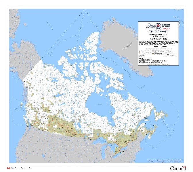
Rail Network, 2006
Date of publication: 2010, 6th edition
Download the map (ZIP – PDF/JPG, 9.17 MB)
View the metadata on Open Government
This map shows the 48 068 kilometres of railways, stretching from the Atlantic to the Pacific oceans. The two largest Class 1 carriers, Canadian National Railway Company and Canadian Pacific Rail Company, owns or leases 22 686 and 12 812 kilometres of railways, respectively. The regional and shortline railways combined, own or lease a total of 11 734 kilometres.
Download previous editions:
5th edition
4th edition
- Railways and canals 1971 – eastern Canada, 1972 (PDF, 2.58 MB)
- Railways and canals 1971 – western Canada, 1972 (PDF, 2.48 MB)
3rd edition
2nd edition
- Alberta, British Columbia and Yukon Railway Territories, 1915 (PDF, 1.86 MB)
- Ontario and Quebec railway territories, 1915 (PDF, 2.12 MB)
- Quebec and Maritime provinces railway territories, 1915 (PDF, 1.89 MB)
1st edition
- Railways British Columbia and Yukon, 1906 (PDF, 1.29 MB)
- Railways Manitoba Saskatchewan and Alberta, 1906 (PDF, 1.87 MB)
- Railways Ontario and Quebec, 1906 (PDF, 1.61 MB)
- Railways Quebec and Maritime Provinces, 1906 (PDF, 1.87 MB)
Marine transportation
Ports
.jpg)
Marine Transportation Infrastructure – Ports (2006)
Date of publication: 2010, 6th edition
Download the map (ZIP - PDF/JPG 9.81 MB)
View the metadata on Open Government
This map shows approximately 590 major ports, the Seaway (including major locks), and vessel traffic service zones. Canada is a maritime nation with access to three oceans (Atlantic, Pacific, and Arctic), and shared access to the longest inland waterway system in the world, the Great Lakes St. Lawrence Seaway system of waterways. The largest ports are the 19 Canada Port Authorities, recognized by the Federal government as vital to domestic and international trade.
Download previous editions:
Harbours
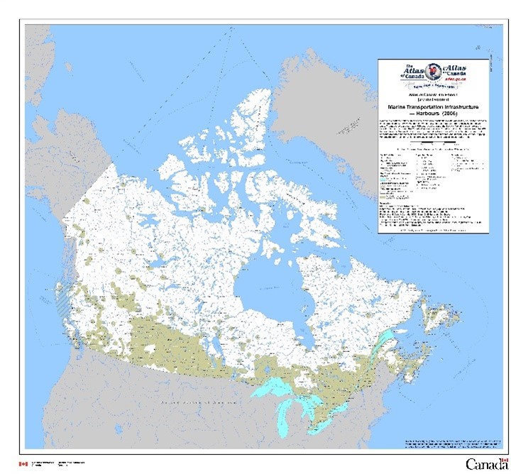
Marine Transportation Infrastructure – Harbours (2006)
Date of publication: 2010, 6th edition
Download the map (ZIP – PDF/JPG, 9.80 MB)
View the metadata on Open Government
This map shows approximately 700 small craft harbours, the Seaway (including major locks) and vessel traffic service zones. Canada is a maritime nation with access to three oceans (Atlantic, Pacific, and Arctic), and shared access to the longest inland waterway system in the world, the Great Lakes St. Lawrence Seaway system of waterways. The harbour commission (Oshawa) is recognized by the Federal government as vital to domestic and international trade.
Download previous editions: