On this page
Territorial divisions
Canada
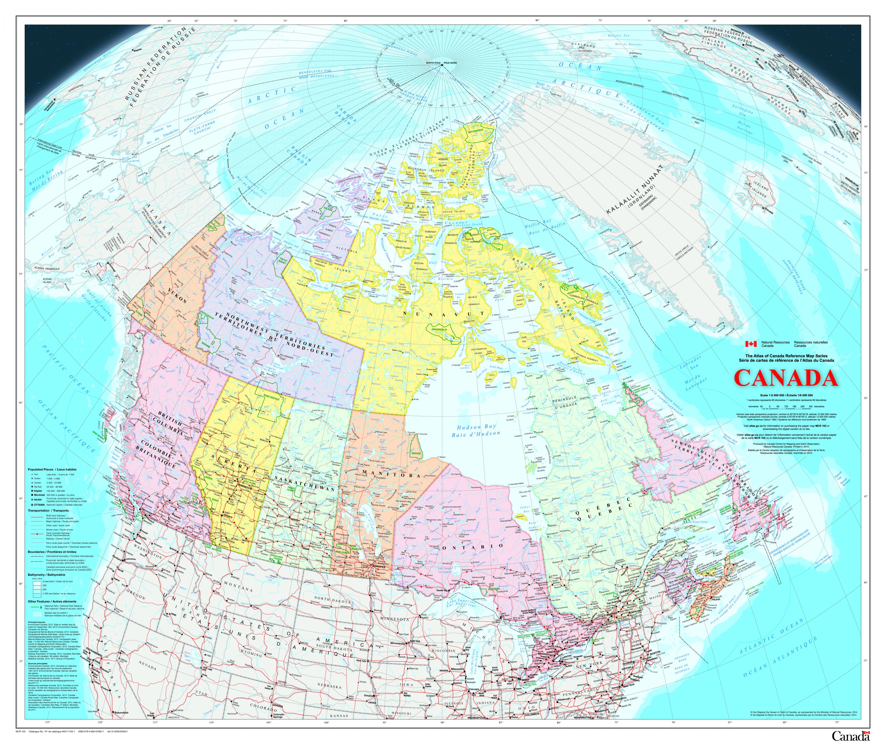
Canada
Date of publication: 2014
Download the map (ZIP – PDF/JPG, 27.7 MB)
View the metadata on Open Government
This map is an update to the paper map of Canada published in 2006, and most data are current to the period 2010 to 2013. This map uses a vertical near-side perspective projection, which provides a unique three-dimensional view of Canada.
Download previous editions:
North Circumpolar
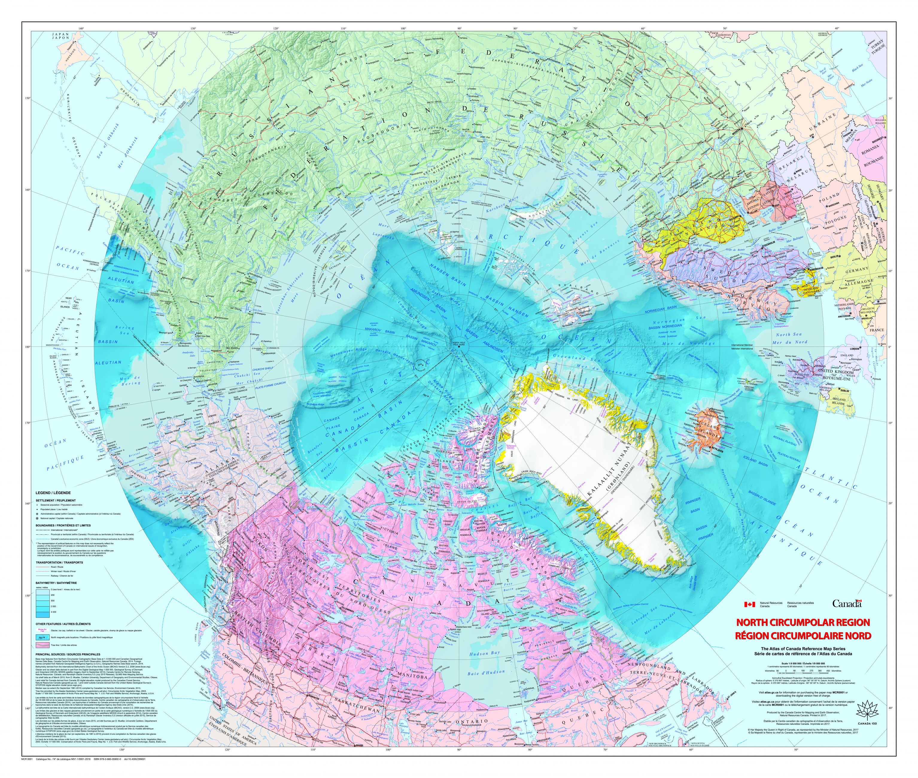
North Circumpolar Region
Date of publication: 2017
Download the map (PDF, 46.8 MB)
View the metadata on Open Government
This bilingual map shows the geography of the northern circumpolar region. It includes all international boundaries, Canadian provincial and territorial boundaries, and Canada's 200 nautical mile offshore exclusive economic zone. The map identifies several significant northern features, including the median sea ice extent from September 1981 to 2010, the tree line, undersea relief, land relief, the Magnetic North Pole, glaciers, ice fields and coastal ice shelves.
Download previous editions:
The World
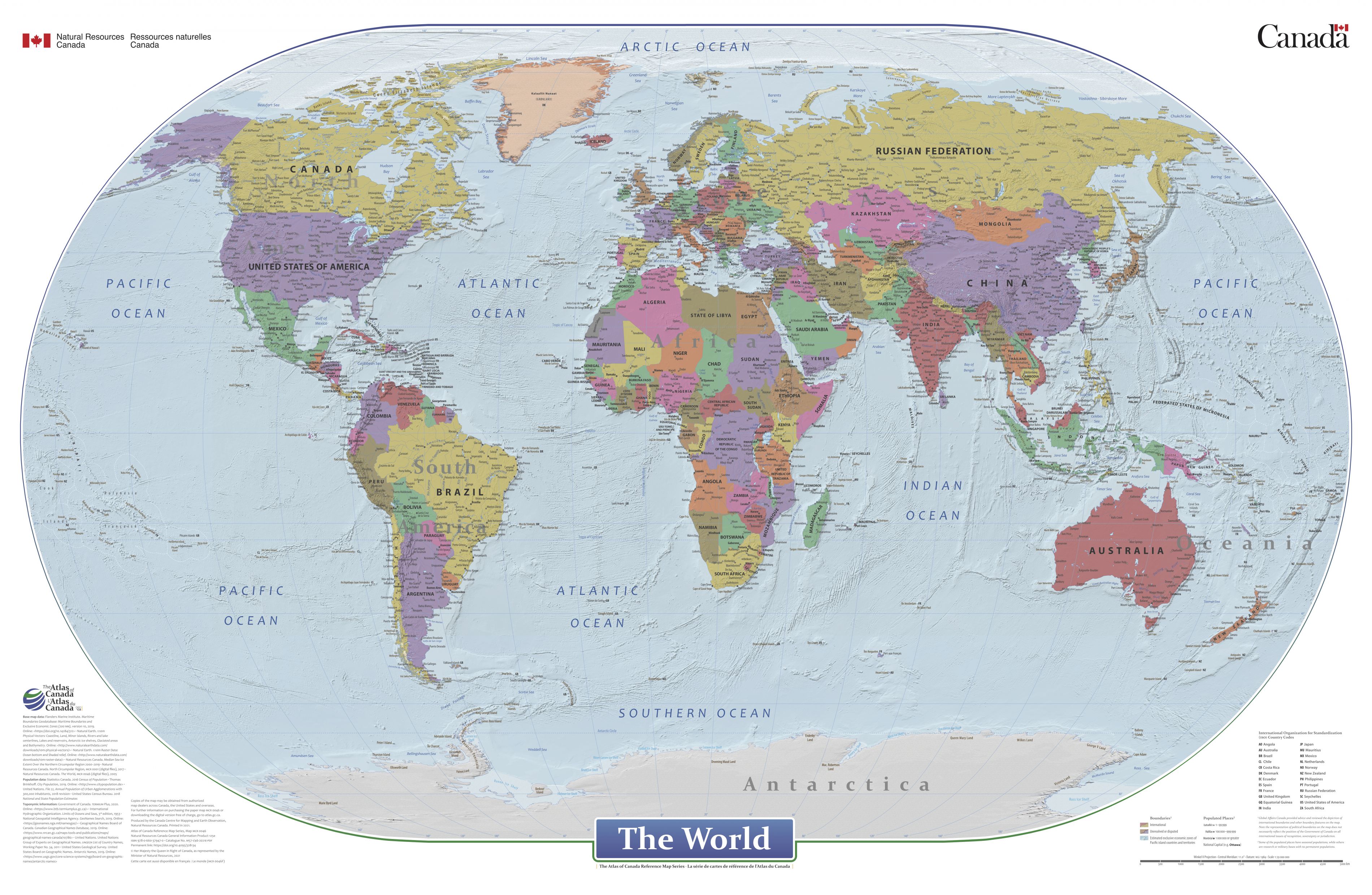
The World
Date of publication: 2021
Download the map (ZIP – PDF/JPG, 395 MB)
View the metadata on Open Government
This map is a general reference political map focused on the names and international boundaries of sovereign and non-sovereign countries. The map shows major populated places, relief, underwater depth of ocean floors, major physical features of bodies of water and adjacent land areas, and major physical land features.
Download previous editions:
Protected places
National parks
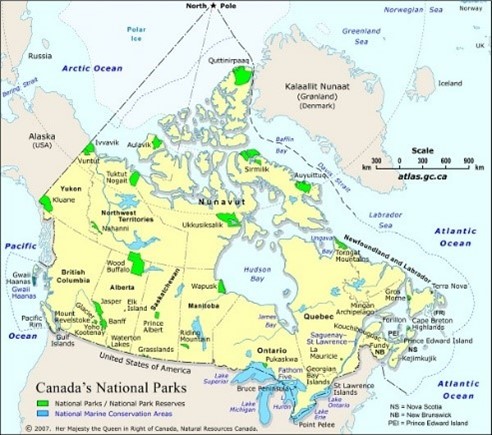
National Parks
Date of publication: 2007, 6th edition
Download the map (PDF, 2.15 MB)
View the metadata on Open Government
This map illustrates the locations, extents and names of National Parks and National Marine Conservation Areas in Canada.
Download previous editions:
Protected areas
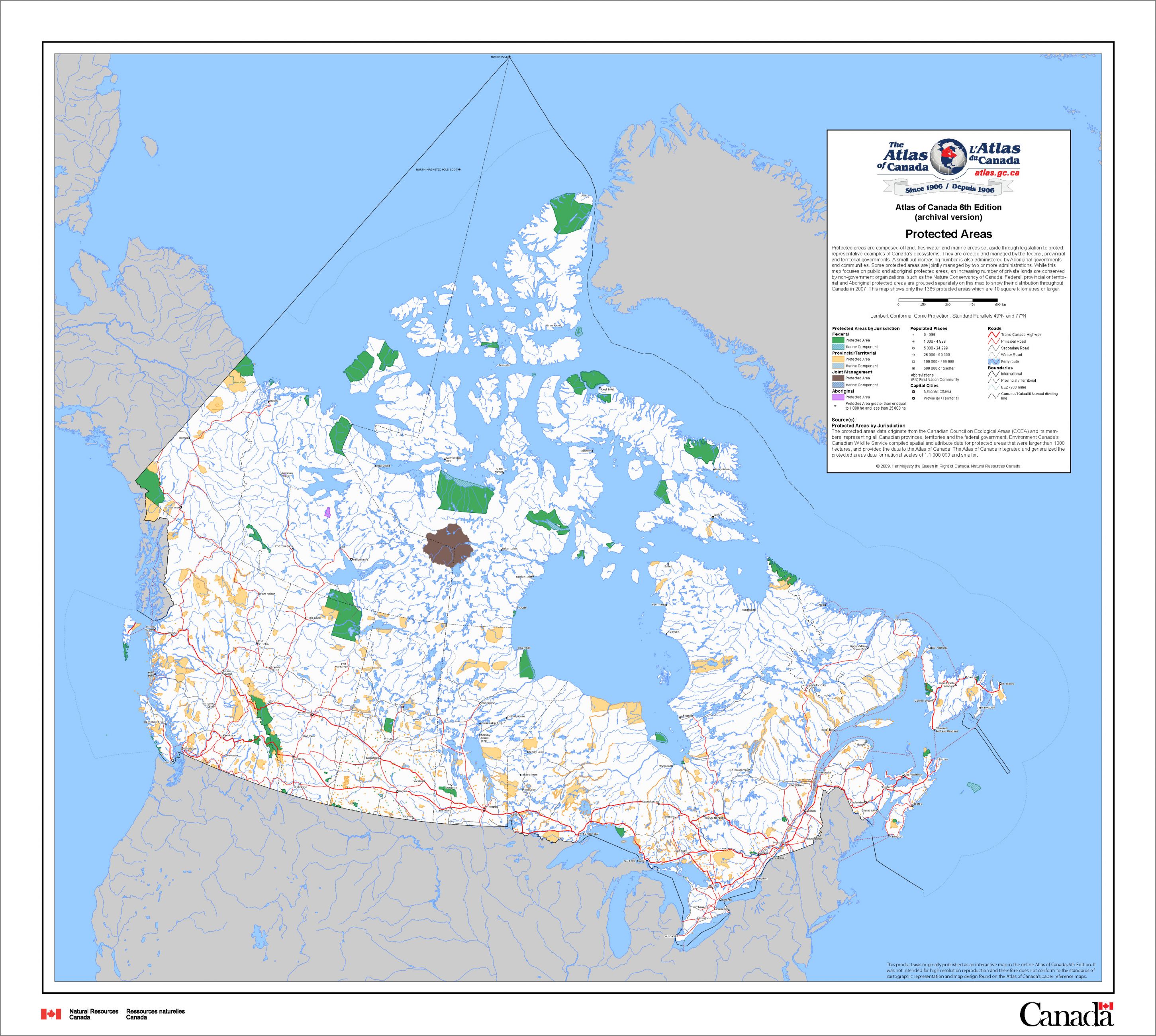
Protected Areas
Date of publication: 2010, 6th edition
Download the map (ZIP – PDF/JPG, 5.16 MB)
View the metadata on Open Government
This map shows protected areas composed of land, freshwater and marine areas that are set aside through legislation to protect Canada’s ecosystems. Federal, provincial, or territorial and Indigenous protected areas are grouped separately on this map to show their distribution throughout Canada in 2007. This map shows only the 1385 protected areas which are 10 square kilometres or larger.
Heritage sites

Cultural Tourist Attractions – National Historic and Cultural World Heritage Sites
Date of publication: 2010, 6th edition
Download map (ZIP – PDF/JPG, 3.89 MB)
View the metadata on Open Government
This map locates the National Historic Sites administered by Parks Canada and the five UNESCO Cultural World Heritage Sites located in Canada. National Historic Sites are maintained to commemorate significant historic places, people, and events.
Demographics

Population Density, 2006 (by census division)
Date of publication: 2010, 6th edition
Download map (ZIP – PDF/JPG, 2.80 MB)
View the metadata on Open Government
This map shows Canada’s population density in 2006. With 3.5 persons per square kilometre, Canada was (and continues to be) one of the countries with the lowest population density in the world. The map shows census metropolitan areas with the highest population densities of Toronto (866), Montréal (854), Vancouver (735), Kitchener (546), Hamilton (505), and Victoria (475) to be located close to the United States border.
Download previous editions: