
Lidar is a remote-sensing technology that measures the time it takes for a laser pulse to travel to an object and return to the sensor. Within a lidar system, a laser scanner emits and receives the laser pulses used to make these measurements. For forest inventory applications, a laser scanner is typically flown in an airplane (airborne lidar) along with positioning and navigation equipment that enables the precise location of each laser pulse to be determined with a high level of accuracy. State-of-the-art laser scanners can transmit and receive up to—and often exceeding—500,000 laser pulses per second resulting in data that can be used to map the forest canopies in high-resolution, three-dimensional detail.
Natural Resources Canada’s Canadian Forest Service (CFS) and its partners have become national leaders in the application of advanced technologies such as airborne lidar for forest inventory. CFS researchers are working with partners across the country to develop best practices and help transform forest inventory practices through the use of lidar.
Text version
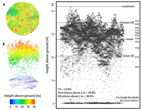
The top view (panel A) and side view (panel B) of an airborne lidar point cloud showing red, yellow, green, light blue and dark blue dots are shown with a colour scale defining the height above ground in metres (range: 0 [dark blue] to 40 [red]). Panel C shows how the various numerical summaries of the lidar point cloud are generated including average height, height percentiles and the 2-m height threshold used for calculating cover metrics.
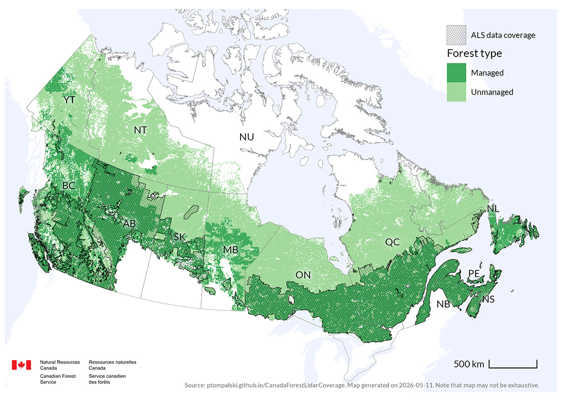
Today, airborne lidar has moved from a pilot technology to a core, operational data source underpinning enhanced forest inventories across Canada. Several provincial and territorial forest agencies now routinely acquire airborne laser scanning data to support strategic and operational inventory programs, with coverage exceeding half of Canada’s managed forest area and expanding annually. These data enable the generation of enhanced forest inventories that provide spatially detailed, wall-to-wall estimates of forest structure, including height, volume, basal area, and stem density, delivered with improved consistency and transparency compared with traditional photo-based forest inventory approaches. Although implementation approaches vary by jurisdiction—reflecting differences in forest types, management objectives, and legacy inventory systems—lidar-enabled inventories are increasingly integrated into forest planning, monitoring, and decision-making, helping address long-standing challenges related to inventory timeliness, workforce capacity, and uncertainty.
Although the information needs of forest monitoring are related but unique from those of forest inventory, airborne lidar still has an important role to play. In a Canadian context, transects of airborne lidar have been used to inform national characterizations of forest structure.
To find out more and get access to scientific publications and best practice guidance, please see the links below.
Related links
Find out more
CFS publications
- Forest inventory
- Enhanced forest inventories in Canada: implementation, status, and research needs
- A best practices guide for generating forest inventory attributes from airborne laser scanning data using an area-based approach, Information Report FI-X-010
- A model development and application guide for generating an enhanced forest inventory using airborne laser scanning data and an area-based approach, Information Report FI-X-018
- Forest monitoring
- Lidar sampling for large-area forest characterization: a review
- Lidar plots—a new large-area data collection option: context, concepts, and case study
- Airborne laser scanning transects over Canada’s northern forests: lidar plots for science and application