
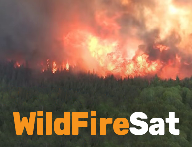
WildFireSat is the first government-owned satellite mission specifically designed to monitor all active wildland fires across Canada daily. This mission will provide timely and essential data to track fire activity and support fire management efforts.
Discover the features of WildFireSat, a mission tailored to the needs of wildland fire management in Canada (YouTube, 11:07)
Budget 2022 provided funding for this shared initiative between Natural Resources Canada, the Canadian Space Agency, and Environment and Climate Change Canada.
Launch is targeted for 2029 and will enhance Canada's ability to manage wildland fires.
The role of Natural Resources Canada
As a mission partner, Natural Resources Canada has two distinct roles:
The Canadian Forest Service (CFS) will provide scientific leadership and support mission delivery by:
- validating satellite data accuracy,
- developing products and training and
- providing near-real-time data to wildland fire management agencies.
The CFS will also support wildland fire managers across Canada with developing the capabilities within their organizations to use WildFireSat products and fully benefit from the mission.
- The Canada Centre for Mapping and Earth Observation (CCMEO) is responsible for the ground station support including:
- managing satellite communications through X-band and S-band frequencies
- ensuring robust data acquisition via high-gain antennas
- facilitating data transmission to data processors using secure, high-speed networks
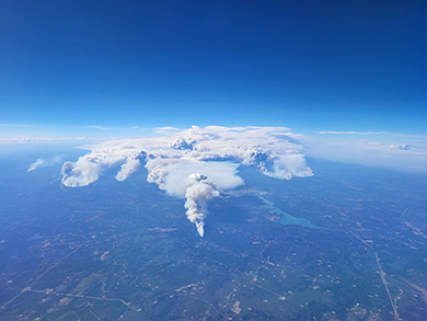
There can be many active fires across the vast Canadian landscape © Alberta Wildfire Management Branch
Additionally, CCMEO will handle Level-1 data processing, preparing it for the creation of timely wildland fire information and management products by the CFS. WildFireSat data will be archived in the Earth Observation Data Management System (EODMS).
WildFireSat and wildland fire management in Canada
Reliable fire information is vitally important. Wildland fire managers need to make decisions quickly; often with limited information when fires are at their worst. The right information, provided in the right way and interpreted correctly, makes a difference when critical decisions are required.
Many Canadian wildland fire management agencies rely on airborne reconnaissance for real-time field observations. However, sometimes an aircraft cannot access a fire because of its location or the flying conditions. Sometimes there are just not enough aircraft to monitor every fire in the country.
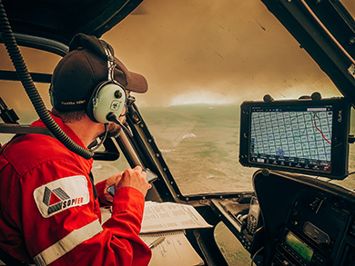
Collecting important visual observations about Fire 602. © SOPFEU
Satellites are the only way to collect wildland fire information for the entire country. Designed for wildland fire monitoring, the WildFireSat mission will provide near real-time coverage when it is needed most, tailored specifically to support wildland fire management.
The success of the mission depends on the successful adoption and use of WildFireSat products by the organizations and people who manage wildland fire. The mission has prioritized engagement and collaboration with wildland fire managers from the onset and throughout its lifespan.