NFCMARS - spatial framework
Canada’s National Forest Carbon Monitoring, Accounting and Reporting System (NFCMARS) was developed to meet requirements under the United Nations Framework Convention on Climate Change (UNFCCC). NFCMARS reports estimates of greenhouse gas (GHG) emissions and removals at the spatial scale of reporting zones.
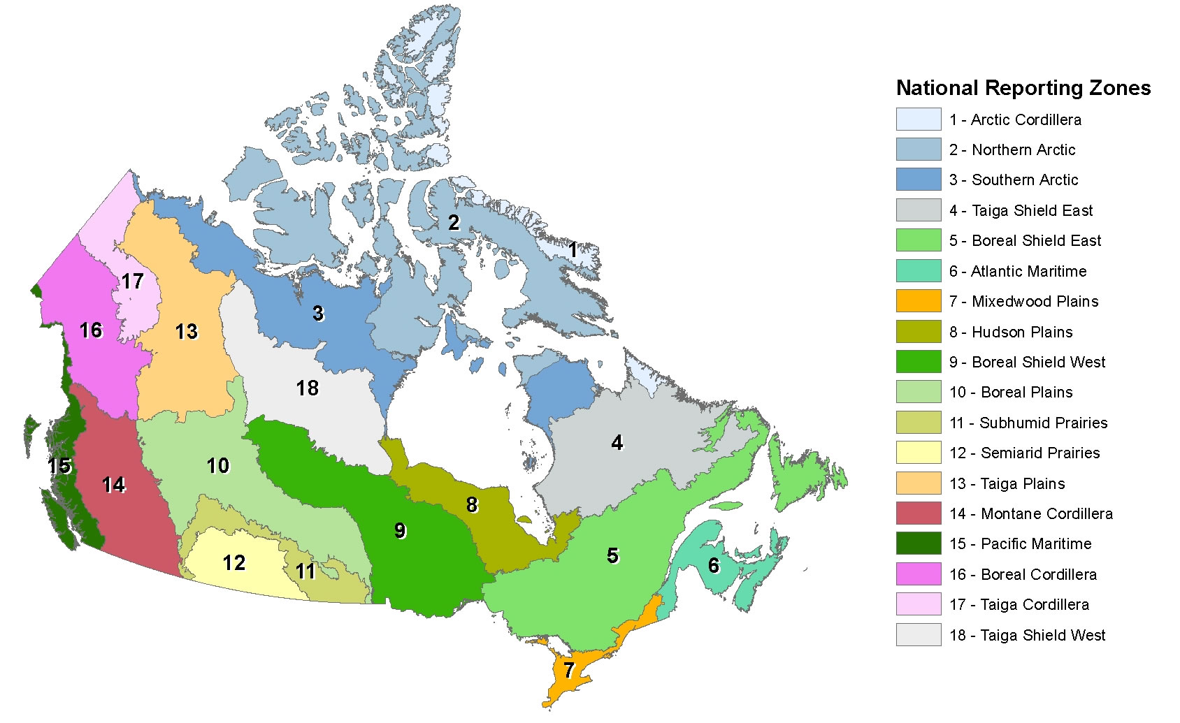
NFCMARS uses a hierarchical ecological framework, consisting of 18 reporting zones based on the terrestrial ecozones of Canada. 60 reconciliation units, 48 of which include Canada’s managed forest, are included within these zones. Reconciliation units are further subdivided into over 500 analysis units defined by the boundaries of forest management units, parks and ecological zones, representing the finest level of geographic resolution. The compilation of land and activity data, as well as the calculation of estimates, occurs at the analysis unit level, whereas the reconciliation of land-use changes between land sectors occurs at the reconciliation unit level, and reporting of emissions estimates occurs at the reporting zone level.
Reporting zones

Reporting zones of the NFCMARS.
Larger image [135 Kb]
The hierarchical ecological framework of the NFCMARS include the following reporting zones:
- Arctic Cordillera
- Northern Arctic
- Southern Arctic
- Taiga Shield East
- Boreal Shield East
- Atlantic Maritime
- Mixed wood Plains
- Hudson Plains
- Boreal Shield West
- Boreal Plains
- Subhumid Prairies
- Semiarid Prairies
- Taiga Plains
- Montane Cordillera
- Pacific Maritime
- Boreal Cordillera
- Taiga Cordillera
- Taiga Shield West
Reconciliation units
Reconciliation units of the NFCMARS. Units falling outside the bounds of reporting (i.e., those without forests) are not displayed.
Reconciliation units for the NFCMARS are geographic entities formed by combining reporting zones with provincial and territorial boundaries. They ensure data from multiple agencies are consistent during estimate development.
Annual reporting
The purpose of the annual reporting of GHG emissions and removal estimates to the UNFCCC is to:
- quantify the impacts of human activities on the atmosphere
- understand the main drivers of these emissions
- inform mitigation policies
- quantify the changes resulting from climate change mitigation activities
In the land use, land-use change, and forestry (LULUCF) sector, the net balance of emissions and removals is strongly affected by humans and nature. However, their relative contribution to totals are difficult to quantify. Current Intergovernmental Panel on Climate Change (IPCC) guidelines for LULUCF national GHG inventories are based on the assumption that all emissions and removals in managed lands are caused by humans. In Canada, natural disturbances can result in large and highly variable emissions and subsequent removals that disguise the impacts of forest management activities.
Page details
- Date modified: