
“The Fire Weather Index System translates weather conditions into a clear picture of wildfire danger. By tracking the factors that influence how easily a fire can start and spread, it provides information that can be communicated through simple tools like roadside signs while also supporting more complex operational decision-making.” — Natasha Jurko, physical fire scientist, Canadian Forest Service, Natural Resources Canada.
If you’ve travelled through a forested area in Canada during the summer, you’ve probably seen roadside signs displaying the current fire danger rating, from low to extreme. Behind those signs are decades of Canadian science and a decision-making support tool used by fire managers every day throughout the fire season.
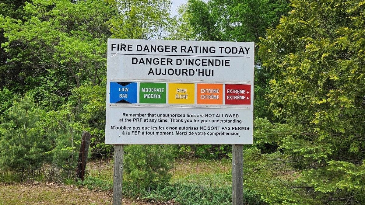
A Fire Danger Rating sign in the Petawawa Research Forest, Ontario.
The Canadian Fire Weather Index System (FWI System) was developed by Canadian Forest Service (CFS) researchers more than 60 years ago. It uses weather observations to estimate potential fire danger. The FWI System doesn’t predict whether a wildfire will occur. Instead, it shows how wet or dry forest floor fuels, such as dead leaves and twigs, are and indicates if conditions are favourable for a wildfire to ignite and spread.
Seven-second summary:
CFS scientists are revising the FWI System to take advantage of the wealth of available weather information — like advanced forecasts, satellite observations and specialized computer programs — in order to give wildfire managers a clearer, more timely picture of changing fire danger.
Researchers are also expanding the system to include a wider range of fuels. The updated FWI System has new components for grasslands and peatlands, where wildfires behave differently than they do in forests.
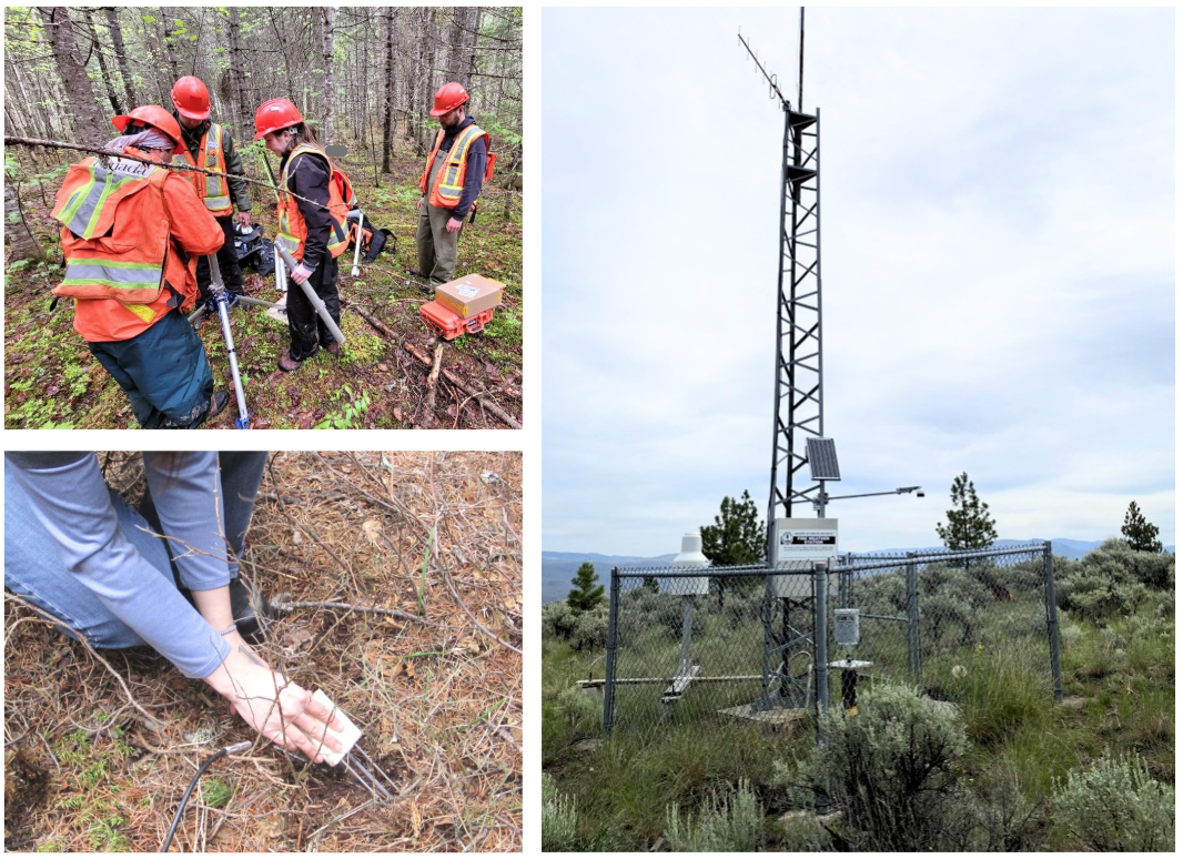
Clockwise from top left: Researchers setting up monitoring equipment in a New Brunswick forest; one of the many fire weather stations located throughout the country to collect data used in the FWI System; installation of a soil moisture probe to track moisture in forest-floor fuel. Photos: C. Hanes.
A more complete picture of fire danger in Canada
- Hourly weather information: Tracking temperature, humidity, wind speed and rainfall by hour shows how fire danger changes over time
- Forest fuel moisture: Tracking how weather affects dead leaves, needles and twigs on the forest floor shows how dry or wet forest fuels are
- From fuel moisture to fire behaviour: The system indicates how easily a fire could ignite, how quickly it might spread and how intense a forest fire might become
- Grassland fire danger: New indicators show how quickly grasses can dry, ignite and spread fire
- Peatland fire danger: New indicators show how wet or dry peatlands are and the potential for fire to spread through them
Earlier versions of the FWI System were based on weather measurements taken once a day, traditionally around midday. Today, automated weather stations throughout the country provide information at all hours. The updated system, known as FWI2025, uses hourly data to give wildfire agencies a clearer picture of changing conditions, helping to assess peak fire danger and the potential for overnight burning.
For instance, the system can monitor weather at night, tracking high temperatures, low humidity and strong winds — conditions in which fires may remain active and continue to spread. This information gives fire managers a much better idea of overnight fire danger.
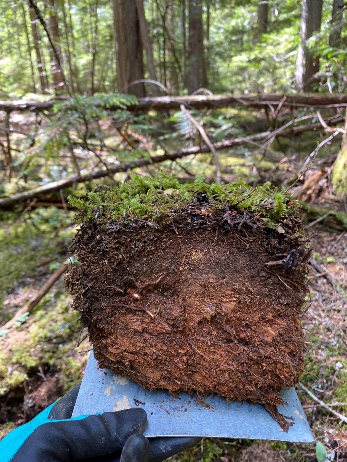
A sample of fuels — here, layers of compressed leaves, needles, twigs and other organic material, also known as duff — found on the forest floor. Tracking how wet or dry these fuels are helps scientists assess how easily a wildfire could start and spread. Photo: C. Hanes
Science that supports decisions
During wildfire season, fire management staff must make decisions every day including:
- Where should crews, aircraft and equipment be positioned?
- Are enough resources available for current fires and possible new starts?
- Should firefighting operations continue later into the evening?
- Are fire restrictions or bans needed to reduce the risk of new fires?
For the scientists developing the next-generation FWI System, the goal is simple: provide a flexible, science-based approach that offers the best possible information to the people responsible for protecting communities, forests and firefighters.
Building the next generation
The FWI System is one part of the larger Canadian Forest Fire Danger Rating System (CFFDRS), a collection of science-based decision-making tools used to assess wildfire danger and fire behaviour. The overall system is being modernized in stages, and this update, known as FWI2025, is the first to be released. Over the next three years, scientists plan to release two more updates to CFFDRS components, including a revised model that will help predict where and when human-caused and lighting-caused fires are likely to occur.
“The improvements in FWI2025 give fire managers a better way to assess fire danger in different types of vegetation and fuels, including fast-drying grasses, forests and slow-drying peatlands. We expect these updates will provide a more accurate picture of fire danger and better support decision-making.” — Chelene Hanes, wildland fire research scientist, Canadian Forest Service, Natural Resources Canada
Impact beyond borders
Since the current version was released in 1987, the FWI System has been an international success story, adapted by countries around the world. Its widespread use reflects the practical value of a simple, consistent, science-based way to understand how weather conditions affect wildfire danger.
As wildfire seasons and the technologies used to track them continue to evolve, the FWI2025 will help ensure that one of Canada’s most influential wildfire science innovations continues to help people meet the challenges ahead.
If you’re a member of the media or an educator and would like to learn more about
Canada’s FWI System or the team’s work, contact us at: sciencecommunications-communicationsscientifiques@nrcan-rncan.gc.ca.
Discover more:
Canadian Forest Fire Danger Rating System – Next generation