
Public access to satellite earth data engine empowers global insights for all

Richard Fernandes
“If you don’t give science away or share science, the science dies. Without sharing, science would grind to a halt.” — Richard Fernandes, Research Scientist, Natural Resources Canada
The seven-second summary:
From monitoring the reclamation of mines and wells in Canada to assessing wildlife habitats around the world, satellite imaging has countless applications. Richard Fernandes pioneered the movement to make this technology openly accessible for citizen scientists worldwide through the creation of the Landscape Evolution and Forecasting (LEAF) toolbox. It’s an online application that generates vegetation maps on a global scale using satellite imagery.
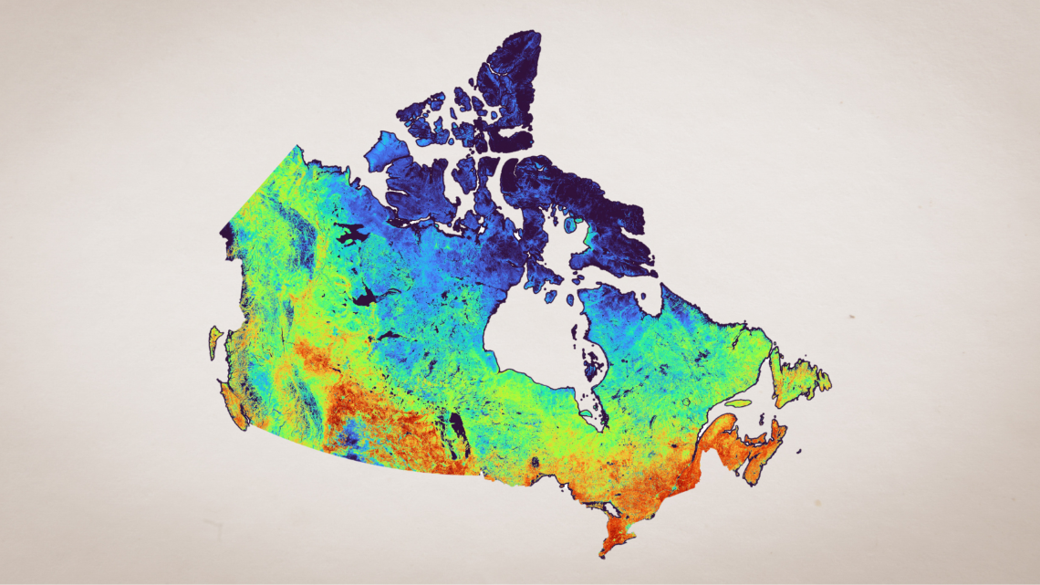
Vegetation Cover map of Canada (map: Geo.ca)
Satellite data enhances vegetation monitoring:
- Satellite data is crucial for monitoring vegetation
- The LEAF Toolbox enables users to map vegetation worldwide, showing where vegetation is growing, how dense it is and how healthy it is
- This information supports reclamation, planning and research efforts by governments and scientists
Satellite data open for everyone:
- All the data and the processing tools are now openly available to everyone
- It supports many applications, such as tracking reclamation projects, assessing crop productivity and forest fire hazards to infrastructure
- This initiative aims to democratize access to information about our changing landscape, much like the way we currently rely on weather forecasts
Open access empowers users:
- With LEAF Toolbox, everyday citizens now have access to detailed environmental data. This capability is invaluable for public awareness, environmental advocacy and accountability.
“As we move forward, continued efforts to simplify and expand access to these tools will play a crucial role in advancing environmental science and foster a stronger relationship between science and the public.” — Richard Fernandes
Discover more:
The LEAF Toolbox: click on the “readme” file to get started.
Geo.ca: Canada’s source for open geospatial information