
Behind the scenes with researchers working offshore to study coastlines.
April 2026
Far beneath the ocean’s surface, Canada’s seafloor holds clues to landscapes that formed thousands of years ago. But how do scientists interpret features they can’t see directly?
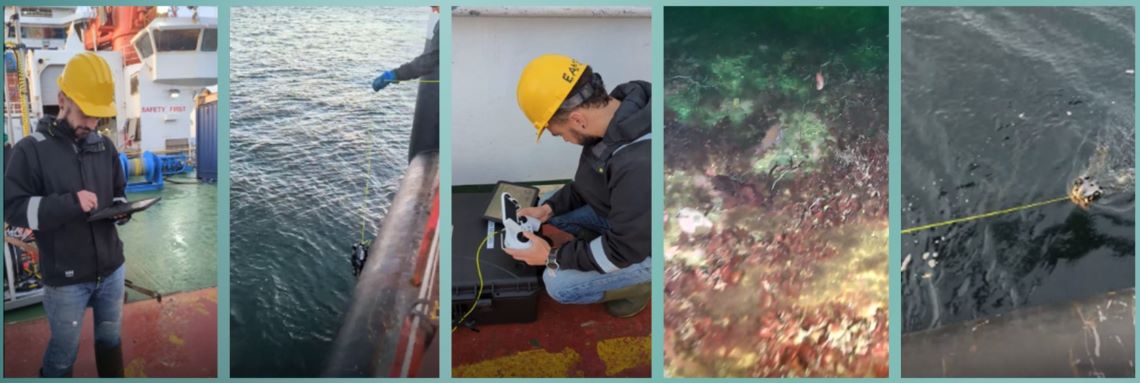
For Natural Resources Canada (NRCan) scientist Jordan Eamer and a research team working off the east coast of Nova Scotia, conditions aren’t easy: high waves, heavy skies, long hours at sea. Still, the opportunity to explore and make scientific discoveries about unexamined areas of the coast and seafloor makes dealing with all the challenges worth it. This photo gallery, curated by Jordan and with his original captions, reveals exactly what that work involves: researchers bracing themselves against the elements to collect valuable data.
By studying present-day onshore coastal conditions, where waves, tides and sediment are constantly reshaping the land, the team can compare today’s shorelines with the ancient formations they’re mapping offshore. Their findings will then help scientists better understand how seabed sediments are formed and how they’re structured.
And with this deeper knowledge of the history written in the seafloor, better-informed decisions can be made on using Canada’s ocean resources, from managing marine ecosystems to planning offshore infrastructure.
To learn about the stories behind the science, click on the images below.
The expedition begins with many questions…
I’m with a group of scientists and technicians deploying a small, remotely operated vehicle to capture video of the seabed in Sydney Bight, located off the northeastern coast of Cape Breton Island and part of the province’s plan for renewable energy development. A growing volume of geophysical data indicates there’s a lot of exposed bedrock in the seabed in this area.
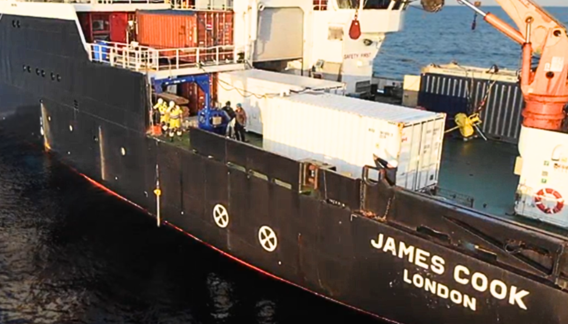
We’re studying the type and structure of this bedrock so we can better assess how the seabed might respond to potential future infrastructure while also contributing to other research questions and collaborative research: Would drilling be required? Is the seabed rough or smooth? Brittle or rugged? Video footage from the underwater rover provides tangible, observable confirmations of our interpretations of other data. And these observations also advance the work of other researchers, including marine biologists, oceanographers and cartographers. (Video from Laura Broom, aboard the James Cook Geological Survey of Canada expedition 2025004.)
Free falling…
Our team of scientists and technicians is deploying a free-fall cone penetrometer, a tool for rapid data collection whose sensors in its tip record soil strength and resistance in real time. It enters the water slowly, and once it’s 30 or 40 metres off the seabed, we essentially let it go, and the action begins as gravity takes over, driving the instrument straight into the seafloor to gather important data.
In 2025, Geological Survey of Canada (GSC) technicians and scientists revived equipment that hadn’t been used for years, allowing us to collect large volumes of data and build a clearer, more detailed picture of the geotechnical properties across Atlantic Canada. This data will help inform potential infrastructure development such as offshore cables, wind turbines and pipelines. Over time, we plan to develop an artificial intelligence model to predict the engineering properties of different types of seabed. (Image Jordan Eamer.)
Going deep
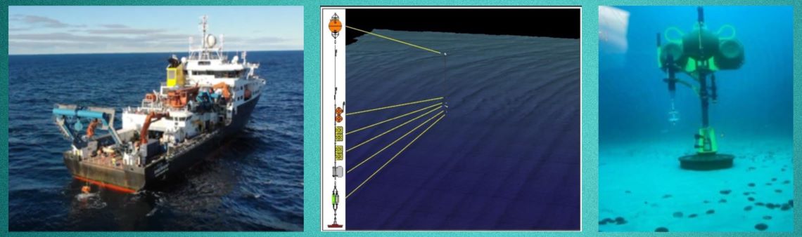
A seabed lander is deployed off the aft deck and released at the surface, where it sinks hundreds of metres to the ocean floor and — hopefully! — lands safely. Once in place, the lander sits on the seabed for months or even years, using cameras and other sensors to monitor ocean conditions and the seabed while tracking sediment flowing through the area. This information helps validate models of ocean water movement, temperature and pressure.
Landers and moorings — which place instruments along a long line suspended in the water column — are also used in collaboration with other scientific agencies, including Fisheries and Oceans Canada, to gather important data relevant to marine species such as whales. Long-term monitoring is an important part of assessing areas for potential future offshore wind development. (Photo Brendan Smith, diagram Alexandre Normandeau, video Jordan Eamer.)

Discovering the unexpected
Understanding the ocean far beneath its surface can be challenging and takes time, sometimes over multiple expeditions. In early 2024, the first-ever high-resolution view of the seafloor of Middle Bank, about 100 kilometres off the eastern shore of Nova Scotia, was obtained on the Coriolis II vessel. That one single image showed the area to be more complex than older maps had suggested: what had been known as a single type of seabed was now revealed to be a complex surface with rippled sands, gravels and fragmented shell debris.
It took another year before we could return to the site aboard the Royal Research Ship James Cook. A remotely operated mini-sub now uncovered other features: a clay-rich cliff, signs of muddy seabed sediments, layering and a lot of biodiversity. And there was a further surprise: a sediment core collected from the top layer revealed a perplexing black, oily sediment unlike anything anyone in the lab had seen before!
This heterogeneity, or varied composition, in seabed sediments has important implications for offshore infrastructure, including wind development. And from a science perspective, these sediments may also tell an interesting story of what this landscape looked like thousands of years ago. Was it a salt marsh above the waves? A lake? A delta? Or could it even have been a Mi’kmaq gathering place once connected to mainland Mi’kma’ki many thousands of years ago? (Core photo Cameron Greaves.)
Compare and contrast
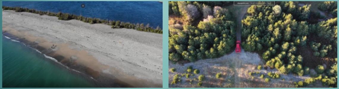
In late 2024, I was working on a research team including Dalhousie University and GSC technicians collecting sediment samples along the coast in Guisborough County, Nova Scotia. We were flying lidar-equipped drones and conducting ground-penetrating radar surveys. Our goal was to identify present-day coastal systems that could be compared with the ancient features we were finding offshore, some of which were formed thousands of years ago. By studying the similarities and differences between modern and ancient coastal features, we can better interpret offshore seabeds and anticipate the properties of their sediments. This knowledge helps inform decisions about how Canada’s ocean resources are managed.
Some coastal sites are hard to access. We can’t drive right up to them, so we have to strap radar to our back, carry our GPS equipment and hike to get to where we need to go. But travelling on foot offers a good opportunity to make observations as we get there! (Beach image Angus Robertson, truck image Jordan Eamer.)
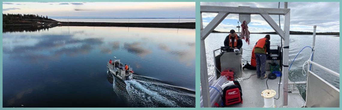
Mapping shallow waters
In late 2025, working in Richmond County, Nova Scotia, we used a new, small research boat from Dalhousie University to collect data and samples in challenging shallow coastal areas that were previously difficult to study. Our four-person team — three from NRCan and one PhD candidate from Dalhousie — set up a sub-bottom profiler, which is a piece of equipment that sends sound pulses down from the boat. We were able to collect data on the sediments below the seabed in waters as shallow as two metres. We focused on coastal areas that may one day support underwater cable crossings from offshore. This information allows researchers to compare modern shorelines with ancient coastal areas that are now located farther offshore and look like drowned or water-logged shorelines.
Working in a region primarily known for fishing, this pontoon boat drew curious looks — especially as we all huddled around a computer in the rain and snow, sailing back and forth in a grid pattern as we monitored data in real time. (Photo and video Jordan Eamer.)
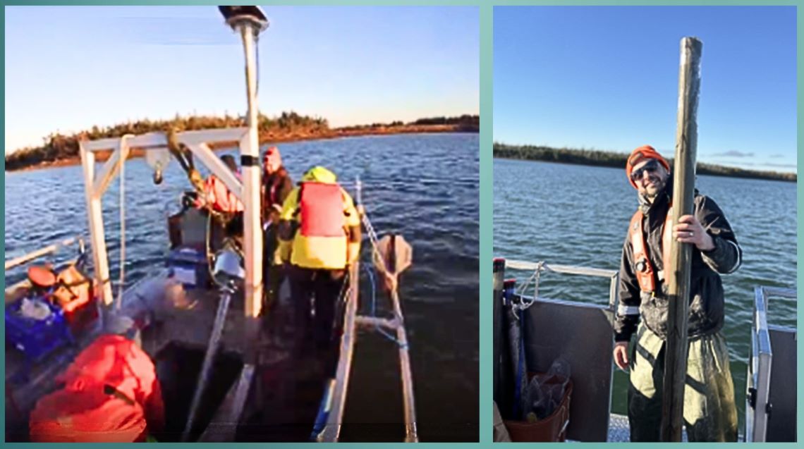
Getting to the core of it
To collect sediment cores from this small platform in very shallow areas around Richmond County, the team developed a novel, hands-on approach. One of the challenges of working in shallow waters is that we had to do most of this work by hand. The team used a vibrocoring system that, though small, weighs more than 90 kilograms when it is filled with a core sample. The vibrocorer uses gentle vibrations to push a tube into the seabed, pulling up a column of sediment that shows how layers built up over time. We bring these core samples of seabed sediments back to the lab where we can study them.
We collected a full, two-metre sample that includes what looks like glacial clay at the base. This could be an important find, since it’s rare to have a full record of how layers of sediment have built up after the last ice age, especially in a coastal environment, and we’re excited to start examining this sample in the lab. (Photo Brendan Smith, video Cameron Greaves.)
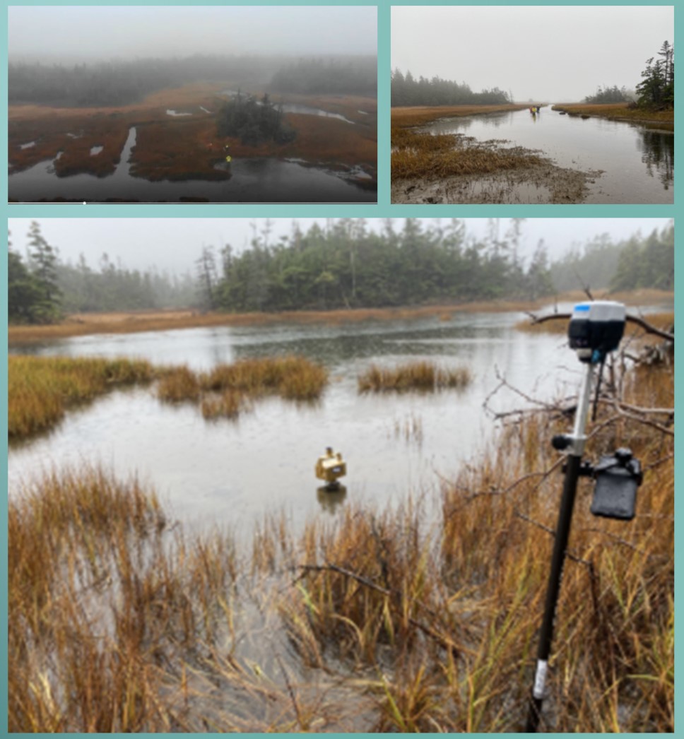
Mission accomplished!
We also used the vibrocorer to collect samples from a modern salt marsh in Richmond County, working through some really horrendous weather. Located behind a barrier beach in a fairly sheltered area, the marsh provides a relatively undisturbed record of rising sea levels and evolving coastlines. In the lab, we’ll analyze these samples and sediments for microfossils and chemical signatures in the form of isotopes to better understand the environment they formed in. These modern samples can be used as proxies, or reference points, for interpreting the paleoenvironments we’re studying offshore to determine if some of those landscapes were once old marshlands.
We can also test the engineering properties of these marsh sediments to assess if these seabeds could pose challenges for building offshore infrastructure. Fieldwork at this site required careful timing: we had to cross the channel at close to low tide, collect our samples and return across the channel before the water rose to a point where we might get stranded.
The final image captures what success looks like, when you’ve buried the vibrocorer all the way to the head. Now to retrieve it — a small but significant win in demanding conditions. (Photos and video Jordan Eamer.)
Discover more:
Mapping the potential of Canada’s offshore wind energy (Simply Science article)
The future of Sable Island(Simply Science podcast)
Geoscience: Marine and coastal (NRCan)