
Simply Science photo gallery, February 2025
In the summer of 2024, Anne Farineau and Rachel van Herpt of Natural Resources Canada’s Geodetic Survey team became part of the first all-woman team to install a global navigation satellite system (GNSS) station in Canada. These stations receive signals from navigation satellites, helping scientists track Earth’s movements, measure tectonic shifts and monitor changes like sea-level rise.
Their journey to set up this high-tech station in L’Anse aux Meadows, a historical site on the northern tip of Newfoundland’s Great Northern Peninsula, was anything but ordinary. They met with wild weather, surprising challenges and even an unexpected Viking connection.
Explore their mission through these photos. Use the drop-down menu to uncover the story behind each image and click on any photo for a closer look. You can find the full story of their groundbreaking adventure here.
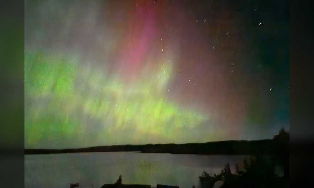
A captivating night sky
Unobstructed view of colourful space weather from the B&B in Saint-Lunaire-Griquet, Northern Newfoundland, on September 12, 2024. This sight was confirmation that, despite an initial hurdle, they were on the right path to install a station in honour of Dr. Calvin Klatt’s contributions to geodesy and uplifting women at the Canadian Geodetic Survey. Geodesy is the science of accurately measuring and understanding the Earth’s geometric shape, orientation in space and gravity field.
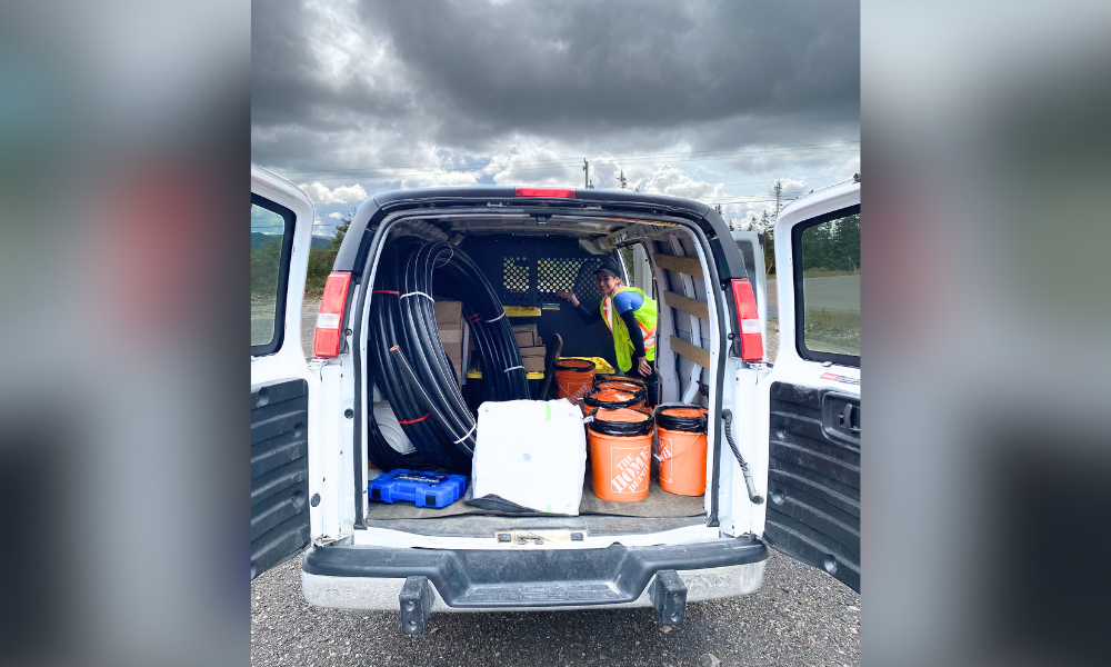
A happy reunion
After losing track of the equipment because of unforeseen hurricane weather over the Gulf of St. Lawrence, Rachel is very happy to finally be re-connected with the apparatus and to take control over the final leg to northern Newfoundland.
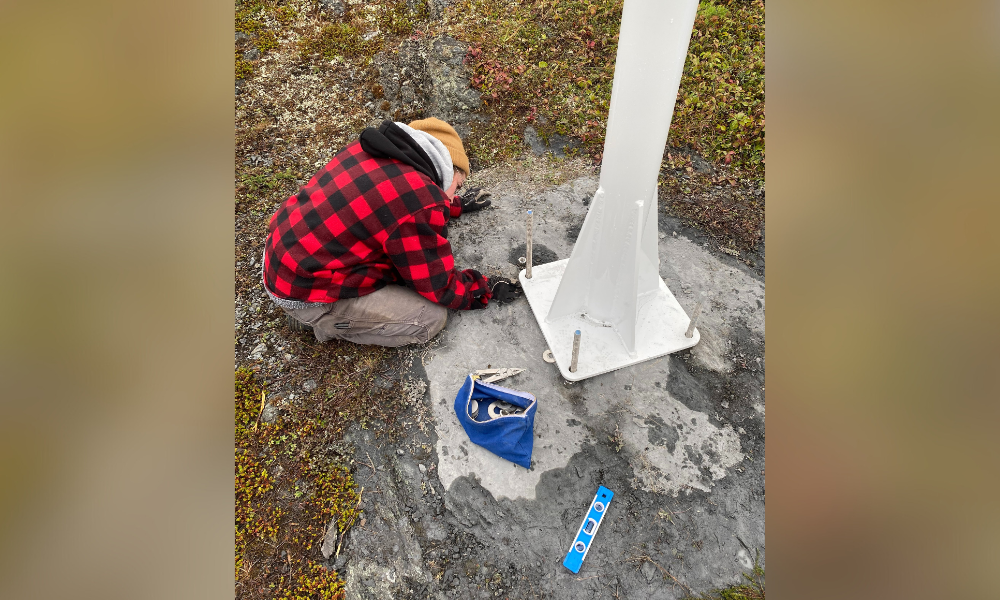
Shimmy, Shimmy
Rachel crouches at the bottom of the monument using various-sized washers to shim the base to level it. The precise levelling of the monument is of the greatest importance as the data collected is used to create Canada’s spatial reference system that accurately marks latitude, longitude and height above sea level.
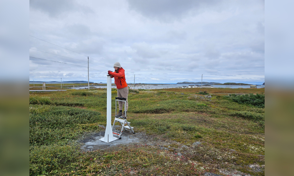
Checking levels
Anne stands at the top of the monument checking the digital level to ensure the monument is level to within two decimals of a degree.
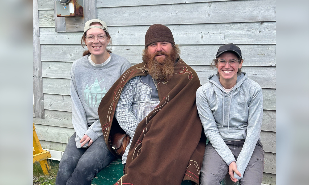
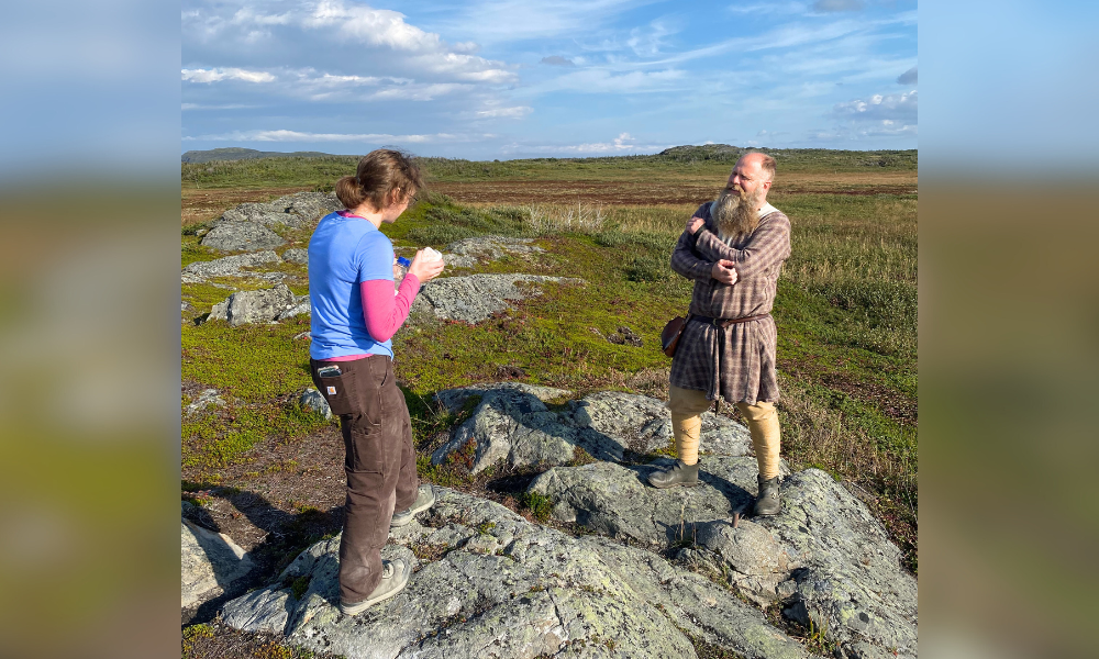
A Viking presence
Anne and Rachel taking a break with Mark Pilgrim, a Parks Canada heritage presenter who — under the stage name Ragnar — takes part in Viking re-enactments at L’Anse aux Meadows. This is the only Canadian Active Control Station installed in a Viking dressing room.
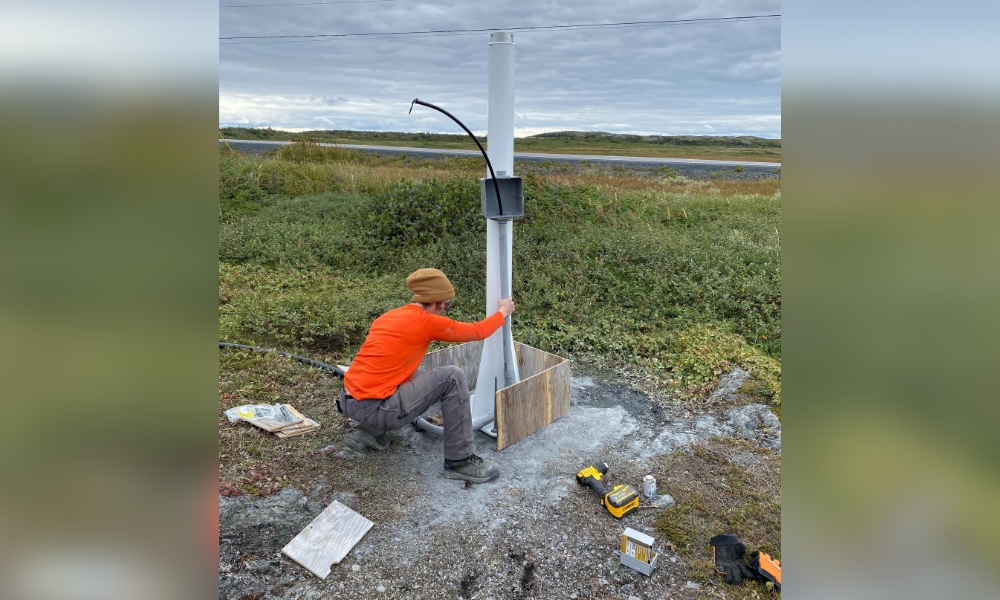
Cut and pour
Rachel setting up the monument for the next stage of installation, the pouring of a concrete base. The conduit needs to be measured and cut to site-specific lengths before the form is built around the monument and the concrete is poured.
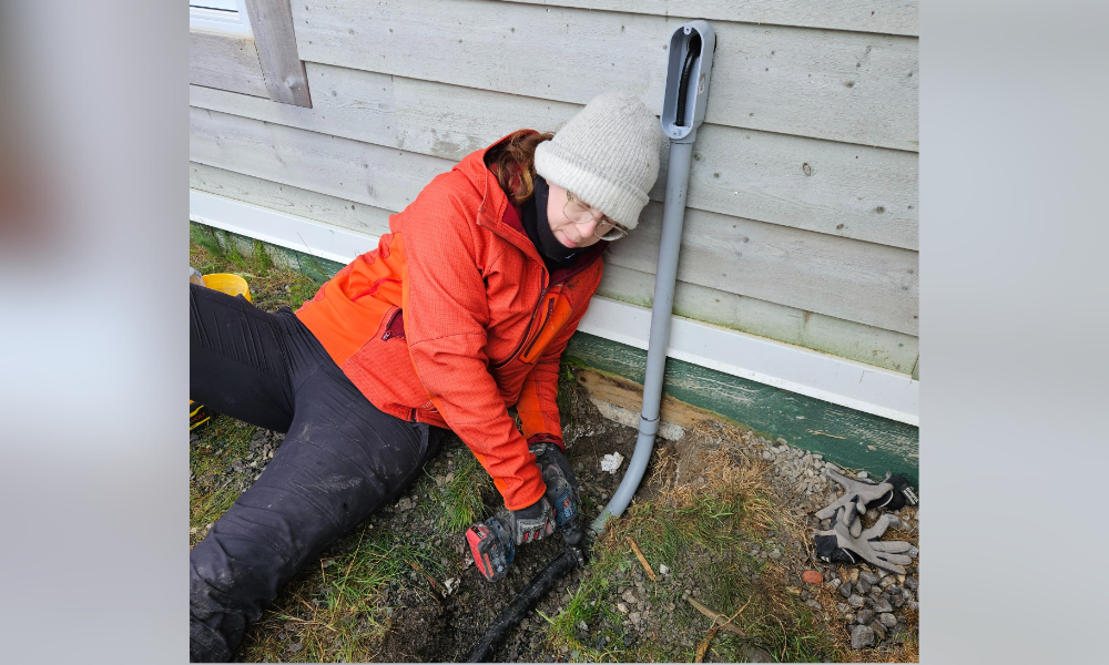
Safe and sound
Anne fastening an adapter to connect the conduit running to the monument with the polypipe going into the building. The adapter ensures water cannot get in to compromise the electrical cable that connects the antenna on the monument to the receiver inside.
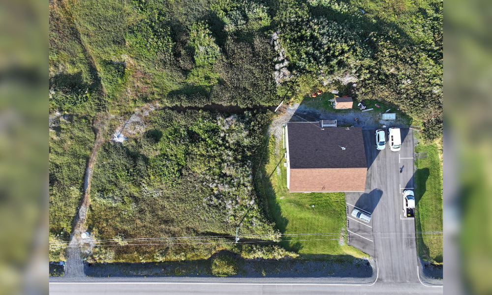
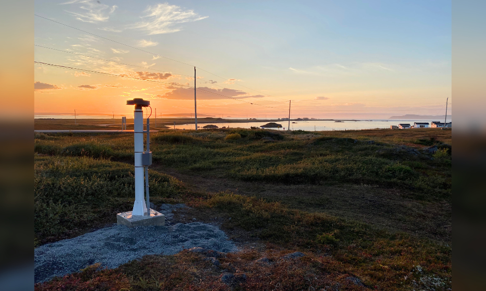
View from above
A bird’s-eye view of the completed station. The monument is the small white structure at centre-left, with the cable running through the brush visible just above, extending toward the Parks Canada building.
Taking one for the team
There’s currently a fun internal competition within the Active Control System Operations team to see who can take the best onsite photo with a sunset in the background. It started by accident when team-member Stuart was in Qikiqtarjuaq, Nunavut, noticed a spectacular sunset happening right behind him as he was replacing a faulty antenna at an existing station. Now everyone tries to capture that magic.
Geology across the ages
Rachel and another Park’s Canada heritage presenter — Kevin Young, who goes by the stage name Finboggi — find a common interest in glacial isostatic adjustment (GIA) and passive control monuments across the ages. At the tip of Kevin’s left foot is a passive control monument that was once used for GNSS surveys conducted in the park as part of restoration efforts and to understand how GIA — the rising of land once pressed down by a glacier — has changed the area since when the Vikings landed.
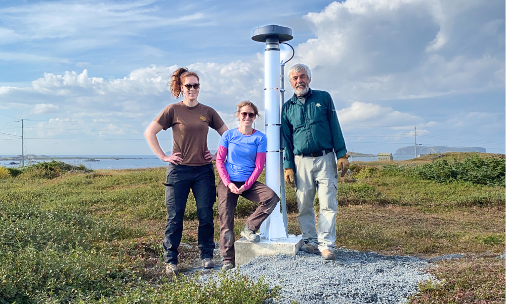
Mission accomplished!
Rachel and Anne stand next to the completed monument with Mike Sexton of Parks Canada. This was the first GNSS station in Canada installed by two women under the direction of a third woman, and Parks Canada staff were always ready to assist.
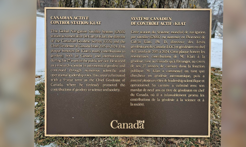
Honouring the past
Naming this station KLAT is unique in that it does not follow classic naming conventions, which usually use a four-character designation. This one is named after the former chief geodesist of Canada, Calvin Klatt. This special plaque will be installed at the station in Newfoundland.