Wetland fire research improves air quality forecasts and carbon accounting
By Peter Glasgow
March 13, 2018
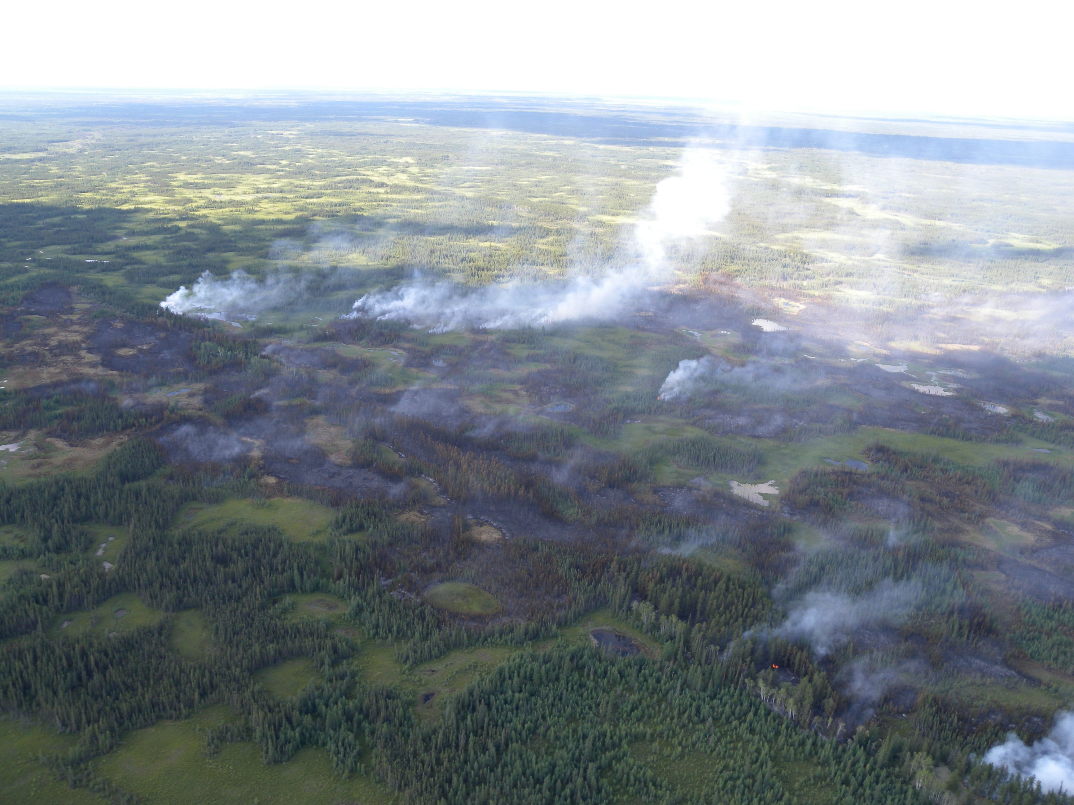
Wildfires — we usually think of them in terms of forests. But in Canada’s boreal forest, up to one-third of the area burned in wildfires can affect wetlands, which include bogs — also known as muskeg — and swamps. And these wetlands have the potential to release large amounts of smoke into the atmosphere, which can be hazardous, especially when burning close to communities.
What’s in a wetland?
Wetlands other than marshes and shallow ponds contain peat, partially decayed vegetation or other organic material that builds up slowly over thousands of years to a thickness of between two and six metres. Much of this peat is formed by the same Sphagnum mosses that gardeners use to improve their soil.
Peatlands cover about 13 percent of Canada, an area about the size of the Northwest Territories. They are found in all the provinces and territories.
Smoke on the Water
Larger image
Peat fire
Peatland fires are of special interest to ecologists and environmentalists, such as Dr. Daniel Thompson of the Canadian Forest Service, part of Natural Resources Canada. “Since peatlands store about one-third of the world’s carbon found on land, peat fires release plenty of carbon dioxide, carbon monoxide and other greenhouse gases,” says Dr. Thompson.
“But peatland fires also threaten human health, near the fire or wherever smoke drifts. Peat smoke is worse than smoke from other wildland fires because of peat’s composition and how it burns. It contains carbon, sulphur and nitrogen compounds that can produce highly irritating and hazardous volatile organic gases.”
A Slow Burn
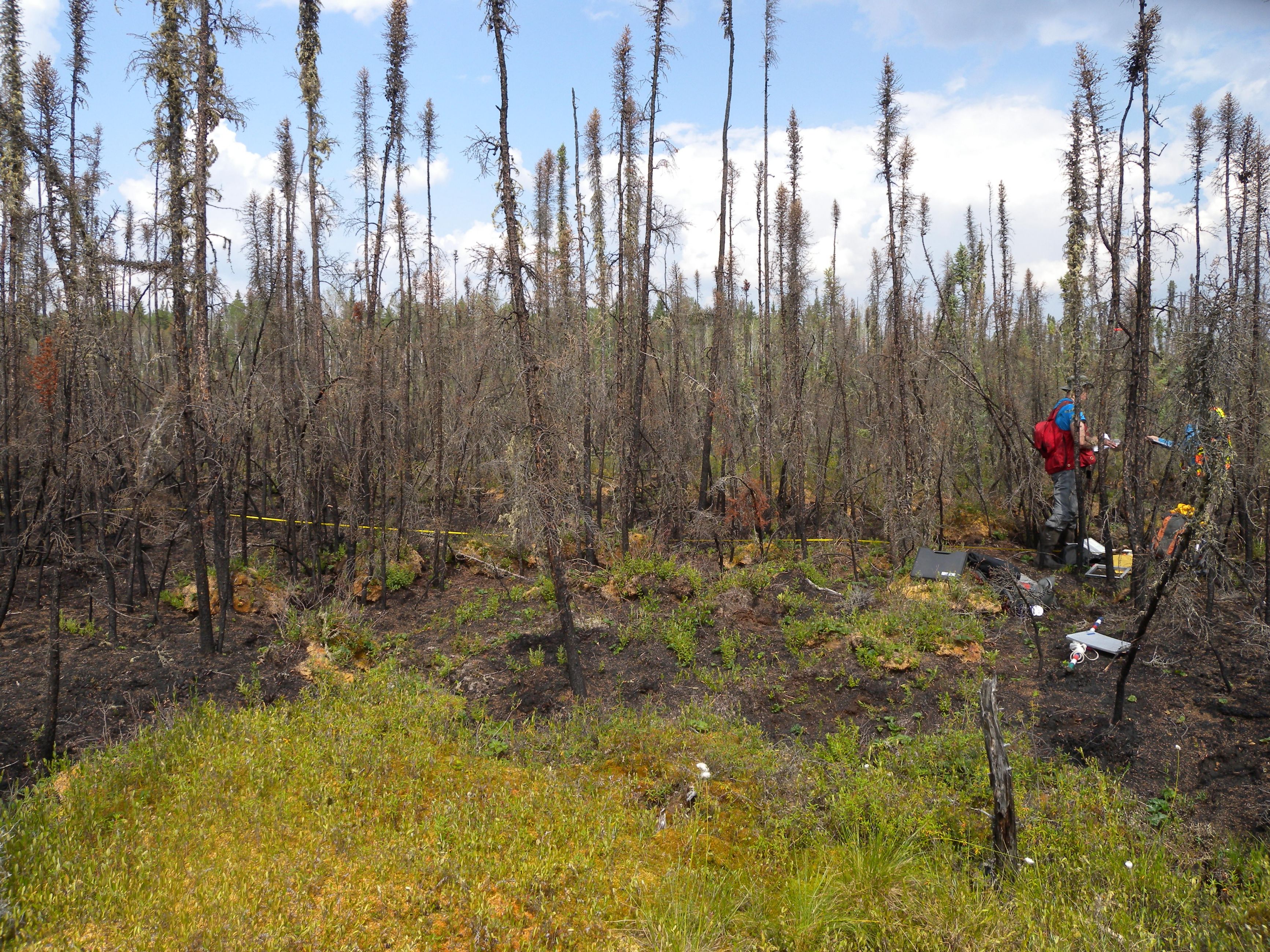
Peat’s high moisture content makes it burn more slowly than standing timber — often underground, undetected, and even under snow — and at lower temperatures. These factors cause incomplete combustion, which produces higher volumes of irritant gases and significant quantities of fine particulate matter that can travel deep into human and animal lungs. This is especially dangerous for infants, children and the elderly, as well as those who suffer from asthma and heart or lung disease.
Concerns about peat smoke are growing with the warmer temperatures and resulting drier conditions produced by climate change.
Pioneers of mapping techniques
To help deal with the problem, Canadian Forest Service scientists are collaborating with partners across Canada and abroad to deepen our knowledge of peatland fires and assess how much more smoke will be produced under increasingly dry conditions.
Larger image
Peatlands of Canada
In order to understand the risk that peatland fires pose to the healthy air quality of Canadians, a knowledge of where these peatlands lie is essential. In the 1980s, Agriculture Canada scientist Charles Tarnocai and collaborators at The Geological Survey of Canada pioneered techniques of mapping and spatial analysis to produce Peatlands of Canada, the first Canada-wide picture of where these carbon-rich ecosystems are found.
Handwritten datasets have enduring impact
However, these large-scale maps reveal little of how dry these peatland systems are or their vulnerability to encroaching wildfire. Parallel to peatland mapping efforts, the late Steve Zoltai of the Canadian Forest Service created an immense body of research in peatland ecology, carbon storage and wetness at the plot scale. He surveyed hundreds of remote sites across Western Canada, dutifully recording details of plant cover and water quality and assessing whether these individual peatlands were dry enough to burn.
“Steve worked tirelessly for over a decade across western Canada, surveying countless peatlands and carefully and accurately recording observations by hand on file cards,” says Dr. Thompson. “He provided a dataset of unrivalled size and scope that we still rely on to this day to help us understand the carbon locked underneath so much of Canada’s forests.”
Steve’s findings are still helping to improve predictions of smoke production during peatland fires. In turn, air quality scientists and health officials are better equipped to predict the duration and severity of poor air quality and to warn the public of wildfire smoke risk to communities.
Advancing climate change science
While these maps and improved predictions are of immediate practical use to fire management agencies, they are also helping advance climate change science. Scientists can use them to predict the effects of future peatland fires and fluctuating water tables on Canada’s national Carbon Budget Model, which tracks the balance between the amounts of carbon that are stored and released.
Page details
- Date modified:
