
The Dangers of Underwater Landslides (Ask NRCan)
On this episode of “Ask NRCan,” research scientist Alexandre Normandeau talks about his work on underwater landslides and their impacts on coastal communities.
Transcript
Joël Houle (Host)
Welcome, everyone, to “Ask NRCan,” our podcast series where we sit down with our experts to talk about an aspect of the work that they do here at Natural Resources Canada. Today, we’ll be looking into marine geohazards, which are geological events like earthquakes, tsunamis and landslides that occur under water.
For those of you who are new to the show, we call this series “Ask NRCan” because we want to hear from you. The purpose of the show is to share with you not only the type of science that we do but also why we do it.
So, at the end of the episode, if you have any questions on this topic, head to Twitter and tweet at us using the hashtag “#AskNRCAN”. Our expert will do his or her best to answer all relevant questions. Sounds good? Let’s do it!
My guest today is research scientist Alexandre Normandeau. Alexandre, thank you for joining us!
Alexandre Normandeau
Thank you for inviting me.
Joël
You study marine geohazards, correct?
Alexandre
Yes, exactly.
Joël
Can you explain to us what are marine geohazards and what kind of research you do specifically?
Alexandre
Marine geohazards are any type of geological events or conditions on the sea floor which can threaten marine infrastructure or life. So you can just think of earthquakes, for example that trigger tsunamis, or in some cases you can see submarine landslides that can also trigger tsunamis but that can also damage the sea floor or whatever is in its path on the sea floor. But it’s not just marine landslides and earthquakes — those are more the ones that we know of. But there’s also iceberg scouring, for example.
For example, an iceberg discharged from Greenland can travel around Baffin Bay and can grind on the sea floor, and if there’s something on the sea floor in that place then it can damage this infrastructure. So there’s a different range of geohazards like that that we see.
But my main focus is related to submarine landslides and all the forms of submarine landslides that exist. I also study turbidity currents. So turbidity currents are more like a snow avalanche, but instead of having snow it’s sand and mud that are travelling on the sea floor. But it’s very similar. You can imagine with a snow avalanche there’s water — replace the snow by the mud, and it’s exactly the same thing.
Joël
What kind of work do you do? Do you do bathymetric [deep water] surveys?
Alexandre
Essentially every year, once or twice a year, we go out at sea on ships — different kinds of ships: sometimes we go on little ones, and sometimes we go on the big Coast Guard vessel ones. The one that you probably all know of is the Amundsen, which is on the fifty-dollar bill. So that’s a science ship that we use sometimes.
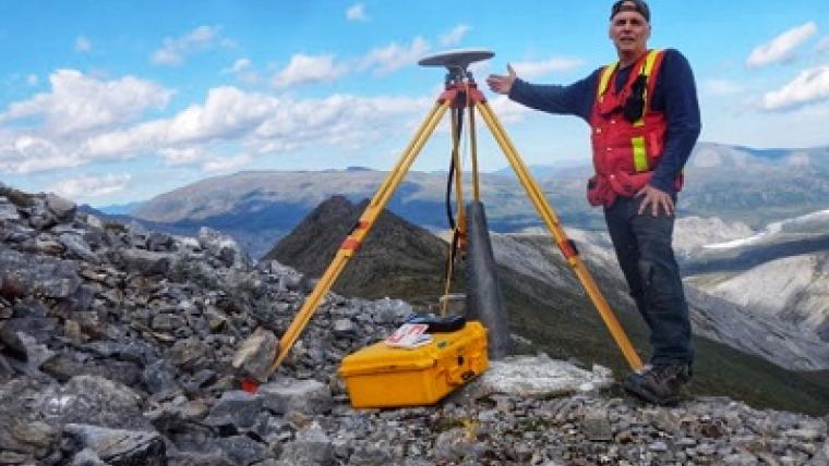
But our main ship at BIO — the Bedford Institute of Oceanography — is the Hudson, and we use that one mostly to go out at sea and we collect some bathymetric surveys. So we precisely measure the depth of the sea floor, and we can image the sea floor just like you do when you go on Google Maps or Google Earth. Using that, you can identify landslides on the sea floor. And we also do some sub-bottom surveys, which allows us to see the layers of sediment below the sea floor and that allows us to see if there’s similar landslides in the past instead of only at the sea floor. So this gives us an idea of recurrence of submarine landslides.
And then once we have this baseline information — which is really important to see where are those geohazards — then we collect some sediment cores, which can be anywhere from one metre to 50 metres long. And we use those sediment cores then to date the layers of sediment and to date precisely the age of the landslides. That allows us to have a better understanding of the recurrence of those hazards.
Joël
So it’s not just looking back in the past but also at potential landslides in the future.
Alexandre
Potentially. So it’s essentially establishing a recurrence of these landslides to see if there’s a likelihood of having some landslides in the future in a region.
Joël
Why is it important to study and monitor earthquakes and submarine landslides?
Alexandre
So the main thing is that when we monitor earthquakes, similar to landslides, we have to understand that they can trigger tsunamis. That’s the main problem in the Arctic.
One of the great examples of the dangers of these types of events happened just last year across Baffin Island and Greenland, where there was a terrestrial landslide — so, coming from a fjord sidewall — and that fell into the water. When it fell into the water, there was a 75-metre high tsunami wave that was triggered right on the other side of the fjord. Then that wave dissipated offshore to one to four metres. But that one to four metres affected a village in Greenland, and four people went missing and are still not found to this day; not to my knowledge, anyways. So probably four deaths like that due to a landslide that occurred in the fjord.
So that’s one thing that we really need to understand that is in Baffin Bay — in Baffin Island — the geology, the fjords, are very similar to the ones in Greenland. So it’s something that can happen and that maybe has happened in the past, but we don’t have the information yet because we don’t have the science yet to understand it. So we need to go to these fjords and understand if there have been some events like those before.
And there’s also been some reports by the local community. So, for example, in Pangnirtung, there’s been some reports of waves, one-to-two-metre waves, affecting one of the islands. What triggered that? Is it a submarine landslide? Is it something else? We don’t know. So that’s the kind of thing that we need to [investigate] in Baffin to understand. One of the most important things for that is in fact mapping the sea floor.
Joël
I read somewhere online that there’s also internet cables under the sea floor, under the oceans. Is that the type of infrastructure you’re talking about as well, beyond oil and gas?
Alexandre
Yeah, exactly. If we take, for example, between Nova Scotia and Europe, there’s a number of internet cables that can be broken and that have been broken in the past. It’s also just communications cables. In 1929 — this is the most known example — there was a landslide that was caused by an earthquake that severed dozens of submarine cables and broke the links between Europe and here. It also triggered a tsunami.
And it’s important also to remember that these submarine landslides have no equivalent on land: they are orders of magnitude larger. One submarine landslide that we discovered in 2012 and that we studied until this year is 15 000 kilometres square — that’s twice the size of Prince Edward Island or it’s the size closer to here, Ottawa, or it’s the size of Georgian Bay. It’s a gigantic submarine landslide that you can see on the sea floor. Anything that’s crossing the path of these landslides can be destroyed by this.
Joël
You mentioned something about communities in the North being affected by this. Have you worked with those communities to mitigate risks?
Alexandre
One important part of the research we do up north is community engagement and going to these communities.
I’ve been at the geological survey for two and a half years now so this project — the Baffin Bay project — has been ongoing since 2011. People before me — my colleagues at the Bedford Institute — have been working on community engagement for longer than I have. But it’s important to go and get to know what the Inuit people know about geohazards, the traditional knowledge. Also to get their insight and what seems important to them in terms of the science that we need to do and also then to report back when we go after our research.
So for example, for the cruise that we had last summer, there were some community engagement tours done beforehand. And then during the cruise we also went to the communities and brought some people onboard to visit the ship and visit the science that we were doing. We’re aiming to go back in March 2019 to report back on the results we found during this last cruise and during the last few years that we’ve been studying marine geohazards.
Joël
What are the challenges of conducting scientific work on a vessel in the Arctic?
Alexandre
The main challenge is weather conditions. Weather conditions are always changing — ocean conditions, storms coming in, coming out — and we need to adapt to those because we can’t work if the waves are too rough or too high. There’s a lot of the equipment that we use that’s relatively fragile where above two or three metre waves it becomes dangerous — for the equipment, but mostly for us people that are working on board to use the equipment. Because of that, we have to adapt and change plans and do other things.
When we go out at sea, we have a plan — a very precise plan at first — on where to core, where to take some multibeam bathymetric surveys and stuff like that. But when you arrive at sea then almost for sure you will change that plan. You need to have Plan As and Plan Bs and Cs and so on so that you can adapt to those situations. But that’s something that happens a lot. You plan on going, for example, to a fjord, but then the weather conditions don’t allow you to reach that place so you have to have a plan B to say “Okay, let’s go to this other place then instead.” So that’s probably the main challenge.
The second challenge is that these crews are always collaborative. It’s rare that you will go out at sea and do only one thing. For example, on our crews the main goal was to study marine geohazards, but it was a collaborative crew and there were other programs, with the program GEM (Geo-mapping for Energy and Minerals) from the Geological Survey of Canada. So there was 20 percent of the time assigned to do some GEM work for oil seeps on the sea bed. There’s also the collaboration we had with DFO, the Department of Fisheries and Oceans, to study the water column. We need to plan accordingly, where everyone can come out of the cruise happy and with the data that they need for their own science. That’s something that we always need to take into account when we’re doing the work.
The other thing — and we were very lucky on our cruise — is the ship crew also needs to understand that we are constantly changing our cruise plan because of the weather conditions or because sometimes operations take longer than expected, and then we don’t have time to do what was planned on the cruise plan. So we say, “Since we don’t have time to do this, we’ll go onto plan B and do this other thing instead.” So we’ve been lucky with our crews at least. The ship’s crew is very understanding of that and allowed us to have a very successful cruise.
Joël
This is all very interesting. Thank you so much, Alex, for your time today.
So, this is the end of the episode, but, like always, it doesn’t mean that it’s the end of the conversation. If you have any followup questions for Alexandre, get on Twitter and tweet at us using the hashtag “#AskNRCan”.
Also, if you are interested in learning more about the scientific work that we do at Natural Resources Canada, check out our online magazine called Simply Science. We have a ton of great content for you, including articles, videos and previous episodes of this podcast.
If you check out the podcast page for this episode, we’ll have links available to any relevant material so you can learn more about marine geohazards.
The best way to find Simply Science is to either Google it or click on the banner on our website at nrcan.gc.ca.
And, If you liked this episode and you are listening to us on Apple Podcast, Google Play or SoundCloud, please consider subscribing so you can check out any previous or future episodes.
I think that’s it for us today. Thank you for listening! We look forward to hearing from you, and we’ll see you next time.


Related stories
Page details
- Date modified: