
Ending the Canadian Digital Elevation Model era with the new Medium Resolution Digital Elevation Model
For years, users have relied on the Canadian Digital Elevation Model (CDEM) and the Canadian Digital surface model (CDSM) for medium resolution elevation data, essential for various applications such as regional hydrologic modelling. Now, as part of the National Elevation Data Strategy, Natural Resources Canada is introducing the Medium Resolution Digital Elevation Model (MRDEM) – a cutting-edge geospatial dataset created to enhance nationwide elevation analysis. This new product, part of the CanElevation Series, includes aligned Digital Surface Model (DSM) and Digital Terrain Model (DTM) at 30 meters resolution.
A new chapter begins with the Medium Resolution DEM. Let’s explore its features and benefits!
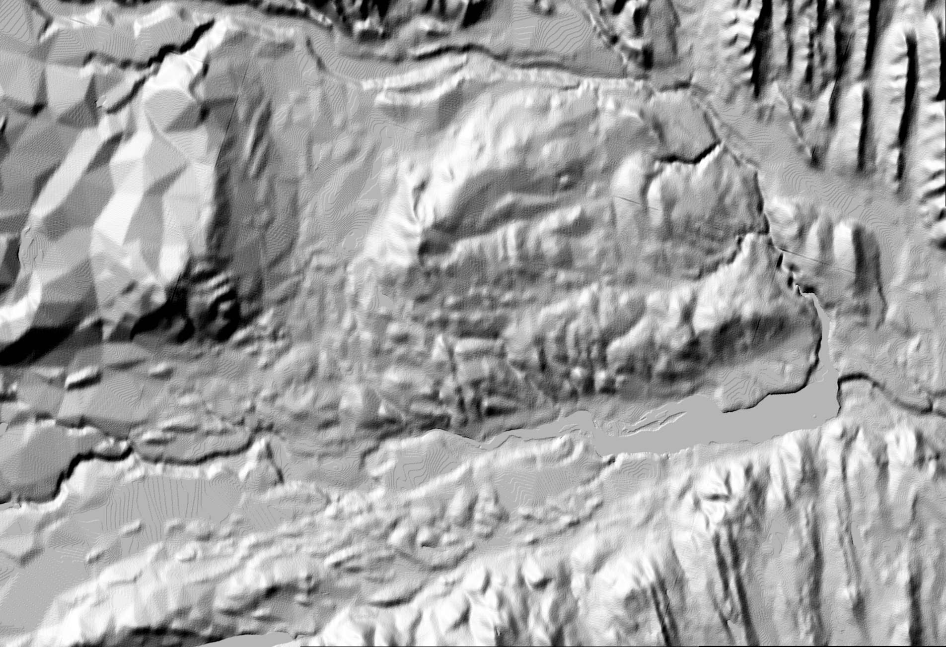
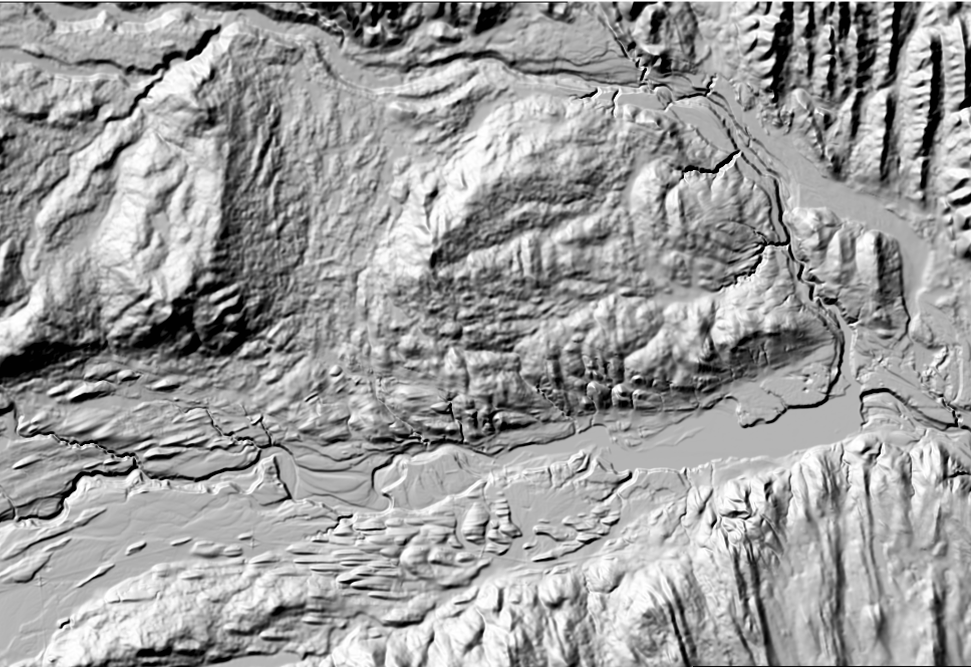
Figure 1. Comparison of terrain models derived hillshade over Ghost Lake, west of Cochrane, Alberta. Left image shows the Canadian Digital Elevation Model derived hillshade. The right image shows the Medium Resolution Digital Elevation Model derived hillshade.
Updated and Improved Accuracy
The MRDEM represents a significant update over its predecessor, the CDEM. While the CDEM relied on older data sources, the MRDEM incorporates more recent and accurate elevation data from the Copernicus Digital Elevation Model and lidar. The Copernicus data, based on satellite imagery collected between 2011 and 2015, offers improved accuracy and more recent data. Where available, High Resolution Digital Terrain models from lidar collected between 2006 and 2023 were seamlessly integrated into the digital terrain model within MRDEM by down sampling the high-resolution data to match the MRDEM's resolution. These localized data enhance accuracy for specific regions, currently covering approximately 93% of the population.
Integrating Copernicus and lidar data ensures that the MRDEM better reflects recent natural and human-caused changes in Canada's landscape.
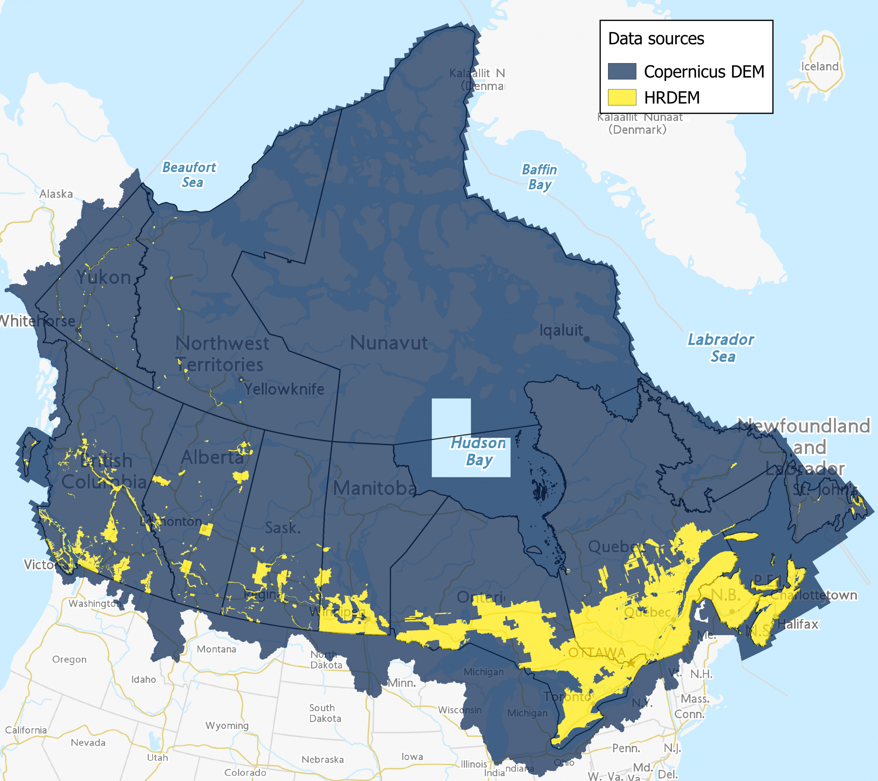
Figure 2. Extent of both data sources used to create the Medium Resolution Digital Elevation Model.
Vertical datum and integration
Referenced to the Canadian Geodetic Vertical Datum of 2013 (CGVD2013), the MRDEM seamlessly integrates with other 3D Canadian datasets. This compatibility streamlines workflows for researchers, engineers and GIS professionals by reducing discrepancies caused by datum differences.
Coast-to-Coast-to-Coast Coverage
From the rugged Rockies to the serene Maritimes and all the way up to the Arctic coast, the MRDEM provides comprehensive coverage across Canada. With its robust vertical datum, the new model effectively manages local variations from the lower sea levels up to the highest peaks. Whether you’re studying urban landscapes or remote wilderness, this dataset has you covered!
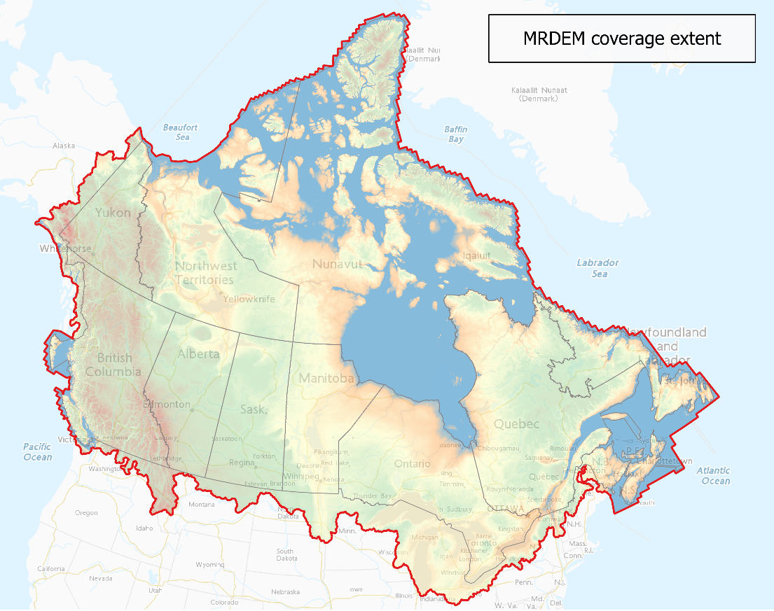
Figure 3. Coverage extent of the Medium Resolution Digital Elevation Model.
Facilitating Cross-Border Hydrological Studies
Just like natural hydrological features, the MRDEM seamlessly encompasses areas beyond Canada's borders. From now on, researchers can easily improve watershed analysis with consistent data resolution for transboundary studies.
Explore it’s potential via an interactive map. For more information, email geoinfo@nrcan-rncan.gc.ca.
Page details
- Date modified: