
Celebrating 10 years!
Since 2015, the National Elevation Data Strategy has transformed how elevation data is collected, shared and applied across Canada-empowering smarter decision-making from coast to coast to coast. This milestone couldn’t have been reached without the essential contribution of provinces, territories, municipalities, federal departments, and Indigenous communities. Thank you for being at the heart of this success!
The Strategy
The National Elevation Data Strategy, led by Natural Resources Canada, uses state-of-the-art technologies (e.g., lidar and satellite imagery) to increase availability and coverage of accurate high-resolution elevation data to support Government of Canada objectives.
Natural Resources Canada collaborates with different partners (provincial and territorial governments, municipalities, and Indigenous communities) to ensure the availability of existing data and to acquire new data across the country. This collaboration is essential for the success of the strategy’s objectives, and is building capacity for better data, science and tools across federal, provincial and territorial jurisdictions.
The Objectives

Offer a higher resolution
Increase coverage of high-resolution elevation data across the country to support Government of Canada priorities.
Improve access
Facilitate access to Canada's elevation data by promoting open licenses and offering datasets to the public through Open Government Portal.

Capitalize on past and future investments
Promote sharing and usage of existing elevation data. Foster collaboration with many partners across the country to acquire new data.
Standardized elevation data
Adopt and promote the new Canadian Airborne lidar data acquisition standard, which replaces the Federal Airborne Lidar Data Acquisition Guideline. Based on the federal guide and enhanced by a committee of experts, including elevation strategy experts, this standard establishes requirements covering all aspects of lidar data acquisition. It ensures consistency and high quality for topographic and topo-bathymetric lidar data collected across the country.
Elevation Data Products
The National Elevation Data Strategy has led to the creation of numerous products:
High Resolution Digital Elevation Model

The High Resolution Digital Elevation Model (HRDEM) product is derived from lidar data and satellite imagery.
It shows the topographical features on the Earth's surface at a spatial resolution of 1m to 2m.
It includes a digital surface model, a digital terrain model when generated from lidar data, and data derived from these models.
View the High Resolution Digital Elevation Model coverage map.
High Resolution Digital Elevation Model Mosaic

The HRDEM Mosaic product allows users to visualize and interact with the data produced under the strategy.
Unlike the HRDEM product in the same series, where data is separated and distributed by each acquisition project, the mosaic provides a single, continuous representation of data from the Strategy.
Fast and efficient dissemination of the mosaic is possible through the data cube.
View the High Resolution Digital Elevation Model Mosaic coverage map.
Medium Resolution Digital Elevation Model
The medium resolution digital elevation model (MRDEM) offers a complete coverage of Canada.
It incorporates elevation data from the Copernicus digital elevation model and lidar. Copernicus data are based on satellite images collected between 2011 and 2015. Where available, High Resolution Digital Terrain models from lidar collected between 2006 and 2023 have been integrated.
The MRDEM comprises a Digital Surface Model and a Digital Terrain Model at 30 meters resolution. The model is referenced to the Canadian Geodetic Vertical Datum 2013 (CGVD2013).
View the Medium Resolution Digital Elevation Model coverage map.
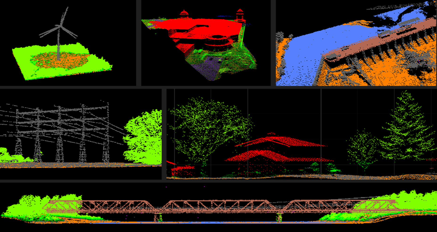
This product contains point clouds from various airborne lidar acquisition projects conducted in Canada. The URL links of each point cloud file can be downloaded, read, visualized and used directly in software that has Cloud Optimized Point Cloud (COPC) file capabilities (Ex. QGIS v3.26 and more recent).
View the lidar point clouds coverage map.
Automatically extracted buildings
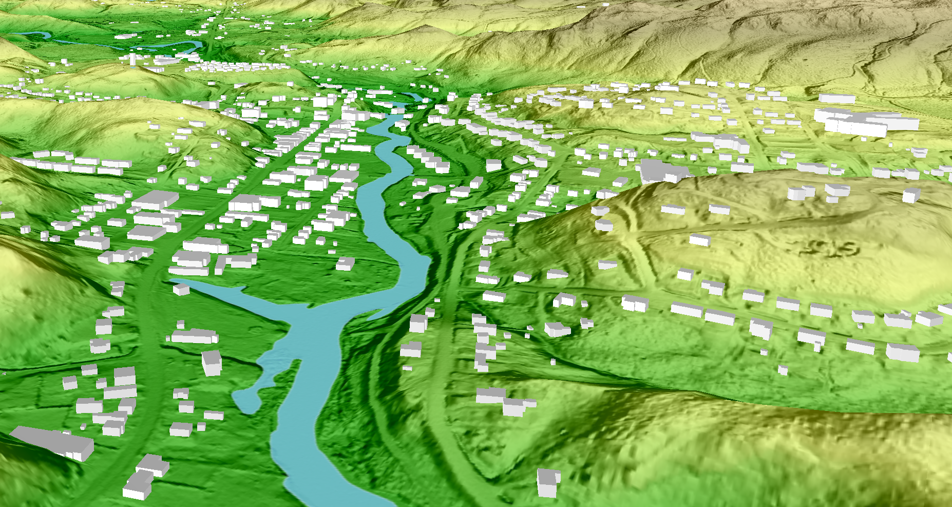
This data layer delineates building footprints that are automatically extracted from airborne lidar data, high-resolution optical imagery or other sources.
The product includes information such as elevation and minimum and maximum building heights.
View the automatically extracted buildings coverage map.
Data coverage highlights
As of June 2026, highlights of the results of the National Elevation Data Strategy include:
- Integrated 2,230,605 km2 of airborne lidar data covering 99 of Canada’s 100 largest cities, and 245 of Canada’s 250 largest cities. Data are available in the HRDEM and HRDEM Mosaic products.
- The data covers areas where over 96% of Canada’s population lives (~39.7 million Canadians).
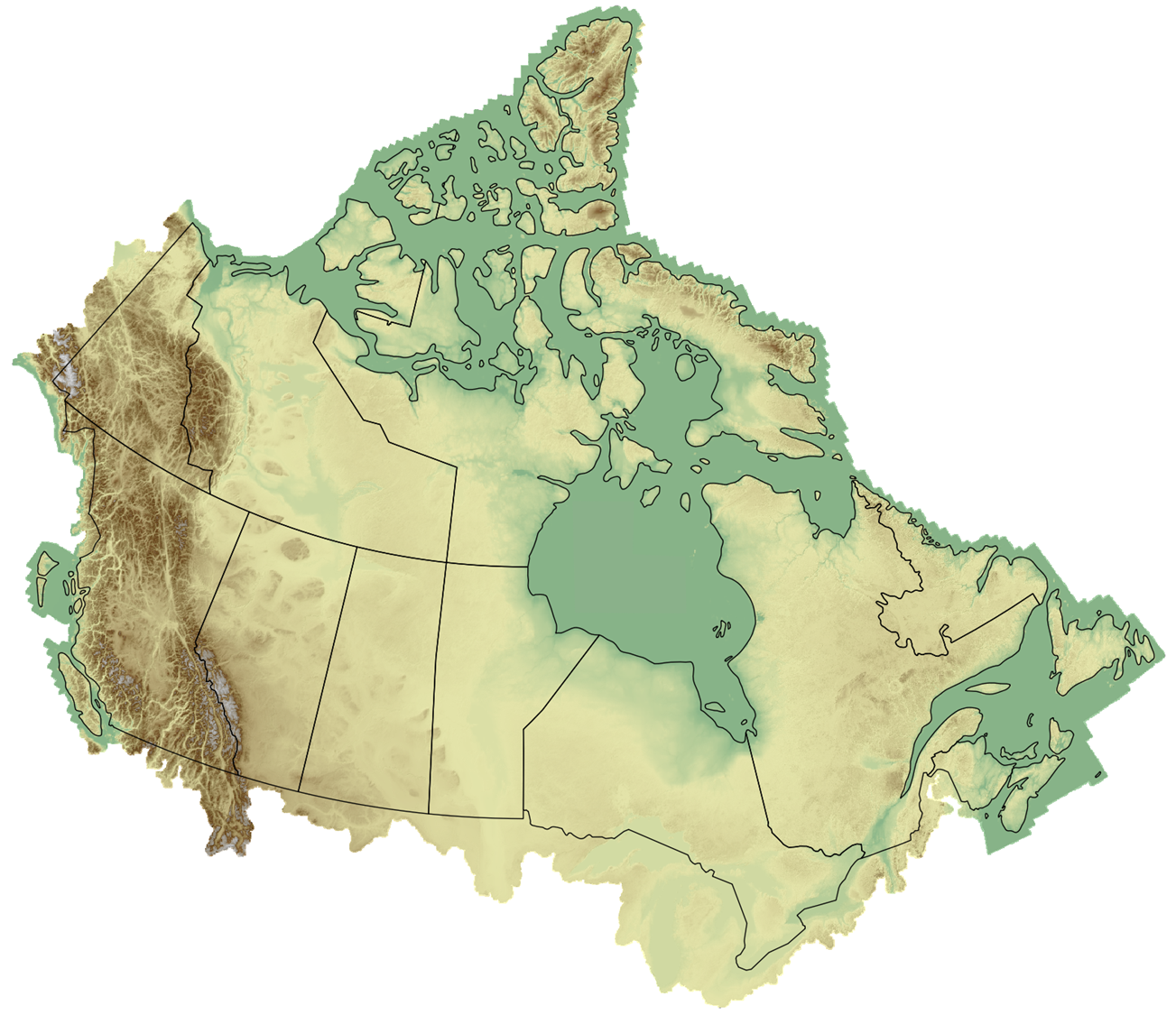
- 4.5 million km2 of elevation data derived from satellite imagery were integrated in the North. This data comes from the ArcticDEM project (external link) and was corrected to match Canadian standards. The source data was provided by the Polar Geospatial Center under NSF-OPP grants 1043681, 1559691, 1542736, 1810976, and 2129685.
- Automatically extracted over 13.6 million building footprints from lidar data.
- Made over 629,674 km2 of lidar data available in the lidar Point Clouds product. These datasets were acquired by Natural Resources Canada or by partners.
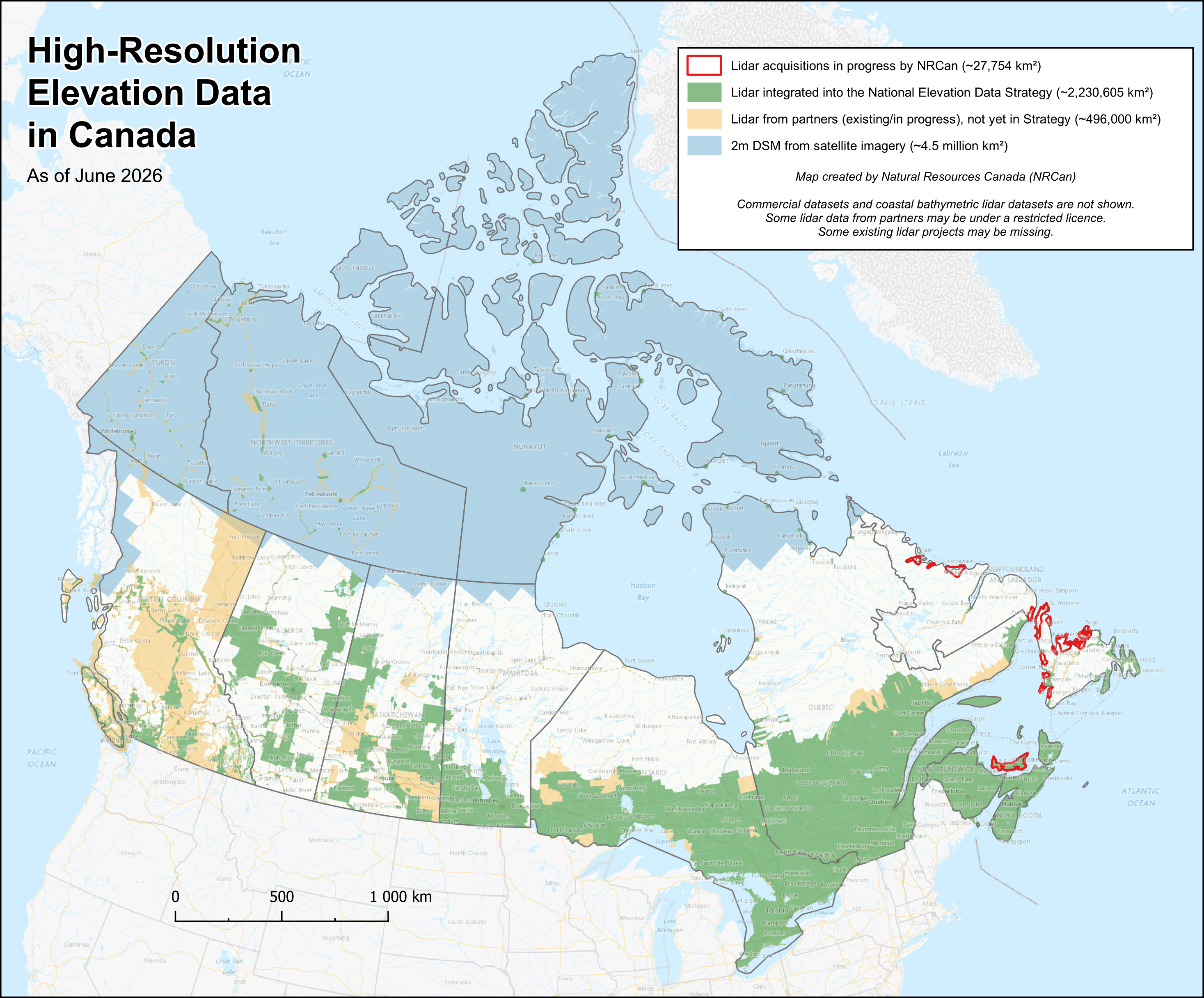
A map of Canada illustrating the current coverage status of elevation data acquired by all levels of government. Lidar projects represented in green have been integrated into the Strategy.
- Review the Canadian Airborne lidar data acquisition standard
- Discover partners in the National Elevation Data Strategy (PDF, 151 KB)
- Follow data announcements on Geospatial news
- Use elevation products from the Data Cube
Contact us
For more information, please email geoinfo@nrcan-rncan.gc.ca