Are you interested in historic flood events? NRCan team publishes Historical Flood Events Data Layer
Every year, small and large flood events affect communities across Canada. Whether a community is in a river basin, along the coast, or near a large urban area, floods happen due to natural water cycle fluctuations and significant rainfall.
The risk of significant floods is increasing for many communities due to climate change and changes caused by urban development. An important part of understanding where to expect flooding to happen is understanding where flooding has occurred in the past.
Since the earliest days of human settlement in North America, people have documented flooding events. Indigenous Peoples share historical records of flood events through culture, story, and song. More recently, settler communities have documented flood events in newspaper articles, reports, and other written publications.
With scattered publication records stretching back to 1696, it has been labour intensive to search publications to determine historical flood events for a specific region – until now. With over 1400 flood events documented in over 7000 locations, the NRCan Historical Flood Events data layer provides an accessible way to view the who, what, when, and where of historical flood events in Canada.

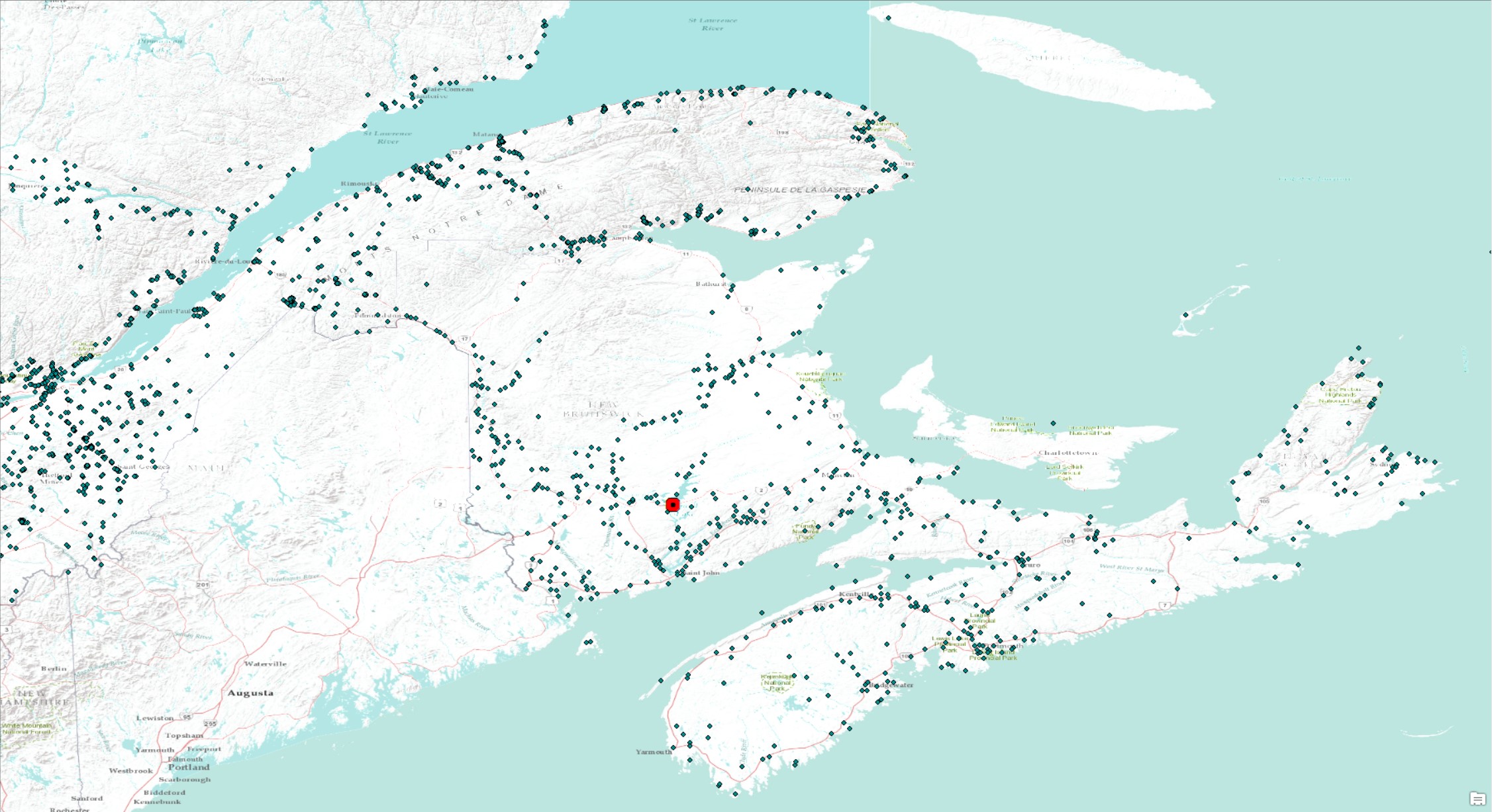
Figure 1 A screenshot of the historical flood events data layer for southern Atlantic Canada. Each point represents a documented flood event. For example, highlighted with a red point is a freshet flood in New Brunswick from 1696 – the oldest documented flood in the HFE data layer.
The Flood Mapping Team within NRCan’s Canada Centre for Mapping and Earth Observation (CCMEO) has completed the digitization of these approximately 1400 historical flood events. By scraping publication records for flood event details, they created a publicly available data layer consisting of point data with attributes for flood location, years/seasons, and details. Sources are available for every point. The maps can be a starting point for understanding regional flood trends or for training machine learning models for predicting nation-wide flood risk. Visit the historical flood events data layer for yourself on Open Maps!
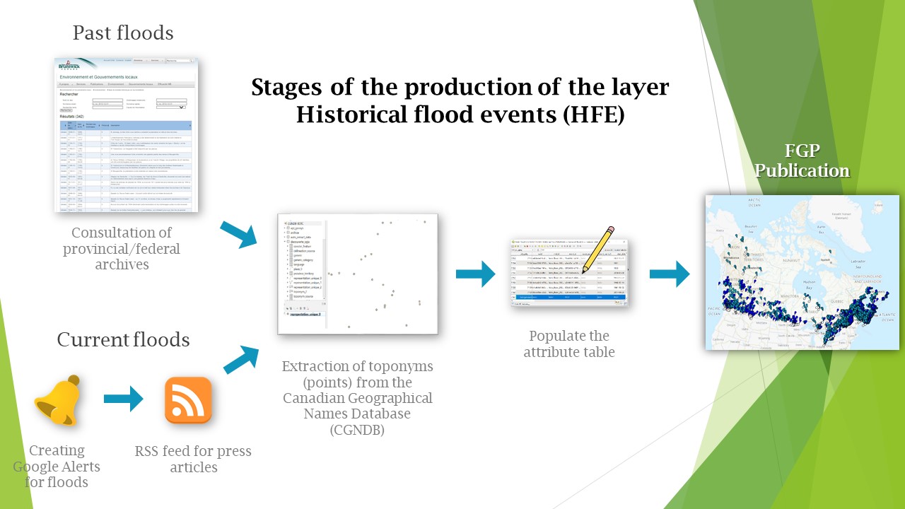
An overview of the different stages of the project

This layer locates the causes of past flood events in the form of points. This inventory is compiled from various public sources (including consulting provincial/federal archives and following media by signing up to RSS feeds). These points are then extracted from the Canadian Geographical Names Database and standardized into a common data model and then published.
Modernizing flood mapping practices
While the Flood Mapping Team has published this archive, the team will continue researching and overseeing the latest innovative flood hazard mapping activities to understand historical and future flood hazards across Canada.
CCMEO’s Flood Mapping Team is advancing flood mapping practices in Canada by leading the Flood Hazard Identification and Mapping Program, compiling existing flood hazard data through the National Flood Hazard Data Layer, digitizing historical flood maps, publishing flood mapping guidelines, and researching innovative ways to advance flood mapping practices relating to geomatics. Overall, the modernization of flood mapping practices will help communities understand and manage their flood risk.
For more information, please email geoinfo@nrcan-rncan.gc.ca
Page details
- Date modified: