Hydrology is the study of water on the Earth's surface, whether flowing above ground, frozen in ice or snow, or retained by soil. Hydrology is inherently related to many other applications of remote sensing, particularly forestry, agriculture and land cover, since water is a vital component in each of these disciplines. Most hydrological processes are dynamic, not only between years, but also within and between seasons, and therefore require frequent observations. Remote sensing offers a synoptic view of the spatial distribution and dynamics of hydrological phenomena, often unattainable by traditional ground surveys. Radar has brought a new dimension to hydrological studies with its active sensing capabilities, allowing the time window of image acquisition to include inclement weather conditions or seasonal or diurnal darkness.
Examples of hydrological applications include:
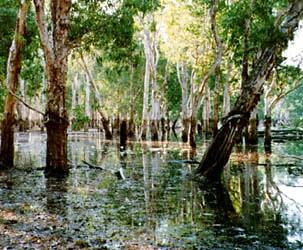
- wetlands mapping and monitoring,
- soil moisture estimation,
- snow pack monitoring / delineation of extent,
- measuring snow thickness,
- determining snow-water equivalent,
- river and lake ice monitoring,
- flood mapping and monitoring,
- glacier dynamics monitoring (surges, ablation)
- river /delta change detection
- drainage basin mapping and watershed modelling
- irrigation canal leakage detection
- irrigation scheduling

Catastrophic flooding can happen almost anywhere. In Iceland, huge floods that carry boulders the size of houses occur relatively frequently. These floods are called jökulhlaups, roughly meaning "glacial flood". Iceland is situated upon the mid-Atlantic rift, an area of frequent volcanic activity. The island itself is a product of this activity, and continues to grow in size with each volcanic event. Covering much of the island, and some of the volcanic craters, is an 8300 km2 ice cap. During sub-glacial eruptions, glacial ice is melted, and temporarily dammed by either the crater or the ice itself. Eventually the pressure of the water is released in a catastrophic flood. A flood in 1996 discharged a 3km3 volume of water, lasting 2 ½ days. The glaciers and landscape are abruptly and extensively modified by this strong force, which erodes channels, moves and deposits huge blocks of ice and rock, and deposits kilometre scale alluvial fans.
Scientists can use radar imagery to create topographic models of the glaciers and extensive outwash plains to use as baseline maps for multitemporal change detection and mapping studies. Radar is preferred because persistently cloudy conditions limit the use of optical data. With new monitoring methods, including the analysis of glacial dynamics related to volcanic activity, scientists are better able to predict the timing of these extreme jökulhlaups.