
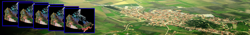
By innovatively combining satellite images from various visible-infrared sensors, the Canada Centre for Mapping and Earth Observation scientists have created consistent national scale cloud free mosaics of Canada that span decades. Raw satellite observations are converted into geophysical variables through a variety of complex processing steps.
Today, LTSDRs are available from the following visible-infrared sensors:
- AVHRR (1 km) ongoing since 1982
- MODIS (250 m) ongoing since 2000
- SPOT (1 km) ongoing since 1998
- MERIS (300 m) ongoing 2008-2012
the Canada Centre for Mapping and Earth Observation (CCMEO) scientists have developed algorithms capable of converting the initial satellite-sensor observations into geophysical variables through a series of processing steps including calibration, geolocation, reprojection, mosaicing, atmospheric correction, clear sky identification and compositing. Ongoing research continually improves these processing steps thus further assuring data quality and consistency.
In addition to transforming data from existing sensors, CCMEO scientists are actively preparing for the transition of current LTSDR datasets into the next generation of visible-infrared satellite sensors like VIIRS and Sentinel 2.
For more information on the LTSDR, click here.
MODIS data at a resolution of 250m was used to map the Arctic Circumpolar region.
SPOT Vegetation data was used to create a Northern Landcover mosaic, circa 2000.
The resultant Long Term Satellite Data Records (LTSDRs) have high radiometric consistency, allowing the identification and monitoring of changes in land surface at high frequency (every 1-10 days) over the entire Canadian landmass.
These products have proven to be invaluable for land surface monitoring in support of assessments and prediction of weather, climate, biochemical cycling, hydrology, wildlife habitat, ecological status and trends. The LTSDRs can be further processed to derived indicators.
Either directly or through models, LTSDRs can be further processed to derive various environmental indicators:
- Leaf Area Index
- Radiation
- Snow cover
- Albedo
- Forest Cover
- Land Cover (and Change)
- Evapotranspiration
- Net Primary Productivity
These derived indicators feed into important strategies for a variety of environmental and economic applications.
LTSDRs can be accessed within the Earth Observation Data Management System and further descriptions of their use can be found under Long Term Satellite Data Records in Use.
Various government departments, universities, private industry, as well as a number of international organizations, rely on the LTSDRs and the methods underpinning them to monitor various environmental indicators and to characterize changes in Canada’s landmass.
Canadian government users who have made effective use of the LTSDRs include:
- Statistics Canada
- Agriculture and Agri-food Canada
- Environment Canada
- Canadian Meteorological Centre
- Parks Canada
There is also active involvement and use by many Canadian Universities and industrial stakeholders.
The following illustrate the use and value of the LTSDR dataset:
- Characterization and Monitoring Change of Canada’s Land Surface
- Northern Land Cover of Canada – Circa 2000
- Using satellite remote sensing to monitor and assess ecosystem integrity and climate change
- Remote Sensing in support of Groundwater Studies