
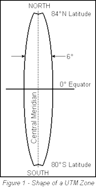
To understand how the projection works, imagine the Earth as an orange, with all geographical features and the parallels and meridians already drawn in. Now imagine taking a knife and, after slicing off small circles at the poles, making a straight north-south cut in the peel of the orange and repeating this north-south cut, at equal intervals, until 60 strips or zones have been detached (see Figure 1).
UTM Zone
Each of these zones will then form the basis of a separate map projection. To envision the flattening, consider the detached zone as a strip of orange peel placed on a level surface. By depressing its centre, one could force the peel to flatten until all of it touches the smooth surface. This flattening action results in a slight distortion of the geographical features within the zone, but because the zone is relatively narrow, the distortion is small and may be ignored by most map-users.
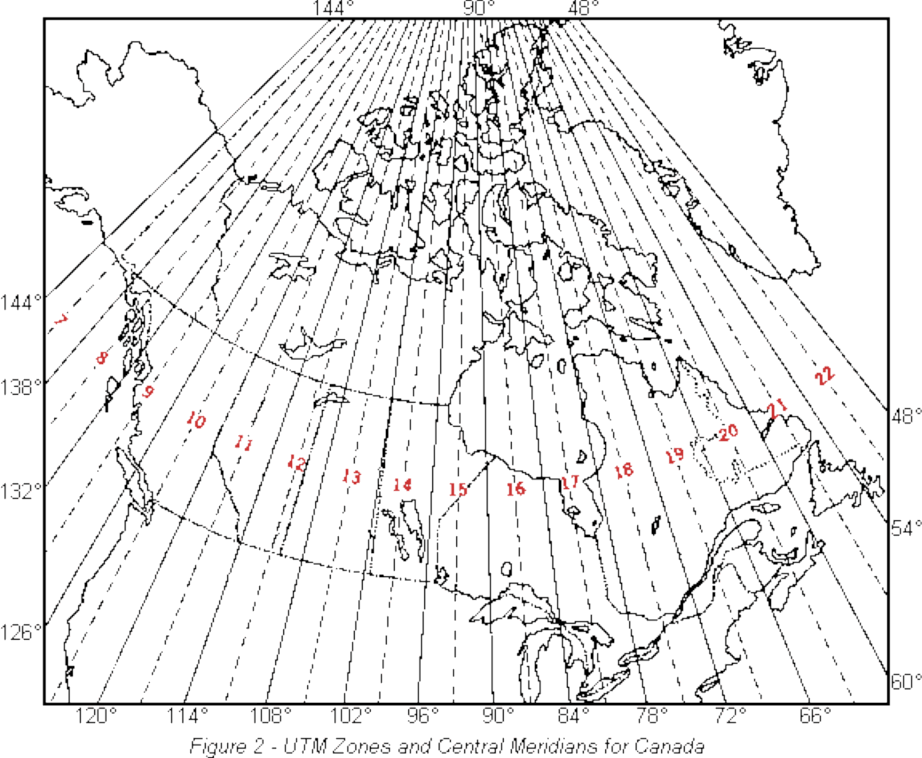
Because the globe is 360° in circumference, a division into sixty vertical zones gives each zone the width of 6° of longitude. By international usage these zones have been numbered 1 to 60. Sixteen of the zones, bearing numbers 7 to 22, cover Canada (see Figure 2).
Once the zone has been flattened onto a level surface it can be divided into a basic set of map sheets of a convenient size. These basic sheets are divided further into sections and each section is published as a map of a larger scale. In Canada this is done to produce the 1:250 000 and 1:50 000 scale maps, which are the two scales of the National Topographic System. By convention, the edges of most maps fall along parallels and meridians. In the far north, where zones are narrow, medium- and small-scale maps may show parts of more than one zone. The important feature of the Universal Transverse Mercator Projection is that the zones are standard and readily identifiable, so that an area may easily be designated as lying within a specific zone.
To help you understand what topographic maps are and how to use them, see National Topographic System (NTS) and The basics.
This material updated from The Universal Transverse Mercator Grid, Department of Energy, Mines and Resources Canada, Surveys and Mapping Branch, Ottawa, © 1969, The Queen‘s Printer.