
Land Cover Products
The Canada Centre for Remote Sensing (CCRS) has developed northern-, national- and continental-scale land cover products that represent data collected by various satellite sensors at different spatial resolutions and at different points in time. Land cover datasets help detect changes in the landscape over time due to natural and human factors, support land use monitoring, and reporting on international commitments.
Northern Land Cover Products
Regional-scale land cover products of Canada`s North above the tree-line support applications including environmental impact assessment, wildlife and biodiversity conservation, protected area conservation, water quality assessment, resource extraction, community planning and renewable energy exploration.
Text version
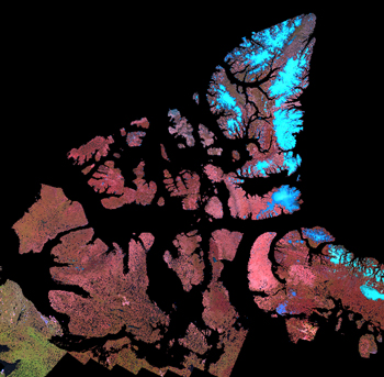
Composite image of Canada`s arctic islands showing land cover classes
Canadian National Land Cover Products
National land cover products are harmonized with North American coverages so land cover data and class descriptions match across international borders with the United States and Mexico.
Text version
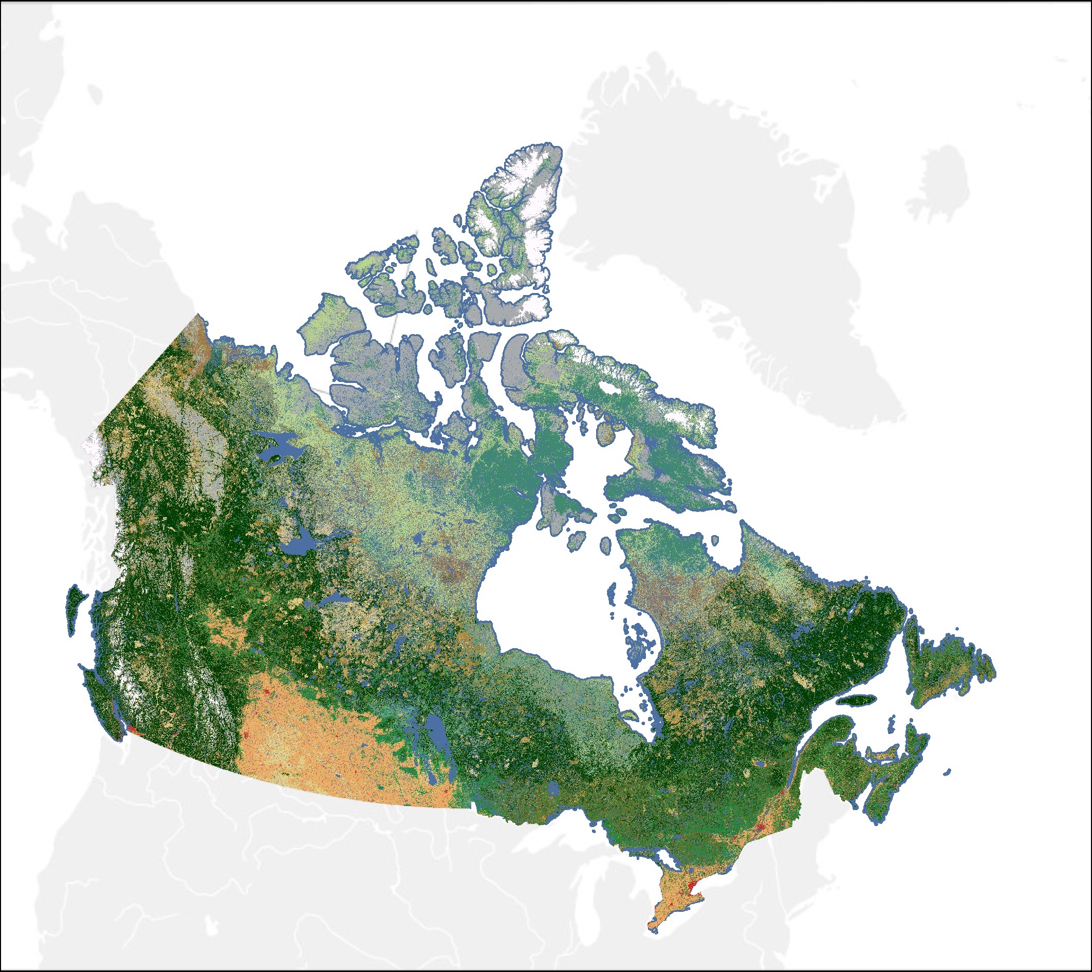
Composite satellite image of Canada`s land classes at 30-metre resolution.
Data Collections
Landsat
View and download map files of the Land Cover of Canada at 30-metre spatial resolution.
Moderate Resolution Imagjng Spectroradiometer (MODIS)
Download map files of Canadian land cover (2001-2011) at a 250-metre spatial resolution.
Open Government Portal Search – “land cover”
Find Government of Canada land cover datasets on Open Maps.
Earth Observation Data Management System (EODMS) - CCRS “landcover” Thematic Datasets
Register as a user to download Earth observation land cover and other datasets at no cost.
Natural Resources Canada Topographic Information Download Directory
Access archived collections of land cover data and imagery on CCRS’ FTP server.
North American Land Cover Products
CCRS works with the North American Land Change Monitoring System (NALCMS) of the Commission for Environmental Cooperation (CEC) to create continental land cover and land-use-change products that are consistent across international borders between Canada, the United States of America and Mexico.
Text version
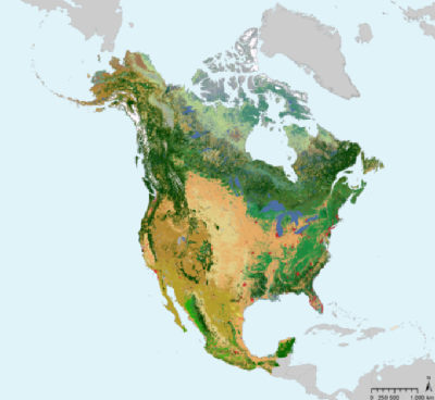
Composite satellite image of North America showing land cover classes
Data Collections
Landsat (Commission for Environmental Cooperation)
Access data files, metadata and the poster for 30-metre resolution North American land cover.
Moderate Resolution Imaging Spectroradiometer (MODIS) (Commission for Environmental Cooperation)
Download map files of North American land cover (2005-2010) at a 250-metre spatial resolution.
North American Land Change Monitoring System (NALCMS) Collection (United States Geological Survey)
Search and download the NALCMS dataset collection and sub-collections.
Pictorial Map of Land Cover Diversity in North America (Commission for Environmental Cooperation)
Explore land classifications in Canada, the United States and Mexico by taking a story map tour through North America.
Page details
- Date modified: