Crop types
Introduction
This satellite image shows a farming area with many fields and several types of crops growing in mid-summer. The different colours indicate different crops, or perhaps what condition the crop is in. Small white dots in some fields are the clearings where the farmhouses and barns are located. Sometimes the image captures a crop being harvested. Look for instance at the field at (3.7,6.7). The different coloured "outline" of the field indicates that the farmer has just started to harvest the corn, starting, of course, on the outside of the field. The very dark green, irregular shaped areas are small patches of woods (trees) - see, for example: (2.8, 3.8).
Task 1
There is a larger town and a smaller village in this satellite image. The approximate middle of each are at the coordinates:
town: (____, ____) village: (____, ____)
A river cuts through the image. It is so narrow that you can't see the water itself, just the vegetation on the river bank. It doesn't follow the road grid and is not a perfectly straight line. It exits the picture on the right at (6.0, ____).
A railroad also cuts through the image. It's a much straighter line and comes from the town and exits the image on the left at (0.0, ____).
Task 2
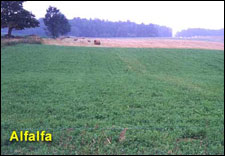
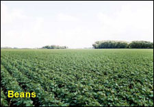
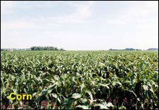
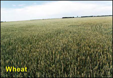
What type of crop is growing at:
a) (1.5, 4.6)
b) (2.9, 3.3)
c) (5.1, 1.7)
d) (4.4, 1.2)
e) (1.4, 3.1)
f) (3.8, 2.2)
g) (4.7, 3.0)
Task 3
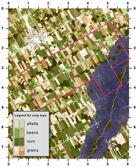
The second satellite image is the same area, but it was imaged during a time when too much rain has caused a small river to flood. The water rose about 1/2 metre above normal, which was enough to flood many farms.
a) What are those patches of green inside the flood zone?
b) An insurance company has insured the grain crops for those farms inside the red outline. For how many fields will they have to pay compensation?
Image 1
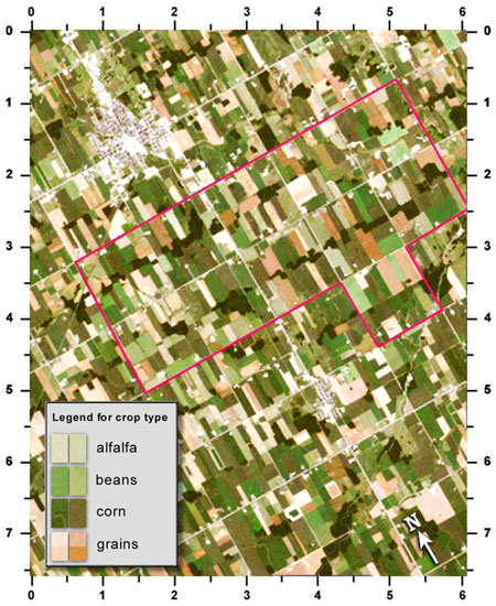
Image 2
Page details
- Date modified: