
At a mine site
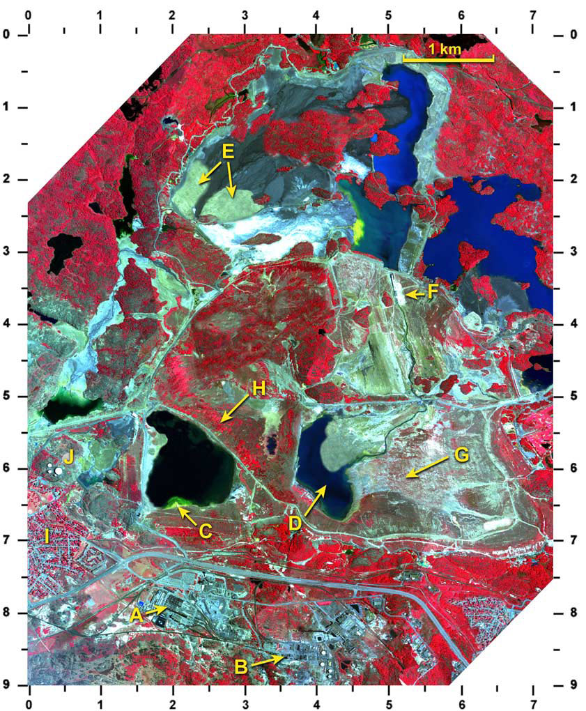
There seems to be a lot of activity going on in this remote sensing image of a copper mine. We are using a sensor on an airplane here, so we have very fine detail of features. Also, the spectral band combinations are chosen to show healthy, dense vegetation as bright red. Less healthy and thinner vegetation will show less red and more brown colouring. Artificial materials like pavement and buildings will appear in different shades of pale blue.
Of course you can't see what is going on underground, but let's take a tour of what happens above ground:
"Ore" is taken from the ground and processed at a mill (A). This involves grinding it up and adding water. The parts of the mixture that are useful are called "concentrates" and passed to the smelter "B" for further processing, while the unwanted parts are called "tailings" and need to be disposed of.
At the smelter, the concentrates go through several processes, including melting at very high temperatures, to isolate the metals that are the desired end products. The remaining materials are called "slag" and also need to be disposed of.
The copper that is produced here, becomes the water pipes and electrical wires in our houses, as well as many other useful products. The unwanted parts of the processes, are allowed to settle and mix with air and water in settling ponds. It takes special effort to overcome the environmental effect that the slag and tailings have on the soil, air, water and vegetation.
We can see in the satellite image, several stages of the environmental recovery that the mine has implemented.
At "C", a pipe is dumping the raw tailings (yellow colour) into a settling pond. What is another location where tailings are entering a settling pond (2.3, 2.6) or (4.7, 1.8) or (4.5, 2.7)?
The settling pond in the satellite image at "D" is almost completely filled in with tailings. Where can you find another almost-filled pond (0.5, 5.2) or (0.5, 3.0) or (2.0, 6.0)?
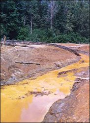
Lime is added to the tailings to reduce its acidity. You can see in the satellite image, a big pile of lime stored at "F". Where is another lime pile (2.2, 7.5) or (6.5, 6.7) or (5.6, 1.0)?
At "G" in the satellite image, seeds have been planted and grass has started to grow on the tailings. A few young trees are also growing here. Where is another area like this (4.6, 3.2) or (0.4, 7.2) or (0.7, 3.4)?
Fully mature trees, growing on old tailings can be seen on the satellite image at "H". Where is another similar area (6.5, 1.0) or (2.2, 0.9) or (3.7, 3.7)?
On the satellite image there is a housing development for mine workers, at "I". Where is another such neighbourhood (0.2, 4.6) or (2.0, 2.0) or (6.5, 8.1)?
A cluster of large storage tanks can be seen on the satellite image at "J". Where is a second group of storage tanks located (6.9, 7.1) or (3.7, 7.6) or (4.1, 8.8)?
Remote sensing image of a mine
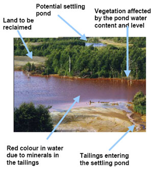
Settling pond being filled with tailings
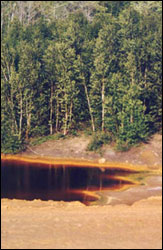
Mature trees growing on land reclaimed from a tailings pile
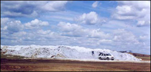
Lime pile at the mine site
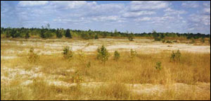
Grass and young trees growing on the tailings
Page details
- Date modified: