You see the things that would be seen by eye or a camera if they were looking down from space. Because we can't see in parts of the spectrum like the infrared, ultraviolet or microwave, we have to use colours that we can see, to represent this kind of information. That's why many remote sensing images have strange colours.
|
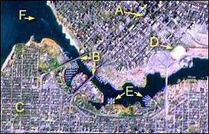
In this view of downtown Vancouver, British Columbia, you can see: |
-
Tall buildings and their shadows
-
Bridges
-
Residential street patterns
-
A large stadium
-
Marinas for small boats
-
A ship and its wake
|

|
|
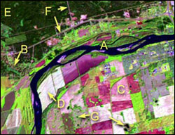
Near Prince Albert, Saskatchewan, you can see: |

|
-
A large river
-
A small, meandering river
-
Farm fields with crops
-
Farms fields showing bare ground
-
Forest
-
Roads
-
Small ponds
|
|
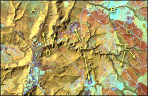
In the Cape Breton Highlands of Nova Scotia, you can see: |
-
Standing forest
-
Recent forest clearcut
-
Older forest clearcut
-
Deep river valley
-
Logging roads
-
Swamp
|

|
|
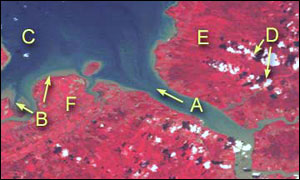
In the Minas Basin of Nova Scotia, you can see: |

|
-
A river carrying sediment into the Basin
-
Shallow water areas
-
Deep water areas
-
Clouds and their shadows
-
Forests
|


