Aerial Survey Data Base
The Aerial Survey Data Base (ASDB) is a data bank of photogrammetric control points that have been established through the process of aerotriangulation. The primary purpose of this data base is to provide a minimum of 4 points for the compilation of each photogrammetric model contained in a 1/50 000 National Topographic System (NTS) map sheet. However, the photogrammetric points can also be transferred to newly acquired aerial photography or satellite imagery and used as control for different derived products such as Digital Elevation Models, Digital Orthophotos, and Digital Perspective Scenes.

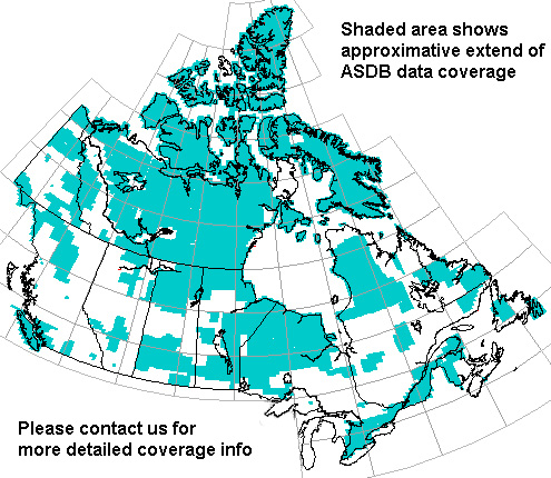
Status map - ASDB coverage across Canada. Shaded Area shows approximate extent of ASDB data coverage.
There are approximately 3 million points and 250,000 aerial photographs and diapositives in the Aerial Survey Data Base (ASDB). The blocks are always identified by an alphanumeric code such as "H013" the letters in the code are used to identify the province or region (H=British Columbia), while the numbers indicate the order in which the particular block was completed within the designated area.
The data base consists of paper prints of the aerial photographs, along with the corresponding diapositives and the results of the photogrammetric adjustment. The adjustment contains (X,Y,Z) co-ordinates of all photogrammetric points. There are approximately three million points and 250 000 aerial photographs and diapositives in the Aerial Survey Data Base covering roughly 60% of the Canadian landmass.
To find out more About Aerial Photography, The Collection at National Air Photo Library, and Purchasing Aerial Photography.
For more information on products and services, please contact National Air Photo Library.
Page details
- Date modified: