
Planning for Sea-level Rise in Halifax Harbour
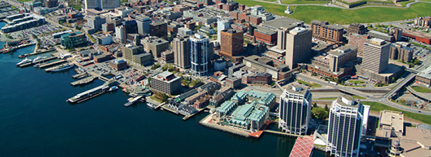
Photo courtesy of Halifax Regional Municipality
ADAPTATION MEASURES CAN BE INCREMENTALLY ADJUSTED AS NEW INFORMATION BECOMES AVAILABLE
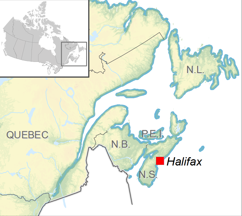
Halifax Regional Municipality (HRM), the capital of Nova Scotia, is Atlantic Canada’s largest city. The municipality covers more than 5500 km2 and has a population of more than 390 000. Halifax Harbour, at the heart of HRM, is a major seaport with significant industrial, military and municipal infrastructure.
Rising sea level, along with increased storm intensity and associated waves and storm surges, presents risks to residents, property and infrastructure in coastal areas of HRM. Following extreme weather events in September 2003 and February 2004, HRM launched ClimateSMART (Sustainable Mitigation & Adaptation Risk Toolkit) to help mainstream climate change mitigation and adaptation into municipal planning and decision making. ClimateSMART initiated discussion of climate change and spurred further adaptation action.
In August 2006, the HRM Council adopted the Regional Municipal Planning Strategy, an integrated land use planning guide for future development. The Strategy explicitly included policies to address climate change impacts. It recognized the need to gather scientific data on sea-level rise, storm surges and vulnerability to inform development of an area-specific land use plan for Halifax Harbour.
To deliver the information needed for effective adaptation planning, a partnership was formed between HRM planners and scientists from Natural Resources Canada, provincial agencies, Dalhousie University and Nova Scotia Community College. The process also involved consultation with major harbour stakeholders. The scientists developed scenarios for sea-level rise and extreme water levels to guide adaptation planning. There were several steps in the process to arrive at these scenarios:
Damaging storms
In recent years, Halifax has experienced frequent extreme weather, including several major storms that caused extensive erosion and flood damage. Most notable was Hurricane Juan in September 2003, a “once-in-a-century” event. This Category 2 hurricane made landfall just west of Halifax and tracked across central Nova Scotia and Prince Edward Island, leaving a trail of damage to property, infrastructure and the environment (cost estimated at $200 million). A few months later, in February 2004, the severe winter blizzard that became known as “White Juan” dumped nearly 90 cm of snow on Halifax in one day ($5 million in snow removal and damage costs). These events increased public concern about the potential impacts of climate change.
Analysis of historical sea-level rise, showing that water levels relative to the land have risen by 32 centimetres (cm) over the last century, a combination of land subsidence (-16 cm) and local sea-level rise (16 cm). The figures were derived from the Halifax tide gauge (since 1920) and crustal vertical motion GPS data (since 2002).
Documentation of stormwater levels and impacts on coastal areas. Scientists analysed 90 years of Halifax tide gauge data to determine the frequency and maximum water levels reached during extreme storms. Hurricane Juan, an exceptional storm with record water levels, was recognized as a benchmark for flooding.
Projections of future sea levels and stormwater levels in Halifax Harbour under three scenarios for 2000–2100: (1) 16 cm – a continuation of the historical rate of change; (2) 57 cm – the upper-limit projection for mean sea-level rise from the Intergovernmental Panel on Climate Change (IPCC) Fourth Assessment (2007); and (3) 1.3 m – a projection based on more recent scientific literature. All of the above were combined with the measured rate of subsidence to give local rates of relative sea-level rise.
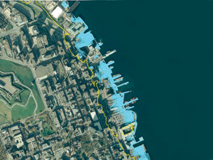
High-resolution mapping of possible future flood levels for each scenario. In 2007, HRM and partners commissioned a LiDAR survey to provide baseline elevation data to a precision of about 15 cm. GIS software was then used to simulate the extent and depth of flooding on harbour-front properties in the year 2100 for various storm events coupled with projected rise in sea level for each of the three scenarios.
In early 2010, following a presentation by scientists and city staff, HRM Council agreed to the use of Scenario 2c as an interim basis for action. This set a policy reference point from which planners can move forward in developing an adaptation plan.
|
Maps of projected sea-level rise are a powerful visual tool for communicating potential flood impacts to policy-makers, land owners and the general public.
Scenario 2 |
||
| Relative sea-level rise 2000–2100 | = | 0.73 m above 2000 level (still water) |
| Add 1 in 50-year stormwater level | = | 1.74 m (tide plus storm surge) |
| Stormwater level in 2100 relative to geodetic datum | = | 2.67 ±0.17 m |
| Add wave run-up | = | +1 to +2 m |
Source: http://geopub.nrcan.gc.ca/moreinfo_e.php?id=248196
Next steps include
- further consultation with property owners and other stakeholders to obtain feedback on options and strategies
- a modelling exercise to accurately predict the impact of heavy wave action on harbour-front properties;
- development of a risk assessment database containing information on the vulnerability of harbour-front properties
- the creation of measures that could include minimum ground elevation for new development, engineered solutions such as raising sea wall heights, and land use and development regulations for flood-prone areas
Together, these will lead to the development of a comprehensive adaptation strategy to be presented to Council.
As an interim measure, a recently approved Municipal Planning Strategy and Land Use By-law for the downtown Halifax waterfront area prescribes that any development (ground floor elevation) must be a minimum of 2.5 m above the ordinary high-water mark. This figure may be adjusted based on ongoing sea-level rise monitoring and analysis.
Halifax has taken a pragmatic approach in adapting to the impacts of rising sea level. It partnered with scientific and technical experts to obtain data to develop scenarios that speak to the concerns of stakeholders. Recognizing that time is needed to complete the planning process, HRM staff have used development agreements – bilateral contracts between the municipality and the landowner – for a number of waterfront parcels to encourage appropriate development while the formal adaptation plan is being formulated.
Staff have also noted that the 100-year period allows for inclusion of adaptation measures when infrastructure is due for renewal. In this way, there is recognition that adaptation is an incremental process and that initial useful measures can be taken despite uncertainties in the magnitude of long-term changes.
Contact:
John Charles Planner, Infrastructure & Asset Management Halifax Regional Municipality Tel.: 902-490-5771 E-mail: charlej@halifax.ca
Roger Wells Supervisor, Regional and Community Planning Halifax Regional Municipality Tel.: 902-490-4373 E-mail: wellsr@halifax.ca
Page details
- Date modified: