
Elevation data
What is elevation data?
Typically, elevation data is represented in three different ways:
- Contour lines: Traditional topographic maps contain these lines which follow the shape of the land and indicate elevation of the terrain.
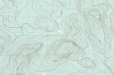 Representation of contour lines on a traditional topographic map.
 - Digital elevation models (DEMs): These models represent the elevation of the land in a grid of squares. Each square (or pixel) in the grid contains the elevation value of the land it represents. DEMs can be categorized into digital surface models (DSM), which include vegetation and buildings, and digital terrains models (DTM), which exclude them.
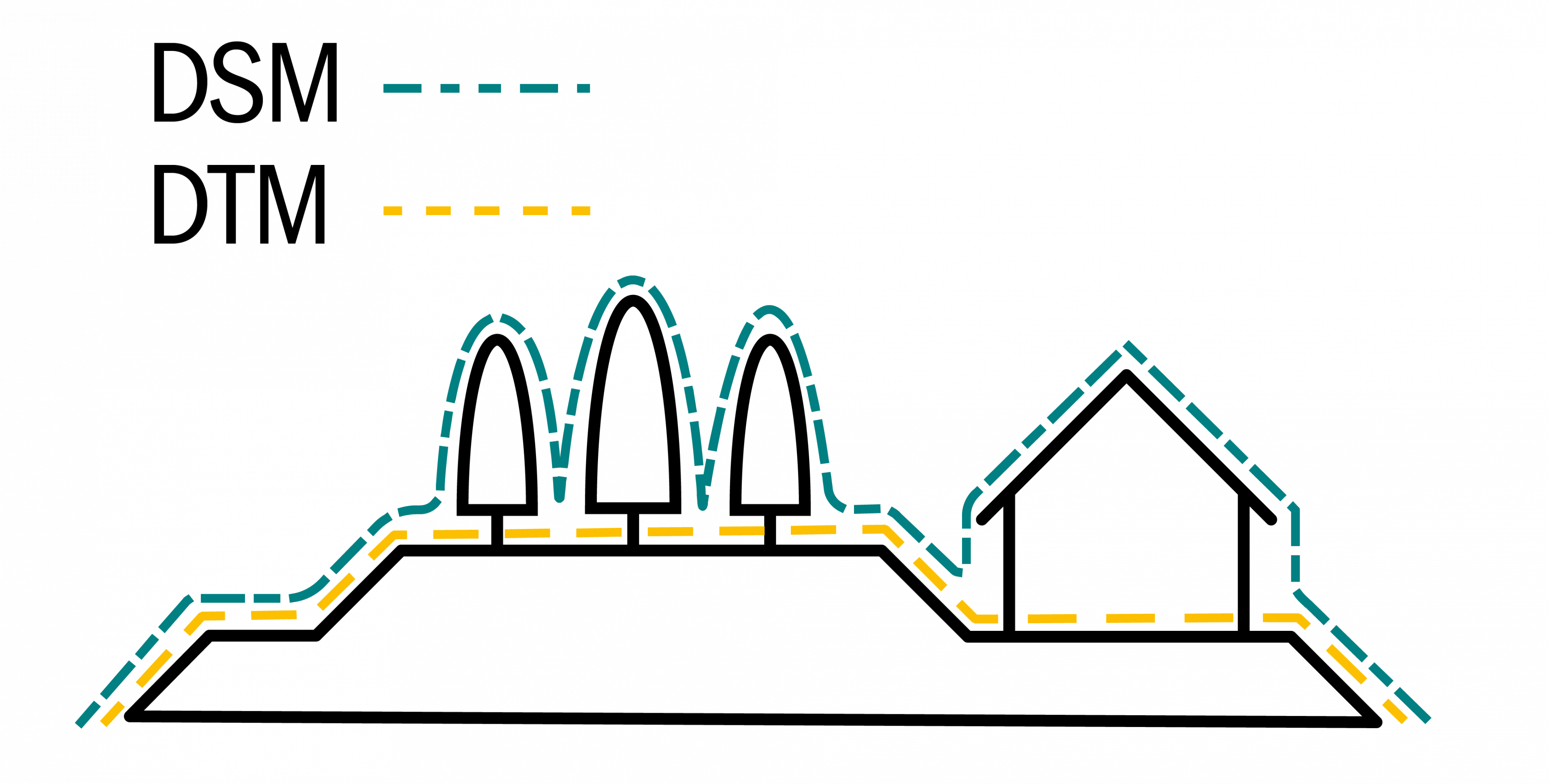 Diagram representing elements included in a DSM versus a DTM.
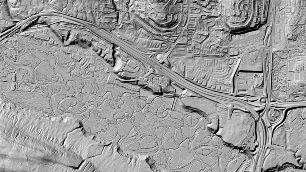
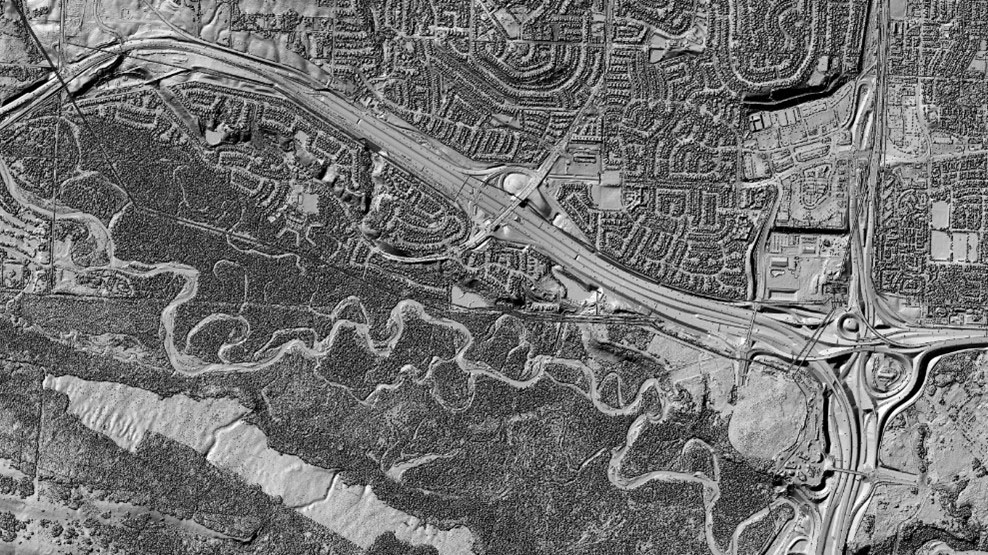 Shaded 3D reliefs of a Digital Terrain Model (left image) and a Digital Surface Model (Right image). The DSM includes vegetation and buildings on the surface of the ground.
 - 3D points and point clouds: 3D points precisely represent information in a three dimensional space (x,y,z). A large dataset of 3D points is called a point cloud. A point cloud is composed of millions of 3D points that represent the relief of the land and the elements on its surface, such as buildings, vegetation and infrastructure.
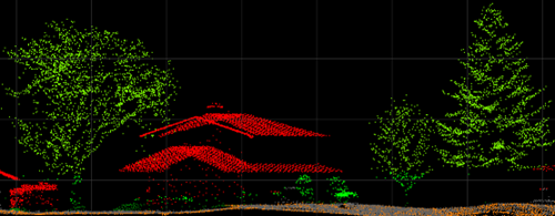 Example of a point cloud representing elements such as a building, trees and the ground.
Why is elevation data important?
We can use elevation data to help us understand the landscape around us, model it, plan efficient routes, and predict the impacts of climate change, including flooding.
High-resolution elevation data is used in many ways, including but not limited to:
Flood hazard mapping
Urban planning
Climate change science
Forest management
Precision farming
Geology and geohazards
How is elevation data collected?
Natural Resources Canada collects elevation data using different remote sensing methods. Both satellites and airborne light detecting and ranging technology (LiDAR) are used through its National Elevation Data Strategy.
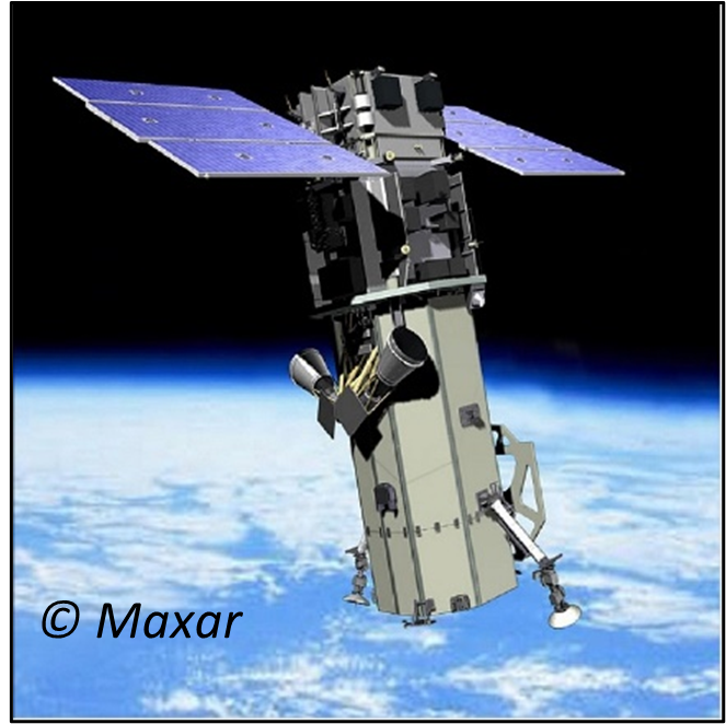 Image of an optical satellite that is used to acquire high-resolution satellite imagery.
 High-resolution satellite Imagery
The high-resolution satellite imagery used in the strategy is manipulated using autocorrelation and photogrammetry techniques. By using two satellite images of a location taken at two different angles, we can extract information on the elevation of the surface to an accuracy of 1 to 2 m.
Photogrammetry is the science of extracting 3D information from photos or imagery.
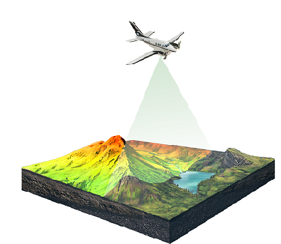
Airborne LiDAR
For this method, a LiDAR sensor is installed on an aircraft which flies over the area of interest. The sensor uses laser beams to capture the precise location of the ground and its land cover, even below the tree canopy, with an accuracy of a few centimeters! All this information is saved as detailed 3D LiDAR point clouds and can lead to the development of very accurate DEMs.
A LiDAR scan creates a large dataset of 3D points collected for a given geographical area, known as a point cloud.
Increasing the availability and coverage of elevation data
Canada’s National Elevation Data Strategy set out objectives, working with provincial and territorial governments, municipalities and Indigenous communities to:
- gather higher resolution data across the country
- capitalize on past and future investments
- improve access to Canadian data
- standardizing elevation data
- Learn about the National Elevation Data Strategy
- Download the LiDAR Fact Sheet [PDF download - 934 KB]
- Review the Federal Airborne LiDAR Data Acquisition Guideline
- Discover National Elevation Data Strategy partners [PDF download - 152 KB]
- Read the latest National Elevation Data Strategy update [PDF download - 7.3 MB]
- Follow data announcements with What’s New
- Use elevation products from the Data Cube
Reach out to us!
For more information, contact geoinfo@nrcan-rncan.gc.ca
Page details
- Date modified: